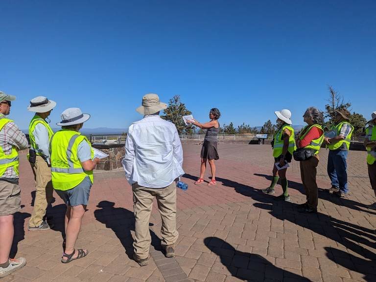
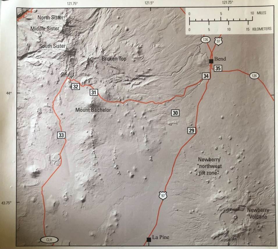
Jan and Janet Discover Mima Mounds from Google Earth Image
/President's SE Oregon Scouting Trip (Take Two)
by Janet Rasmussen
Jan Kessler
On Monday, June 1, Jan Kessler and I headed down to SE Oregon to scout my field trip stops for the September GSOC trip. My husband Doug and I did a preliminary trip last August.
We had Marli Miller's new Roadside Geology of Oregon with us so the navigator could read aloud from it as we travelled. It was very helpful. We stopped at Glass Buttes off Hwy 20 between Bend and Burns. Neither of us had been there before. The turnoff is on the south side of the highway, just west of milepost 77. Look for a cattle guard. I was disappointed that it wasn't a sparkling glass mountain as I had imagined.
The obsidian we found was in other folk's discard piles, which were numerous. But we found some nice pieces anyway. I would suggest that you spend more time than we did and really look for nice original finds.

This is the nicest piece of obsidian Jan found.
We followed the main road some distance, and saw what appeared to be white (!) mine tailings on some other buttes to the south. Further research revealed that these are old mercury mine diggings from the 1930-1950's. And, according to mining geologist Howard Brooks, who wrote a report on this mine back in the 1950's, the white rocks are altered obsidian called "opalite." I couldn't find a clear definition of opalite. The "opaline" is associated with the occurence of mercury ore, or cinnabar. Along the road we began to see a few glassy white rocks, and I picked one up. Last year Doug and I found a flaked point made from a similar rock in the Trout Creek Mountains. We wondered what kind of rock it was. There are mercury mines in many of the mountains of SE Oregon.

kiger mustangs at BLM Wild Horses
A few miles west of the Burns District BLM office are the BLM wild horse corrals, containing such gorgeous Kiger mustangs. There were also mares and lovely colts in separate pens. I believe they said there were several hundred horses. This is definitely worth your time to stop and drive through--it's an unguided auto tour around the facility. While Jan and I were staying at Hotel Diamond, other guests talked about seeing the Kiger horses in the hills south of Diamond. The road is marked as a Kiger horse viewing area. We drove down there on our last morning but only saw two herds in the distance.

buena vista overlook - malheur national wildlife refuge
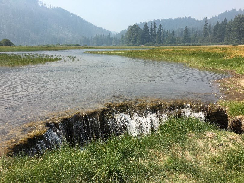
We also stopped at Buena Vista Overlook within Malheur National Wildlife Refuge. This will be one of our first stops on the field trip. It was a good time of year for us to see many birds. I'm not sure what birds are there in September. On our first day of the field trip we'll drive along a road between two canals in the refuge for 10 miles or so. Jan and I saw lots of birds and some deer there.

hotel diamond
We found, at last, the Hotel Diamond in the little settlement that was once a town (but very small.) There were many birders there. What a lovely place to stay! We stayed here two nights. I can't recommend it as lodging for the field trip, since it's 40 miles from our starting point. But any other time…Yes! They serve a family-style dinner that was fabulous. And the company was great. Mosquitos, however, prevented much wandering about outdoors. Large screened porches are typical of many homes in this region.

cinder cone at diamond craters
On our first day we explored Diamond Craters. Doug and I were here last summer, but the weather was wicked. This cinder cone will be one of the stops. Note the narrow road going right up to the top!
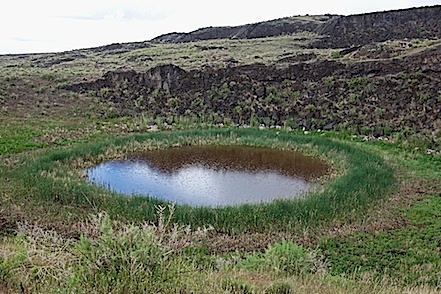
maars crater (created by Underwater volcanic stream eruption)
It began to sprinkle a little. Near the end of the road are two maars (craters of underwater volcanic steam eruptions), one dry, and one with a lovely little pool. The pool sediments were cored to help obtain an age range for Diamond Craters. When I walked down close to the edge, the ground was very spongy, and with every step, I had a whiff of sulphur. I couldn't get close enough to get the temperature of the water for fear of the ground collapsing and tossing me in.

juniper at crest of hill
We saw this juniper crowning the crest of a hill near another crater, and decided to walk cross-country to see it better. We saw a small lava flow along the way that wasn't visible from the road, but worth seeing. Just past the juniper was a rough road leading back towards the entrance to the Craters. I suggested to Jan that she walk back and drive the car to the entrance, while I walked down this other road to see if it would be driveable for the field trip. It wasn't, but I discovered another crater along the way.

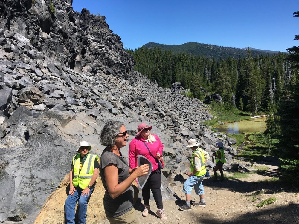
collapsed crater just off main road
This interesting crater is just off the main road, but not mentioned in the brochure. Note how it has collapsed in the center. Diamond Craters is known for its inflation and collapse features. I'll make it the last stop of our first day. We had to walk down a short, steep hill and then balance carefully while walking around, as the broken slabs of lava sometimes would shift slightly. Those who don't want to explore it can go back early.
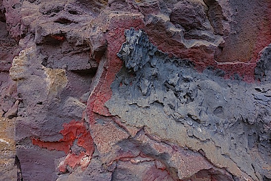
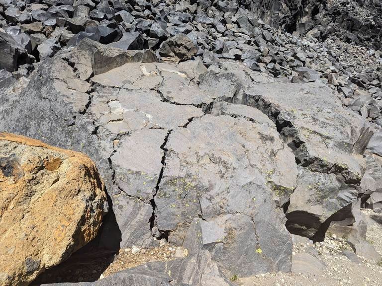
overlapping lava flows with black western fence lizards
One of the nicest finds in the crater were these overlapping lava flows, of many colors and textures. We saw some little black lizards running along the rock walls. I read that they are just the usual Western Fence Lizards, but with adaptive coloration for dark lava.
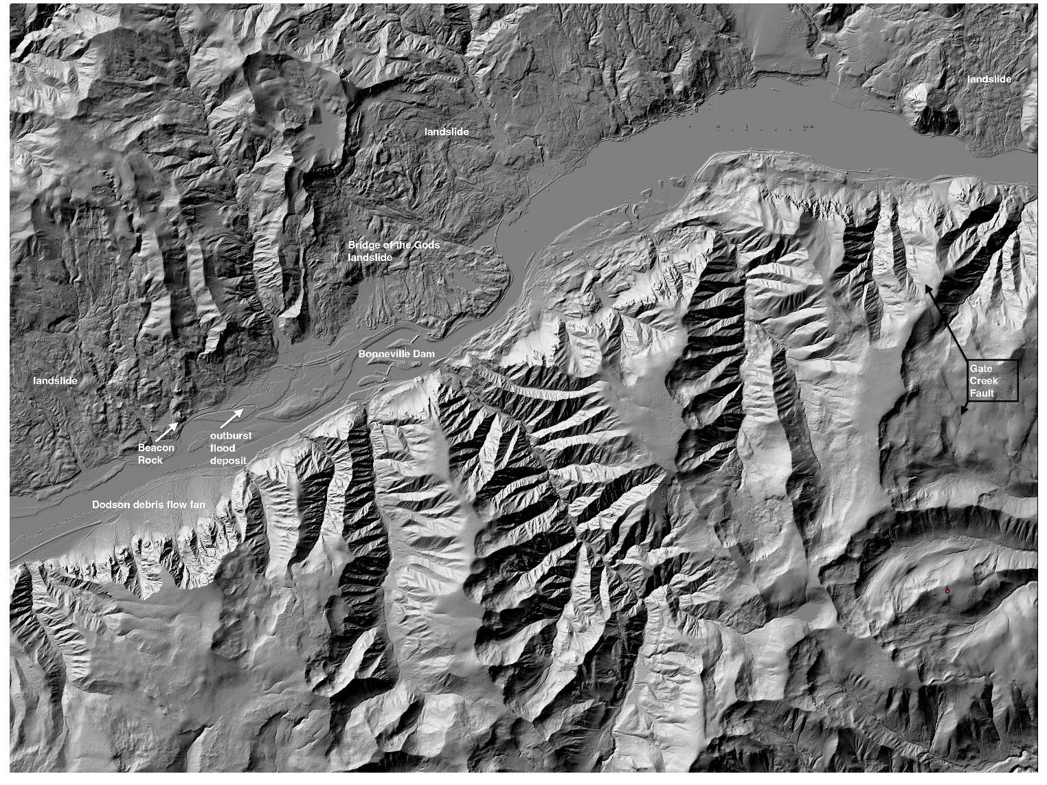
Next we headed to the north end of the Steens Loop Road to find these odd landscape features seen here on Google Earth. The road was gated farther up, but we were able to get close enough. I had sent this photo to several Portland State University geology professors a couple months ago. They thought these were Mima Mounds, formerly unknown on Steens Mountain.
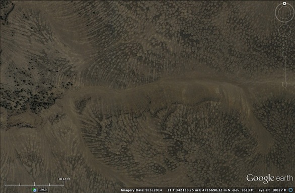

I had marked the location of these dark networks so that we could find them from the road. I wondered if the dark lines were rocks or vegetation?

jan at center of mima mound
They were clearly rocks. Jan stands near the center of a low mound, about 50 feet across and maybe 1-2 feet high, ringed by basalt bedrock. The soil on the mound is very fine-grained. We'll study these during the field trip. Do your research!
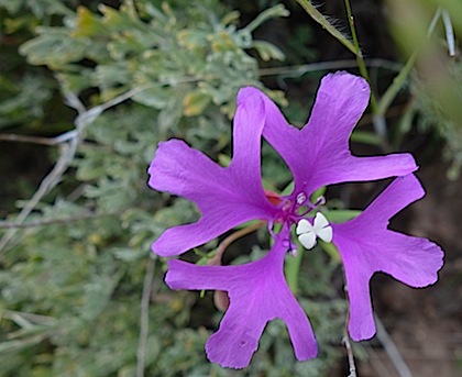
Clarkia pulchella
Scattered on the mounds were blooming Clarkia pulchella, "discovered" by Meriweather Lewis and described by William Clark in 1806. I have to put discovered in quotes because my source said it was "first discovered" by Lewis. Come on. I'm sure someone saw this flower before him. I wish there were better terminology to express that he may have been the first person to write about it in a document that survives or something. I've only seen this flower blooming once before, in NE Oregon.
Driving back to Diamond, we enjoyed the vista of these lovely mesas, capped by Devine Canyon Ash-Flow Tuff, about 9.7 million years old.

mesas capped by 9.7 mya devine canyon ash-flow tuff
catlow caves
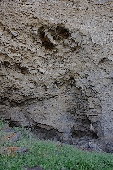
On our second day, we drove down the west side of the Steens, along the Catlow Valley. We met with Roaring Springs Ranch biologist Andrew Young. He has agreed to meet with the group during the field trip and talk about his work for the ranch. There are caves, once occupied by native people, at the base of the basalt cliffs above the ranch. He gave permission for Jan and I to explore them on our way back that day. He also showed us the location of the Catlow Caves further south. While he drove back to work, Jan and I climbed up over several ancient terraces of pluvial Catlow Lake, to reach the caves. Usually there's nothing I love more than a cave, but these frankly made me nervous. Not the least reason was an obvious owl nest in the center, right over our heads. Also, large rocks scattered on the floor of the cave hinted at the possibility of sudden death. On our return to Steens Mountain Resort, we were too tired to climb up to the caves at the Ranch.

domingo pass
We drove on past Fields on the eastern side of the Pueblo Mountains (which are south of the Steens.) Then we drove up to Domingo Pass on the only road that crosses the Pueblo Range. I wasn't sure if people would enjoy this (it's narrow and rocky), but Jan loved it. It was beautiful up there!
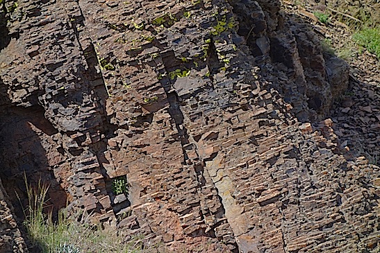
unusual fracture pattern in steens basalt outcrop
There's an outcrop near the top of Steens Basalt, with an unusual fracture pattern. Looks like those rocks used to face houses. At the summit, there's just enough parking. We walked to the top (not far) where a small rock shelter stands. The elevation at the pass is about 6300 feet.

So Many flowers in bloom up here!
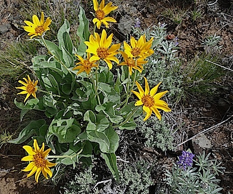
Balsamroot and Lupine
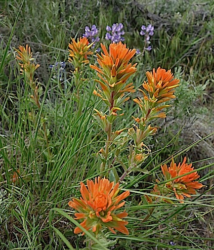
Orange paintbrush and lupine

Buckwheat
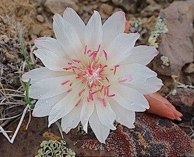
Bitterroot was blooming everywhere on the summit of the Pueblo Mountains. Such a rare treat to see!
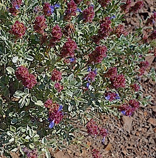
When we drove down to the "opal diggings", we saw what I think is purple sage.

horned lizard phrynosoma platyrhinos
Under the sage were two horned lizards, Phrynosoma platyrhinos. I took this photo from the web because mine didn't turn out very well. I saw these (first horned lizards I've seen in many years!) in the same place where last summer I saw a Long-Nosed Leopard Lizard. We also saw some Western Fence Lizards around.
It appears that others have been digging on this hillside, where nice opal rocks can be found. Here is a vein filled with opal in situ (about 1/2 inch thick.) But I haven't seen the site in any "rocks & gems of Oregon"-type books.
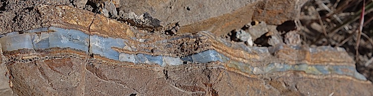
opal vein in situ 1/2" thick

One of Jan's finds

A bit of Steen's Basalt found in the Pueblo Mountains
After leaving the Pueblo's, we stopped at Fields Station for their legendary hamburgers and milkshakes. I wasn't sure if they were really all that good, or it's just that there's no place else to buy prepared food for 100 miles or so. Well, I can say that they are both delicious and enormous. The burgers are hand-formed, and 1/2 lb. size. One would do for two people easily. The shakes were so large that one could satisfy 3 or 4 people. They're served in those gigantic metal containers.
I asked the owner if it would be possible for our field trip group to pre-order burgers and shakes at least on one day of our trip, if we could arrange to arrive over the lunch hour. She was quite alarmed at the size of our group: we would have to order 2 weeks in advance and then from a limited menu. She could not even quote a price because it would depend on the price of hamburger at the time. Still, we might think about it. We can only buy gas at two places: Frenchglen and Fields, and they only have regular or diesel. The price? Why even ask, you have to buy it, and I was grateful it was available.
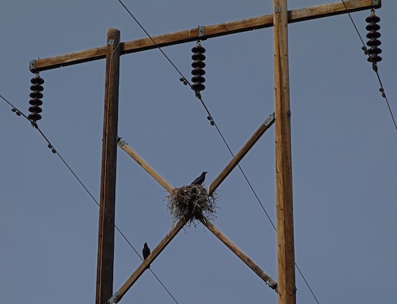
ROOSTING BIRDS
A few miles north of Fields, we turned onto a dirt road near a power station, heading NE to find Borax Lake. These birds were harbingers of trouble, it turned out...
We found the lake. That wasn't the hard part. The lake was lovely, with the relics of borax mining nearby. We did not walk along the trails to the springs, but will do so on the field trip. I think I saw some of the endemic and endangered chub in the lake. We took a sample bottle of lake water to look at later with the digital microscope. The far edge of the lake appears to be abrupt because the land falls away from the lake on every side. It occupies the top of a biogenic mound above the ancient lakebed.

BORAX LAKE
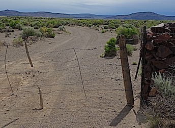
These barbed-wire gates were very difficult for us to get through. It took both of us to open and shut them. We really only needed to open and shut one, but...
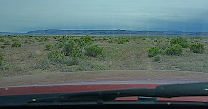
FAINT TRACKS THROUGH SAGEBRUSH FLATS
I wanted to try an alternate route from the lake due west to the Fields-Denio Road. It showed up on my large Oregon Atlas map and also on my IPhone map. We followed it for a few miles, having to hop out and open and close several more of these pesky gates. Eventually, however, the road faded to faint tracks through the sagebrush flats. We could just see the main road in the distance, but came up against a fence with no gate. So we had to turn around, running over several sagebrush, and go back. Again we hopped out to wrestle with the gates. We were working more efficiently with so much practice. Except one time, we closed it with Jan on the wrong side. She couldn't get through the fence so we had to do it again. I would say we're expert at the process now, though no stronger. It took an hour and a half for all this foolery to transpire, and I was so grateful that there wasn't a long line of cars following me!!
All day big dustdevils were being whipped up over Alvord Lake playa, though the sky was cloudy and temperatures moderate. There were some mammatocumulus cloud formations such as are associated with tornadoes in the midwest. Doug and I saw these also, but more prominently, in late August last year.
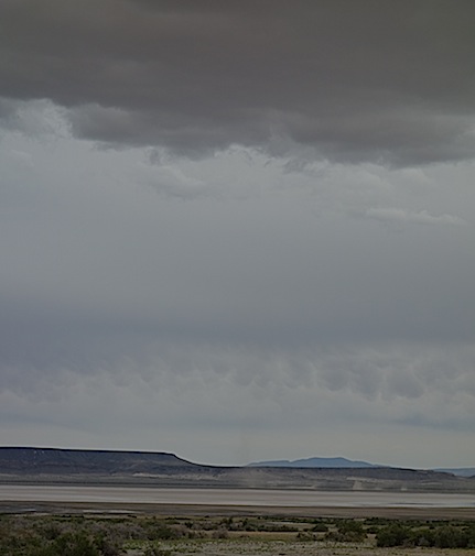
Mammatocumulus Cloud Formations

This dust devil looked like a very thin tornado

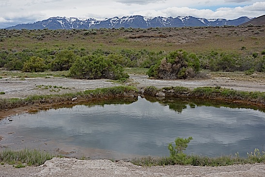
ALVORD HOT SPRINGS
We stopped at Alvord Hot Springs on the way up to Mickey Hot Springs. The soaking pool has a valve to allow bathers to adjust the portion of hot water coming in. I took temperatures of the pool, the stream nearby, and the springs just below the road. The pool was technically too hot: 107.9 F. Near the pool, the natural waters were 122.5 F, and at the source, 168.9 F. The water is slightly alkaline. I took a small bottle of water with some algae in it to look at later with the microscope.
I was pleased to see that our friend from last year, Joseph, is still the caretaker at Alvord Hot Springs, which now has a small store and restroom. He has an assistant, Rose, who was away at the time we visited. Between them, they get free parking for their RV's and may use the facilities, as well as a wage, in exchange for facility maintenance and staffing the store.
We found Mickey Hot Springs easily. The road is now signed. The road wasn't in bad condition except near the springs where it had recently been eroded by some heavy rain running off the desert. The large pool at Mickey was so beautiful. There were many more mudpots, active steam vents, and small boiling, hissing pools, than we saw in late August. It could be that there's more water available this time of year to interact with the heat from below.
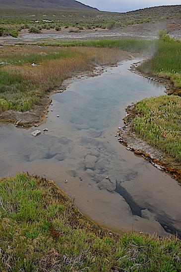
MICKEY HOT SPRINGS

One of the mud pots had these tiny mud volcanoes within (a couple inches across.) Steam was venting from the large opening.
The snow-covered Steens beyond one of the hot springs. We met a woman at Alvord Hot Springs who said she had been to the summit the day before. We were very surprised, as the road is gated. But she said she drove to the locked gate and decided to walk several miles in to see it better. A road grader picked her up and gave her a ride to the top! She still had to walk back to her car. How fun!
SNSTEENS OW COVERED STEENS MOUNTAINS

I wanted to go to Pike Creek Canyon, but wasn't sure which road took us there. We did finally find the right one. We met a fellow just driving in, Lee Howard., who said he was there to do some photography for a book.

The road in was pretty bad, with large rocks sticking up in places. But there were many places to pull out and park. It's not a long walk up into the canyon from the beginning of the road, and you can find pretty rocks all the way up. At this campsite area, a tree grows from a fracture in this huge boulder. Lee told us that we could have crossed the creek here and walked up an old mining road on the south side of the canyon. We'll make that an option on the field trip. Jan and I stopped the truck just below this spot, and walked in as far as we could on the steep slope of loose rock along the right side of the creek.

This rock was a little too large to pull out of the ground and carry, but isn't it interesting?? Former GSOC president Bart Bartels has some beautiful specimens he picked up here years ago. He'll be coming on the field trip and help us to identify some of these rocks.

We saw three large snakes while in the canyon. This one is a harmless gopher snake. Its markings caused me to mistake it for a rattler until I saw its head and tail. I saw another gopher snake, and a large boa (also harmless.)

Back at our cabin at Steens Mountain Resort, where we stayed the last two nights, we enjoyed "dinner and a movie." There were plenty of little creatures in the water from the hot springs and it was fun to watch them while we had our dinner. The microscope also runs on batteries, so I'll set it up wherever we visit a water feature for folks to observe the life in the water. One of my classmates did a great thesis on the diatoms at Mickey Hot Springs, which will be excerpted in our field guide.
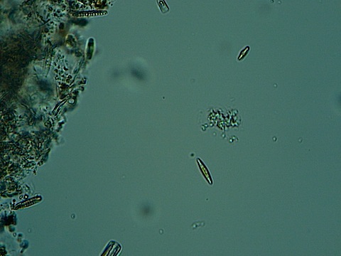
A variety of diatoms inhabit the water from Borax Lake. Many were motile.
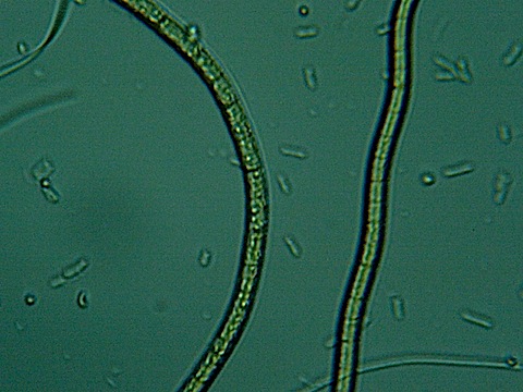
wo strands of algae (?) that seemed to move about, but maybe were just floating in the thin lens of water on the slide.

A nice sunset from the deck of our cabin. We risked major mosquito attacks to get this photo!