Day 1 of the 2020 trip to Eastern Washington
/Carol Hasenberg, Past President of GSOC and current Field Trip Director, visited eastern Washington recently with her husband John. They based the trip primarily upon the geologic topics covered in the “Nick From Home” video series by CWU professor Nick Zentner. If you’ve come in through the back door, i.e., Facebook or some other link directly to this page, you may want to start at the introduction page to the trip.

Overview of Day 1.

Day 1
We were happy to leave Portland for a break! The trip started on Sunday, July 26, 2020, with us barreling down I-84 east through the Columbia River Gorge. Our first geology stop would be Wallula Gap. On the way out, to get us into geo-mode and to break the monotony, I pointed out the roadcut with palagonite near Hood River, and the Ice Age Floods gravel bar in Phillipi Canyon near the mouth of the John Day River. Eventually the Wallula Gap hove into view, and we were rarin’ to go! We whipped by the parking lot for the Twin Sisters and had to turn around and backtrack to it (the first of many such instances).

My sidekicks on the trip, husband John and Lucy the Australian shepherd, posing in front of the Twin Sisters.
At Twin Sisters, there is short hike up the draw and we bore right, towards the top of the bluff overlooking Wallula Gap and with a great view of the Twin Sisters. These are a couple of stubborn pillars of basalt which resisted the assault of tens of massive floods as they poured their waters through the gap and over the smaller bluffs. Up we went and were rewarded with a spectacular view of the Gap.

Panorama of Wallula Gap from the bluff near Twin Sisters.

Closeup of the route from Wallula Gap to Lewis & Clark SP. Can you tell which way the water flowed during the Ice Age Floods?

My closeup of the Gardena bluffs and the Touchet beds. How many can you count?
I was keen to try out a very recent purchase of a clip-on telephoto lens (for my iPhone X), and I thought that the Touchet beds in the Gardena Bluffs just south of Touchet would be a good trial. I had studied and studied Google maps but could not find a place to go right up to the foot of the cliffs. So, we drove down Byrnes Road just west of the town, then down Maiden Road, around an airstrip, and alongside a farmer’s field on the dirt road. Not sure if this was a public road, but it did have a street sign.

The car got caked with loess while we looked at the Touchet beds. Fortunately there were lots of car wash emporiums in Walla Walla, just down the road.
As we got as near as we were going to get, I assembled my camera gear. I had a bit of trouble lining the lens up with the camera, so I ended up with a less than perfect shot. It was clear that I needed to practice with the lens a lot more. It didn’t help that we were practically up to our ankles in powdery loess, that wonderful soil of the Palouse but very susceptible to blowing around. Well, that is how it got to the Palouse. The soil was ground from rock by the Cordilleran Ice Sheet and it was blown all over Washington and parts of Oregon. Check out our car from a brief exposure.
But getting back to those Touchet beds. BTW, I’ve heard it pronounced as TOO-shee. According to Bjornstad, there are 62 rhythmites, or slack water deposits, from the IAF’s exposed on the Gardena cliffs along the Walla Walla River. Clastic dikes occur as well, and I think I’ve got one in my photo, such that it is.
It was a pretty big deal to see this site because I didn’t know of any other place which is accessible where so many rhythmites could be seen. Burlingame Canyon is on private land, and permission to see that site is very limited.

Map of where we viewed the beds in relation to the town and US 12. You might also be able to approach from the south side of the river, or on a boat.

This digital zoom from the iPhone is also a bit disappointing, but you get the idea.
The two sites were all that I had planned to see on the first day. We continued through Walla Walla, and the hills of the Palouse, until we reached Lewis & Clark Trail SP and made camp for the night.
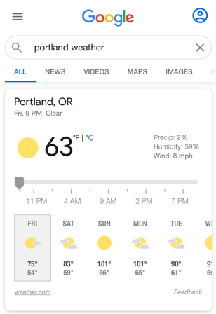
Friday July 24 weather forecast.
A word about the weather may be in order here before I conclude the discussion of Day 1. We started this trip thinking that we were going to have really hot weather for a day or two and then it would be cooling down. That cooling down did not happen, and the heat wave kept sending us temperatures in the 100+ range through Thursday, July 30. So, plans had to revise a bit based on environmental conditions.
COVID-19 assessment of Lewis & Clark State Park: Restrooms were cramped and the shower area was inside the restroom. Lots of families were camping there and not being especially careful. We decided not to shower at this park, and wore masks in the restrooms and washed hands well!
Click here for Day 2.


