DIY Geology Trip to Eastern/Central Washington State
/Inspired by the “Nick From Home” YouTube live casts
What do you do when you can’t go on a GSOC field trip?!? Well, my husband John and I have been watching Nick Zentner do his video thing all spring and summer on YouTube, and we really wanted to see some of the features of Washington state that have been highlighted on the series. So, we decided to go ourselves to eastern and central Washington and see some of this geology. This article is an interactive travelogue of that adventure!

Above is a map of the whole trip. Built on a Google maps satellite base, It shows the entire road trip with color coding for the days. If you want to bypass the prep talk below, here are the direct links to the blogs for each of the days:
Day 1 - Portland to the Wallula Gap, Touchet, and Lewis & Clark Trail SP.
Day 3 - Potholes Reservoir SP, Ephrata Fan, Columbia West Bar Overlook, Potholes Coulee, Frenchman Coulee, Ginkgo Petrified Forest SP, back to Potholes SP.
Day 6 - Lakeside Lodge, Wenatchee, Cashmere (home of Aplets and Cotlets!), Peshastin Pinnacles SP (almost!), Leavenworth, Icicle Gorge Trailhead, south on US 97 through Liberty, Ellensburg Motel 6.
PREPARING FOR THE TRIP
The first thing to do was to figure out what geology features we wanted to see, then where all the features were. I started making a bunch of lists, and I collected all the books I had on the area.
Our main objectives were to see features of the following:
Columbia River Basalt aka “The German Chocolate Cake”
Ice Age Floods
Features from the Okanogan Lobe of the Cordilleran Ice Sheet of the Pleistocene
A bit of the Crystalline Core Province of Washington
Mt. Stuart batholith area
Liberty area
Yakima River Canyon
Of these, the Ice Age Floods features of the Columbia River Province were of prime importance. This includes a variety of features, including:
COVID-19 is an important consideration in planning a trip this summer. As John and I are older adults, we definitely wanted to minimize risks at restroom stops, food shopping, and gas stations. Our original plan was to car camp, bring most of our meal food with occasional stops at grocery stores, and avoid crowds.
I also found and referenced the State of Washington COVID-19 Data Dashboard so I could monitor which counties were “hot” while we were on the trip.
Palouse Falls - I’ve always wanted to see this!
rhythmites/slackwater deposits
scablands
gravel bars/giant ripple marks
coulees
expansion bar fans
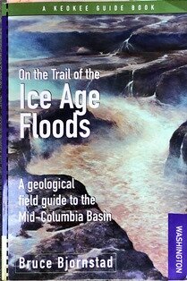
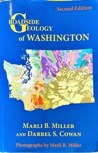
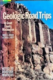
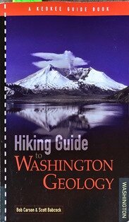
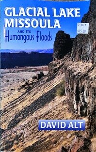
I consulted a number of reference books on the subjects. Nick Zentner highly recommended Bruce Bjornstad’s book On the Trail of the Ice Age Floods for touring the area, so I ordered a copy and we used it extensively. I also relied heavily on Marli Miller and Darrel Cowan’s Roadside Geology of Washington. I also referenced several of the trips mentioned in Mark Amara and George Neff’s Geologic Road Trips in Grant County, Washington (a souvenir of the 2002 GSOC trip to Wenatchee) and Bob Carson and Scott Babcock’s Hiking Guide to Washington Geology. The David Alt book Glacial Lake Missoula and its Humongous Floods is a classic and is good for referencing flood features from the illustrations.

Then of course there were the maps. I gathered the state highway maps from our stock of paper maps, and then got online and downloaded as many geology maps and topo maps of the areas that I could find at a variety of scales and loaded them on the Drop Box for use on my iPad. These were available from USGS, the NFS, and Washington State. My favorite was the Geologic Map of Washington State, 2005, by Eric Schuster.
After the basic areas of interest were identified I lined up the campsites. The first four nights we could stay in state parks, and I made those reservations. I also saw that to visit state parks and other features you pretty much had to get a Washington Discover Pass, and I ordered that right away as it took two weeks to get in the mail. I already had an America the Beautiful Lifetime Senior Pass, which would cover any federal properties we visited.
For the last 3 nights (we originally planned the trip for 7 nights) our plan was to snag a campsite in the national forest on Icicle Creek. There were 6 campgrounds up there and about 150 campsites. I figured there would be open campsites on a Thursday, as most of them were rented on a first come, first served basis. As you will see, it’s always good on a trip like this to keep a flexible outlook on your plans.
Then the route planning happened. I had reserved campsites in the following parks:
Lewis & Clark Trail SP - Night 1. Although it was situated right along US 12, it was the only state campground open near Palouse Falls, the easternmost of the features we wanted to see. A number of carmpgrounds were closed due to COVID-19 cutbacks.
Potholes Reservoir SP - Nights 2 & 3. This was the most centrally located campground in the Columbia Basin, near a lot of features, so I reserved it for 2 nights so we’d have one full day to tour around the area. It was also right by the Drumheller Channels, a major flood feature.
Alta Lake SP - Night 4. This park is located on a glacial remnant lake perched in a small valley above the glacial outwash deposits from the Okanogan Lobe of the Cordilleran Ice Sheet. It is a good spot to camp after travelling north up the Grand Coulee and heading south down the Columbia Valley.
The trip was made on July 26 through August 1, 2020. You can see the routes on the above map and to continue the tour, click on the links to the trips for each day. I’m going to be publishing the days as I complete them, so if links are not yet up do come back in a day or two. Enjoy geotouring with me!


Field Trip Director
Annual Newsletter Editor
fieldtrips@gsoc.org