John Day Raft Trips
/Enjoy the slideshow of the sights on the John Day River!
Trip Report: May 25 -28, 2021 by Bill Burgel
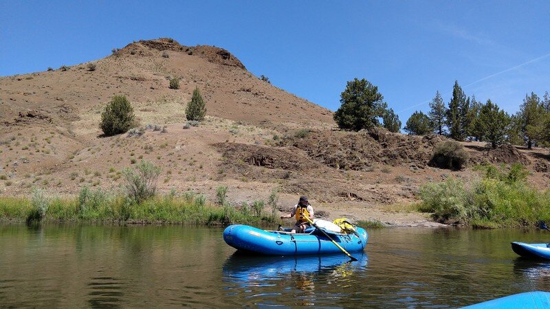
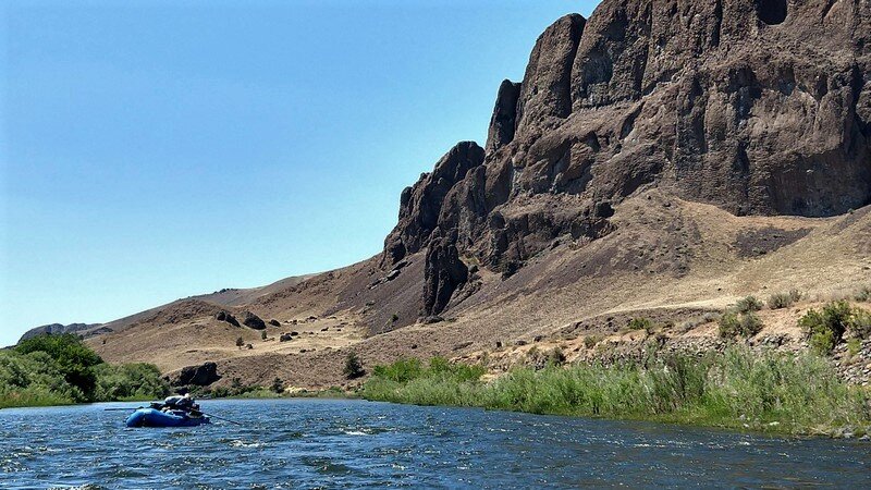
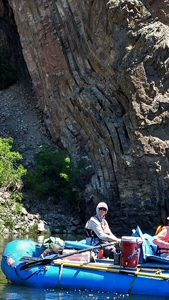
Under threatening skies, 12 GSOC adventurers and 4 Ouzel guides with raingear nearby shoved off from the banks of the John Day River near Service Creek. Our gear boat had already drifted off with all our personal belongings, tents and provisions committing us to this journey. Led by Geologist Dr. Gordon Grant, we were soon floating past outcrops of Picture Gorge Basalt leaving all traces of civilization behind. Geesockers in this “early group” included Nancy Collins and her partner Kevin Brown, June and Norm McAtee, Brian Scott and Bernadette LeLevier, Julia Demaree, Bill Burgel and his spouse Charlotte Finn who invited their geology-friendly friends Ron and Cathy Waterman.

Starting out on the Paddle Boat
Dr. Grant oared his solitary raft from raft to raft explaining the subtleties of the geologic landscape as it unfolded while we drifted downstream. Soon the skies opened up and those who hadn’t already covered up, did so as we continued to make our way to camp. Because of the weather, our guides camped early this first day which enabled us to hike up a side canyon to look at the hackly exposures of Picture Gorge Basalt. Dr. Grant delighted in explaining the evidence for the numerous debris flows that surrounded us as we hiked…now under a rather heavy rainfall. We sixteen were very grateful when our rainstorm ended just before dinner.
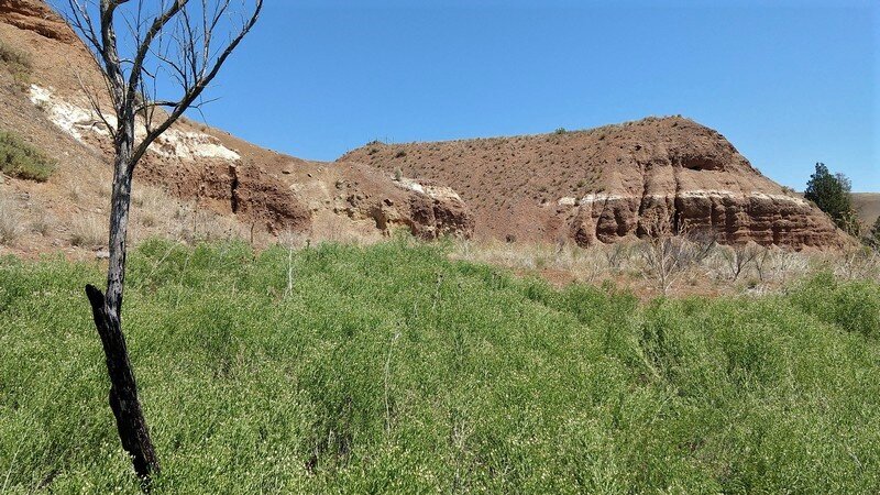
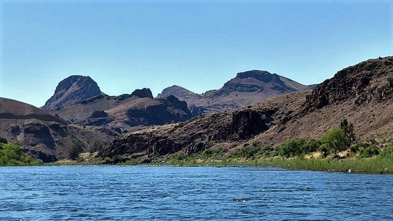
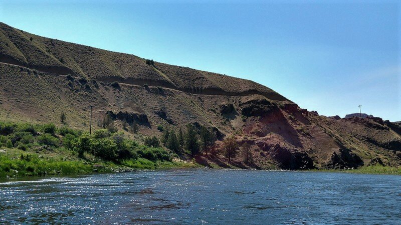
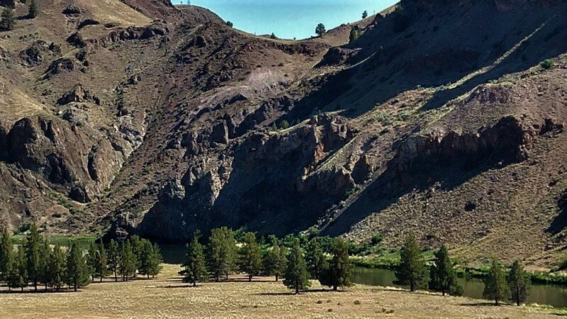
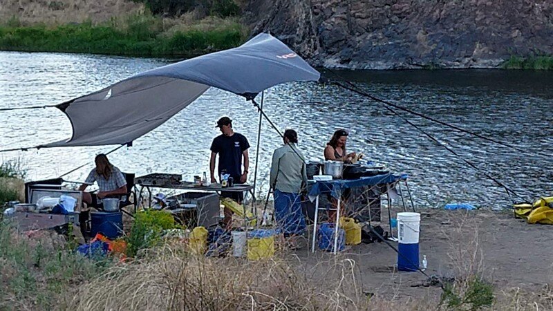
As we packed up the next morning, Dr. Grant walked us through the depositional regime along the beach we found in camp. He discussed the 1861 flood event on which we camped the previous night. Day 2 had us floating out of the last of the Picture Gorge Basalt and into the John Day Formation. As we approached Twickenham, the only habitation on our journey, the valley widened out as we encountered the ash beds of the John Day Formation. Highly erodable, the ancestral John Day cut easily into the John Day Formation ashbeds creating pasturelands for the ranchers in the Twickenham area. We soon drifted out of the John Day and into the Clarno Formation. We would stay in this varied facies terrain until reaching its type locality at Clarno, the end of our float trip. Day 2 camp was a “tight” affair with us all pitching a tent within 10 feet of each other. Our weather improved significantly and many of us jumped in the river to bathe.
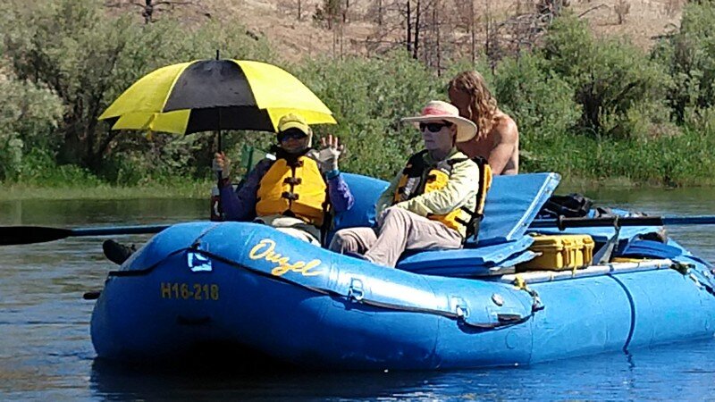
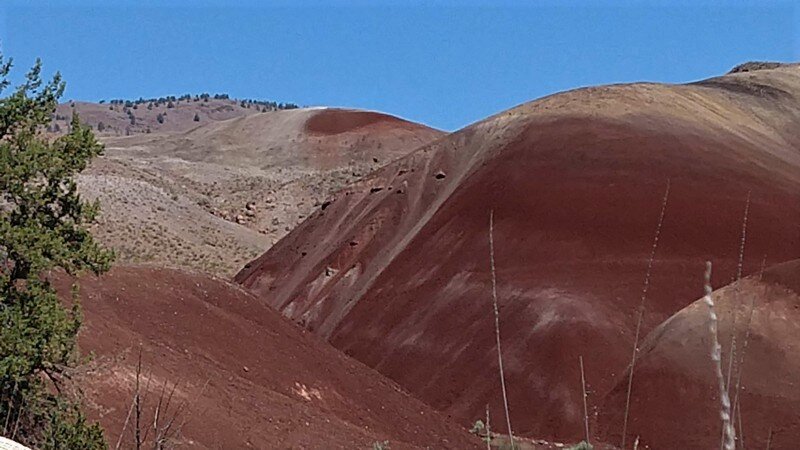
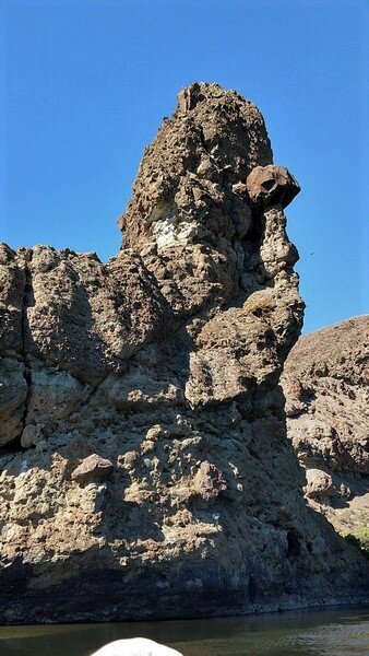
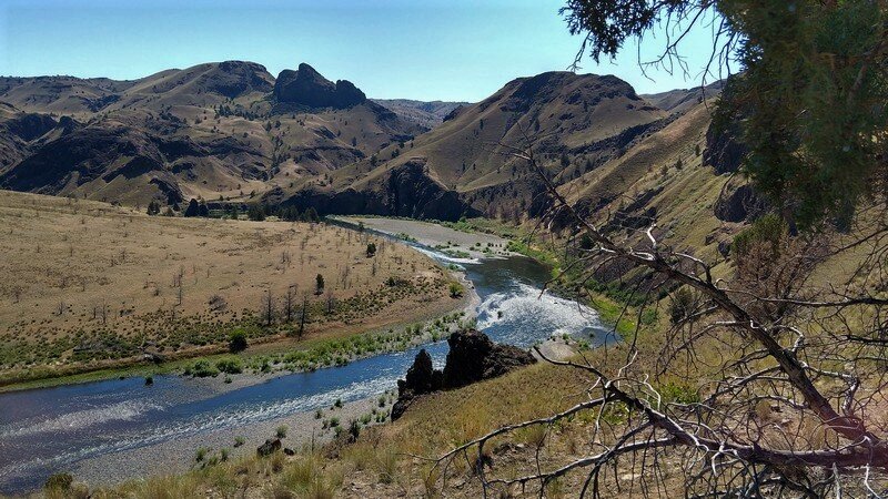
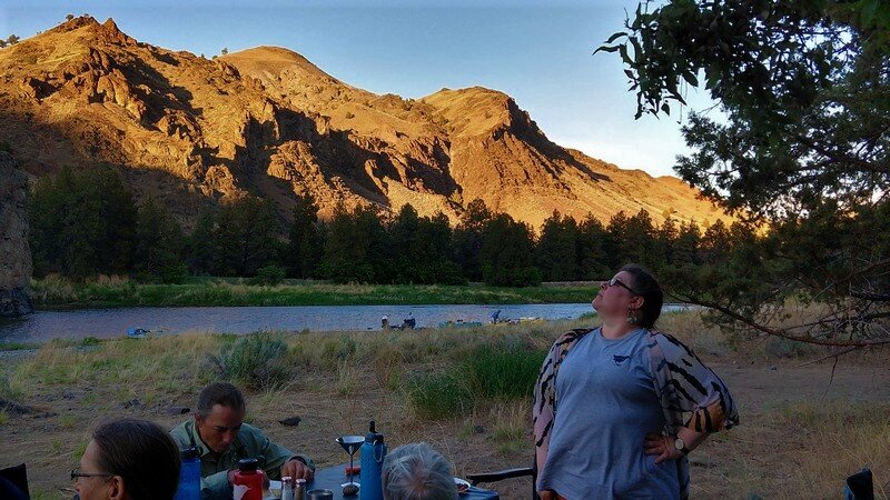
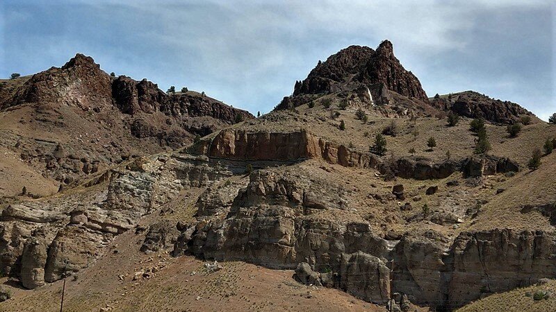
Our float on Day 3 saw us encountering the basaltic and andesitic lava flows and debris flows of the Clarno Formation. We hiked with Dr. Grant at lunch time on a large meander loop breaking rocks again and again to examine the erosion “rind” on each clast. Our guides paddled against a slight headwind as we reached our last night’s camp at Last Chance campground which offered us geologists a prime view of Cathedral Spire (?), a plug of columnar Clarno Andesite. Our guides and a few of the guests dressed up on costume night.
![Cathedral “Rock” “Spire” [???] (Name is not clear.)](https://images.squarespace-cdn.com/content/v1/5358c2a3e4b00ce4f224c17d/1624835778536-LIZJVJRXKML9G0CNS3DQ/IMG_20210604_072538693.jpg)
Cathedral “Rock” “Spire” [???] (Name is not clear.)
As we prepared to push off on our last day, Day 4, Dr. Grant explained the nature of whitewater and how the frothy “white” seen on the tips of fast moving waves was the result of energy conversation during super critical flow. He further explained that he and his associated were working on a hypothesis attempting to examine if lava flows also exhibited some of the same features as seen in water moving under various tranquil and super-critical flow regimes.
By 2pm we reached our take-out at Clarno and quickly de-rigged. I think I speak for the group in saying that after being re-supplied, we would have gladly continued another 5 days down to Cottonwood, the next location on the John Day River from which you can exit the river. Thanks to GSOC for organizing such a wonderful journey and we hope that GSOC arranges for more geologist-guided trips with Ouzel Outfitters in the future.
GEOLOGY, HYDROLOGY, and PICTOGRAPHS – oh my!
Just a little description of some of the science we learned along the way, by Patty Hyatt, Bill Burgel and Barb Stroud.
This information is from the two Ouzel Outfitters John Day rafting trips that GSOC arranged in May and June 2021.
The John Day River beginning at Service Creek (1650’ elevation) flows east and then north through Picture Gorge Basalts (16-5 Ma), the John Day formation (18-39 Ma), and ending with Clarno formation (54-40 Ma), with takeout at Clarno (1260’ elevation).
Dr. Gordon Grant tells us we will get a feel for the geology of north central Oregon. He states that geology is destiny: soft rocks result in a wide, slow river. This area is all volcanic. We are surrounded by what look like pyramids of stair steps of the Picture Gorge Basalts (PGB), a large volume of relatively young flood basalt that flowed from vents in eastern Oregon and Washington to the Pacific Ocean via the ancestral Columbia River. For comparison, the oldest rocks we will pass are the 50 ma Clarno Formation. Lest we forget, he informs us that the youngest rocks of the Grand Canyon are 225 ma. PGB are categorized with the Columbia River Basalt Group, a group that we will be out of before the end of today. To identify the PGB look for flat-lying flows with columnar jointing and a crinkly entablature. The columns are cooling cracks.
Dating Flood Deposits:
Dr. Gordon Grant talked with us about dating of flood deposits, explaining some of the impacts of the major 1861-2 western US flooding. This included dating techniques.
1. Detrital zircons have been used to constrain the depositional age of host sediment and reconstruct provenance
2. Cosmogenic dating also called surface exposure dating is a collection of techniques for estimating the length of time that a rock has been exposed at or near Earth's surface. It is used to date erosion history, rock slides, fault scarps, and other geological events. It is most useful for rocks which have been exposed for between 10 years and 30 Ma, and works to figure elapsed time a rock surface has been exposed to cosmic rays.
3. Carbon-14 works for things younger than 50,000 years.
4. Biogenic dating relies on the growth of organisms on the surface of rocks.
5. Dendrochronology is the scientific method of dating tree rings to the exact year they were formed. As well as dating them, this can give data for dendroclimatology, the study of climate and atmospheric conditions during different periods in history from wood.
6. The tephra library is a reference of ash fall deposits and describes characteristic material that comes to rest in layers from a volcano. It is fragmental material produced by a volcanic eruption regardless of composition, fragment size, or emplacement mechanism. Ash turns into clay in a process called diagenesis. Diagenesis is the process that describes physical and chemical changes in sediments caused by water-rock interactions, microbial activity, and compaction after their deposition.
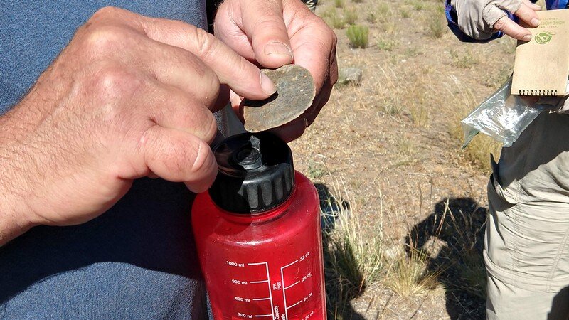
7. Weathering rind measurements of thickness may help dating a flood.

Note the large flood deposit in the upper center of the picture.
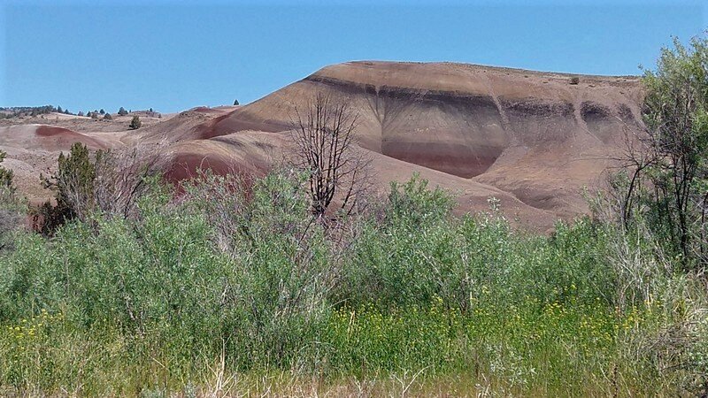
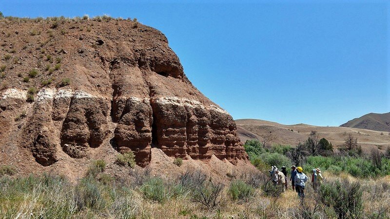
Our own ‘Painted Hills’ and ash layers:
The John Day Formation (18 – 39 ma) lies unconformably below the flat-layering Picture Gorge Basalt (16 ma). At the contact, the JD has ash from remote volcanoes, some over 100 miles from the ash beds. The contact we observed from the rafts at the end of the first day is on the north bank. An extinct range of volcanos (precursors to the Cascades) to the west are thought to be a candidate source. White ash can be fossiliferous. In the time between the eruption of the PGB and the ash falls of JD-time, landscapes (streams) developed. JD time is wet and tropical as evidenced by the depletion of its ash beds.
Our rafts approach Priest Hole, an eruptive center, which is located about 12 miles from Mitchell, Oregon. This has been mapped by DOGAMI as Clarno but looks a lot like the John Day with the Painted Hills peeking through.
The colors represent paleo environments: Red color indicates oxidized paleosol humid conditions (think Puerto Rico). Green can be from a reducing environment such as a marsh. Buff colored rocks formed in arid conditions. We see from the river, not too far from shore, a large white layer among the colors. What is it? Need a closer look. Possibilities may be an ignimbrite, ash fall, or lake deposit. If it is a lake deposit, we can possibly expect fossils.

Painted Hills (not the National Monument)
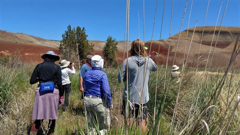
We get out of the boats and bush whack slogging through some mud and up a steep bank: we are really geologists now. Still going after that white layer we want to see the rocks that comprise it and make our hypothesis as to its origin.
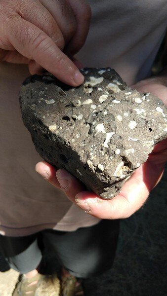
Here, we find angular clasts. This is no lake. A lake has tumbled clasts that arrived by many river miles of river travel, like us. Angular, not tumbled, but big clasts supported by the matrix and lots of it. Is this a lahar (short-lived debris flow)? If this is Clarno it would have developed relief. We can’t use the ash library; this is too old.
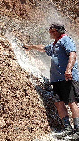
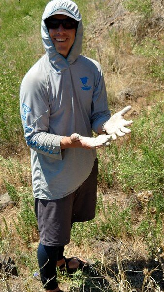
We get right up and touch (whack with a geologist’s hammer) this white layer that we saw from our first landfall. It is a soft, white powder that reminds some of us gardeners of diatomaceous earth.

Gordon Grant with ashfall tuff
This soft white ash would have required a good amount of relief to flow like a lahar. After several white layer locations are observed and hammered on with a rock hammer, the ashfall tuff seems like a shallow flood plain deposit with lenses of gravel. A lake is low energy. This is flood plain, with its subtle variation in grain size, cross bedding, and scoop-shaped lenses of gravel that indicate a high energy depositional environment as a debris flow. The Clarno Formation is famous for high-energy environments.
Advice from Gordon: The present is the key to the past. Look at what you have, before letting unfounded ideas and assumptions guide your exploration.
On the way up to another viewpoint, Dr. Grant displays yet another talent by reciting the entirety of Robert W. Service’s The Cremation of Sam McGee from memory!
Wave Physics:
Dr. Grant described the physics of water flow. He started by describing air travel and sonic booms – sonic, supersonic, and subsonic – traveling in that case at, above or below the speed of sound. Then he compared the water flow to those states, critical, supercritical and subcritical. He demonstrated by tossing stones into the moving river. We observed that the ripples move away from where the stone hit the water in a oval manner, where the water is slowly flowing. Upstream of where the stone entered, the oval is compressed, whereas downstream it is elongated. As water increases in velocity going into a supercritical state, the pattern is interrupted and may not even be visible.

Rapids (class 1) with small hydraulic jumps, or holes as described by rafters.
To help us better understand this concept, Dr. Grant referred us to an issue of Science Findings (published by USDA, Oct 2020) by Andrea Watts. Here are a couple of quotes from this article and here is the web location: https://www.fs.fed.us/pnw/sciencef/scifi232.pdf
“Just downstream of these rocks one typically sees a white foamy wave —that’s a hydraulic jump. Kayakers and rafters call it a ‘hole.’ The water flowing over the rock is supercritical and the water further downstream of the rock is subcritical. This foamy wave is the way the energy in the water is released”
and:
“The critical flow theory suggests that mountain streams adjust their beds and banks to maintain a hydraulic condition called critical flow. This is an energetic optimum whereby the maximum volume of fluid is moved with a minimum amount of energy.”
Interestingly, we found by reading this article that Dr. Grant was the developer of the hypothesis of critical flow in the 1990s. Recently the idea was verified under laboratory conditions and is now being used by water managers and scientists to better understand flow not only of water, but potentially also of lava and mudflows.
Ancient Floods:
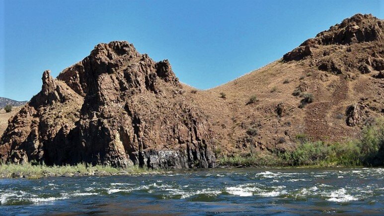
At the top we observe evidence for an anomalously large outbreak flood: giant sand bars and flood plain. We can see our tents far below. Giant floods are associated with, and likely the result of dam breach following a landslide up river. Reference the Clarno Rapids which we will avoid by taking out just before we reach them. Giant landslide dams have also been identified on the Deschutes and Owyhee Rivers.

Our campsite at the base of the Clarno, possibly on land created in the 1861/2 flood event.
Dr Grant draws our attention to the dramatic change in the course of the river as it is constrained now by the hard, high, and varied rock of the Clarno Formation, which he called “the dog’s breakfast”. This formation is a volcanic landscape dominated by andesite, which is higher in silica than the PGB and does not flow far from its eruptive center. Compare the JD, which is characterized by ash from distant sources.
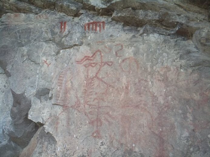
Pictographs:
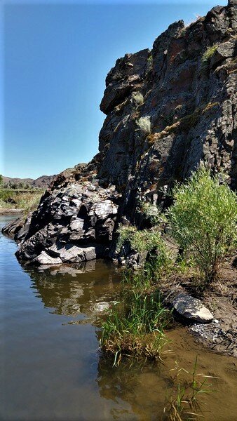
Time for a voyage of discovery on Dr Grant’s part. He is secretly searching for pictographs which he has marked on an old map as near to the Island Embayment ATV track. He rows across the river and hikes to the top of the terrain finding quartz veins. Quartz has a low melting point, so when other species have crystalized out of a melt, the quartz remains liquid. That’s why we see quartz veins. He also found big breccia and a lava flow. And he did find the pictographs, marked many years ago by a sign (BLM?) stating petroglyphs (which are carved into the rock). Pictographs are drawn onto the rock, in this case in a red ochre color.

Pictograph near the river.
Granodiorite:
A set of collected rocks gradually increases on the dining room table. Patty’s contribution is a granodiorite transported hundreds of miles down the JD River from one of the exotic terranes. Granodiorite is a phaneritic-textured intrusive igneous rock similar to granite, but containing more plagioclase feldspar than orthoclase feldspar. Granodiorite has greater than 20% quartz by volume, and between 65% to 90% of the feldspar is plagioclase. Hornblende is more abundant in granodiorite than in granite, giving it a more distinct two-toned or overall darker appearance.

Rocks and cheesecake for dessert!
All in all, a wonderful time for all of the GSOC members and guests on both of our raft trips, and most of us want to schedule another trip with Ouzel Outfitters soon!


