Janet's Journal: GSOC Mount Hood and Eliot Glacier Field Trip
/by GSOC President Janet Rasmussen. Additional photography by Julia Lanning and Paul Edison-Lahm.

Panorama Point Overlook
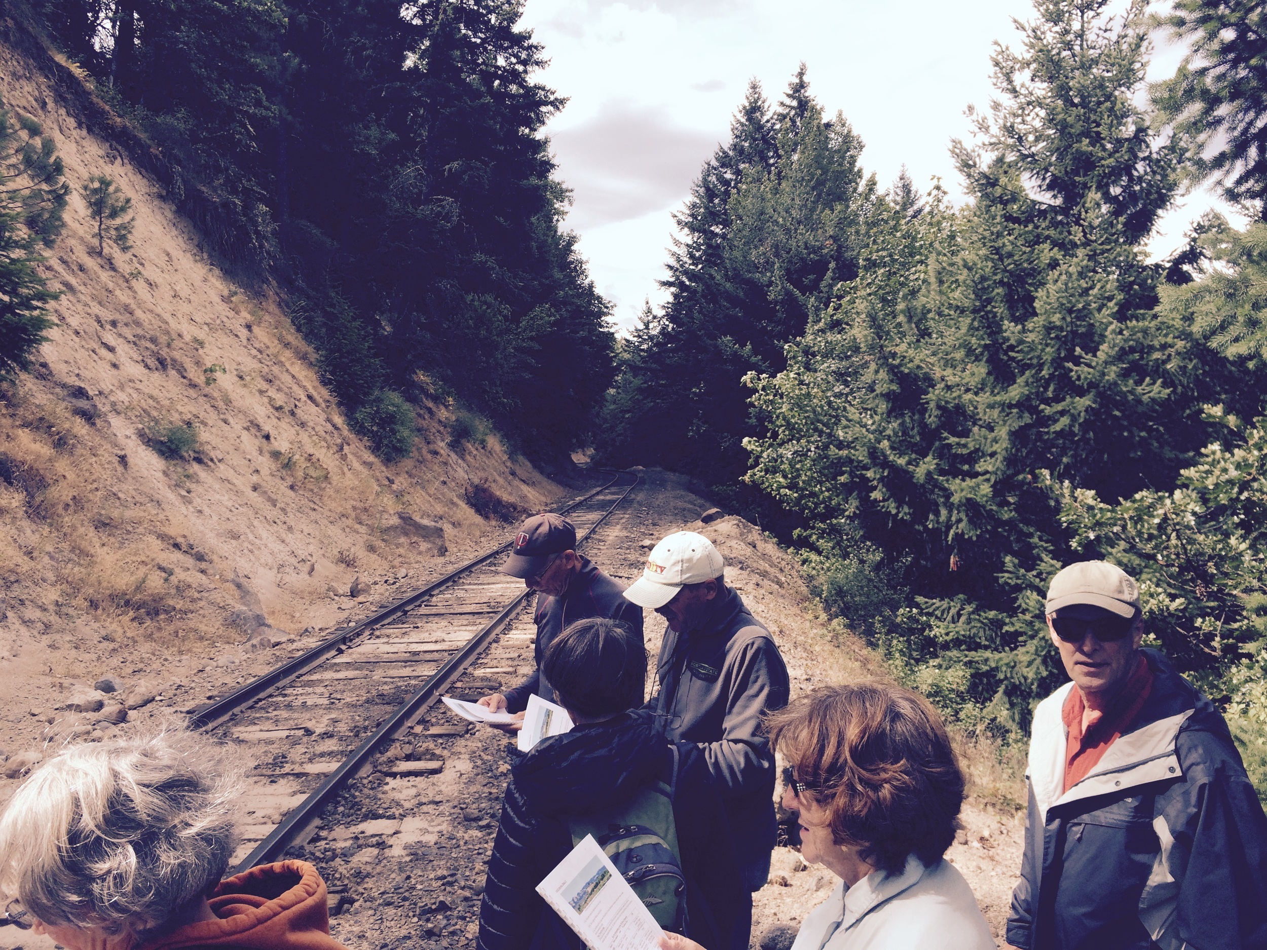
On Saturday, July 11, 2015, Bo Nonn and Larry Purchase led GSOC members on a field trip to Mount Hood and Eliot Glacier.
We met at Panorama Point Overlook outside of Hood River and traveled to our first stop on the shoulder of Highway 35 beneath a railroad overpass. Here we are looking at a cutbank of lahar sediments from Mount Hood, which are less than 38,000 years old.
Lahar Sediments
Author Janet Rusmussen
Our next stop was the debris flow below the Middle Fork Hood River Bridge.
Middle Fork Hood River Bridge debris flow
Yes, we spent quite a bit of time beneath bridges. This one-lane bridge was replaced after the 1996 debris flow, caused by the failure of a lateral moraine at Eliot Glacier. It primarily serves logging trucks. While scouting the trip, Bo had to leap over the railing to avoid being crushed by one of them.
Trip leaders Larry Purchase and Bo Nonn.
Julia Lanning snapped this photo of the group, all eager to learn more about Portland's closest active volcano
Julia gets her shot.
Following Lava Bed Road took us to a colorful junkyard, and just beyond it, to the foot of the massive 7700 year-old Parkdale Lava Flow.
Picturesque scrapyard (photo Julia)
Parkdale Lava Flow - Google Earth Image
The lower end of the flow loomed more than 300 feet above us.

Parkdale Lava flow rises more than 300 feet above the surrounding country.
Our next stop was where the 1996 debris flow came across the road to Mount Hood.
We walked through the debris flow to the vent area at the top of the Parkdale Lava Flow.
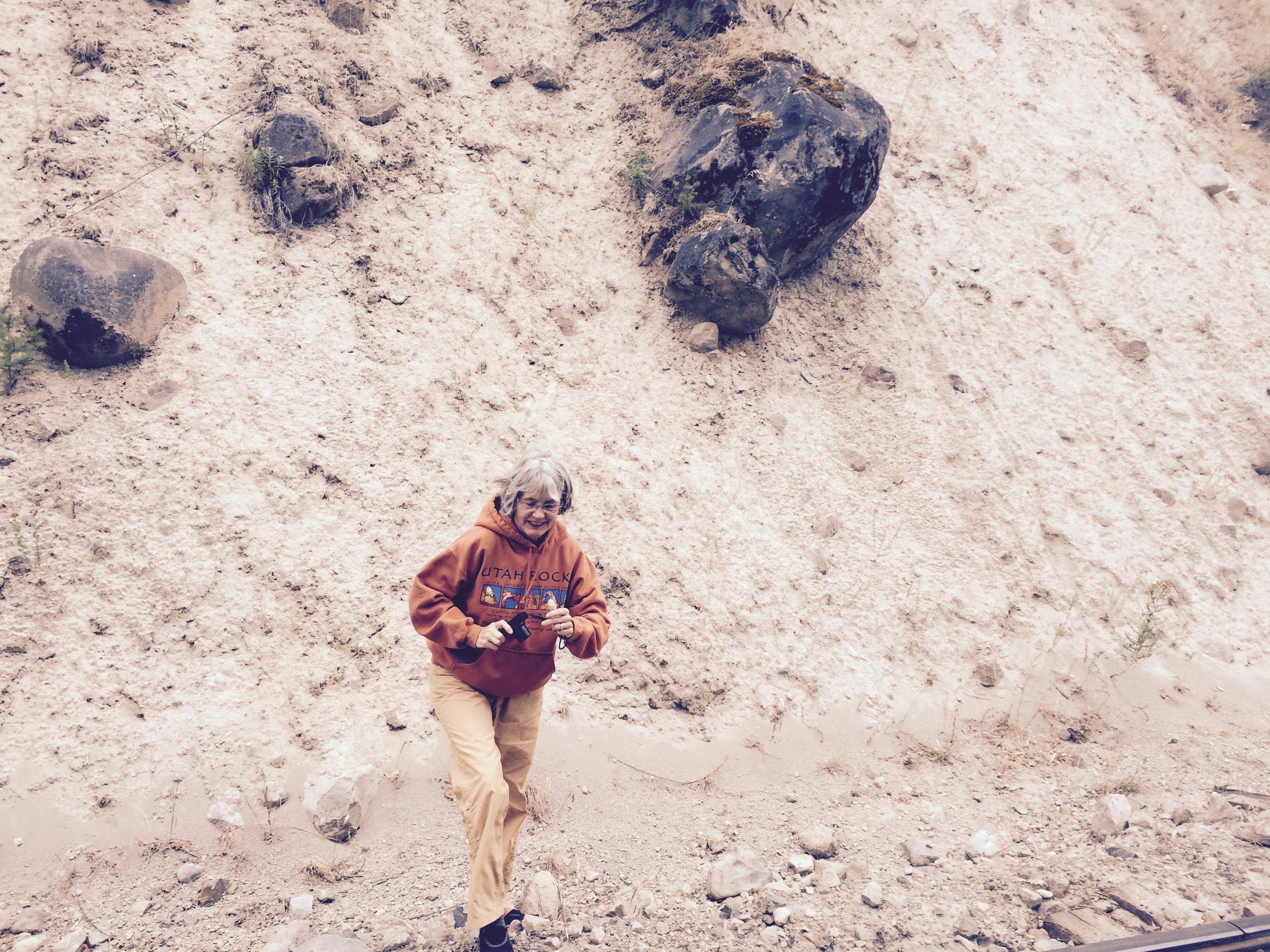
Dawn stands for scale against an enormous boulder that was carried down the mountain by the power of the debris flow.
A group photo of everyone but me, since I was taking the picture. Aren't they a handsome group?
(Left to right seated: Larry, Mark, Julia, Paul, Dawn; standing: Doug, Ellen & Bo, Dennis, Rebekah & Eric.)
We began the long drive up to the Cloud Cap Inn campground, not far below Eliot Glacier.
This is a part of Mount Hood I've never seen. There were some outcrops of volcanic rock along the way that exhibited puzzling fracture patterns.
In 2011, the Tilly Jane Fire burned very close to our campground and to Cloud Cap Inn.

Fracture pattern mystery
Campground
Finally the campground! We all chose spaces near one another for ease of visiting. We had trouble understanding the posted rules for payment and usage, which were vague, contradictory, and certainly open to interpretation. Finally we chose a plan and stuck to it. We weren't ticketed anyway.
Now for the fun part: We took a great hike. I was walking slowly up the forested trail and suddenly came into the open. There was my group, far ahead on this narrow path along the ridge of a moraine.
It was exhilarating!
Down below us was the toe of Eliot Glacier, where the meltwater is running out of the holes. The Glacier is covered with debris down here, so not the sparkling beauty we see farther up the mountain.
Ellen Nonn
Bo and Ellen Nonn have climbed this mountain a number of times, and by a different route than most. While we were up there, some younger folks came down carrying skis. They had hiked up thousands of feet to ski on the snowfields!
Doug and Janet on the hike. What a beautiful day!
Back at the campground, Bo drew my attention to the unusual assemblage of rocks on the hilltop nearby. Why/how does the lava form curving cooling fractures? What is the significance of the red scoria caught between the smoother gray andesite?
A large block of swirly vesicular rock rests near the bottom of the hill.
To the north, we could see Mount St. Helens.
In the morning, we all walked over to view nearby Cloud Cap Inn.
I watched an Oregon Field Guide episode about this wonderful old lodge, so I was excited to see it. It was locked up but Larry gave us an overview of its history.
It's huge, and built sturdily of logs way back in 1889 by William Ladd of Portland. It's off the grid, and lit by lanterns and propane lights. There is a generator for a two-way radio.
Larry discussed the history of the Inn's ownership over the years. We regretted that the only tours would be later in the day and were by reservation only. As he wrapped up his presentation, though, here came two rangers to open the lodge for the day's tours. They were kind enough to invite us in and we got a tour after all! It was wonderful!
Larry in the dining area of the Inn, full of memorabilia going back over 100 years. Right now a group called the Crag Rats maintain the Inn.
I took photos of photos. This one was scary!
The Inn has a long hallway, from which are many rooms with bunk beds for the mountain climbing-skiing enthusiasts.
It looks like when the door hardware failed it was replaced but not removed.
The front windows, with many small panes, still held the old wavy glass.
This 1931 poster illustrates a failed plan to put a tram up to the top of Mount Hood from a rebuilt Cloud Cap Inn. In front of the luxurious hotel appears to be an ice skating rink. I love the airplane buzzing over the scene. Well, it didn't happen...
This photo shows the gracious living achievable in the early days of the Inn. I could sit around reading in this environment!
A ranger pointed out the signatures written in pencil on some of the walls. I wouldn't have seen them, but my flash picked them up.
Climbers back in the day included women. Note that they're all hanging onto a rope…but not attached to it. I understand there was a secured rope at one time all the way up. That would help, or maybe just give false assurance.
Later, we took another short hike past some of the cottages which can be rented near Cloud Cap. Isn't this one charming?
An A-Frame crowded with trees that have grown too big. Some are flagged to be taken out.
We finally got on the right trail to see the headscarp of the 1980 landslide that caused a flood at Pollalie Creek downstream.
Searching for more information about this event, I found United States Geologic Survey open-file report on the Christmas Day event. Here is an excerpt from the abstract of the above-mentioned report, written by Gary Gallino and Tom Pierson in 1984:
At approximately 9 p.m. on December 25, 1980, intense rainfall and extremely wet antecedent conditions combined to trigger a landslide of approximately 5,000 cubic yards at the head of Polallie Creek Canyon on the northeast flank of Mount Hood. The landslide was transformed rapidly into a debris flow, which surged down the channel at velocities between about 40 and 50 ft/s, eroding and incorporating large volumes of channel fill and uprooted vegetation. When it reached the debris fan at the confluence with the East Fork Hood River, the debris flow deposited approximately 100,000 cubic yards of saturated, poorly sorted debris to a maximum thickness of 35 ft, forming a 750-ft-long temporary dam across the channel. Within approximately 12 minutes, a lake of 85 acre-feet formed behind the blockage, breached the dam, and sent a flood wave down the East Fork Hood River. The combined debris flow and flood resulted in one fatality and over $13 million in damage to a highway, bridges, parks, and a water-supply pipeline.
Our last official stop was at White River Bridge.
The White River has washed out bridges repeatedly in the last 100 years. The problem is that the glacier rests over geothermally active ground. It can melt at its contact and when certain threshhold conditions arise, suddenly release a flood of pent-up water and debris, which incorporates more loose material farther down the canyon.
GSOC past President Rik Smoody had assisted in planning this trip for the past couple years while the road was being repaired. During his presidency, he lead an excellent field trip to Mount Rainer, focussing on the process of aggradation. Aggradation is the increase in land elevation due to the accumulation of sediment. We took 20 minutes or so to sit under the White River Bridge and observe this process close-up. Sometimes we helped it along by throwing another rock into the stream. As we sat, fascinated, I saw enough small rocks go by in the narrow, shallow, but rapid flow of one streamlet to fill the bed of a truck. Or at least a large wheelbarrow. Anyway, it was hard to pull away from it. Thanks, Rik!

After the final stop, many were returning to Portland. Dennis Chamberlin, who lives south of Portland, as Doug and I do, agreed to drive along with us farther south to stop and look at some Mima Mounds.
Bo and Ellen, and Larry came too. I had seen these on GoogleEarth, but wanted to look at them close-up. They're located 8-10 miles north of the town of Warm Springs on Hwy. 26. These are higher than the ones on Steens Mountain. Also, they didn't appear to be ringed by bare rocks as the others are.
Suddenly a saw a rock "stripe" between two mounds. These rocks are smaller and more rounded than the ones in the Steens, but similarly bare of soil, at least at the surface. I didn't expect to see them here.
Then I saw these ants. They're Formica ants, same kind I saw at Steens.


