Two Cascades Field Trip 2023
/
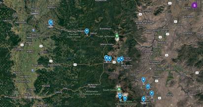
Google map displaying our field trip stops.
This trip was scheduled for Monday and Tuesday, July 17th and 18th in order to avoid traffic on the roads and obtain lodging in Bend.
The trip leaders were
Sheila Alfsen - GSOC Past President and current Program Director, Instructor at Portland State University, Linn Benton and Chemeketa Community Colleges
Dr. Daniele Mckay - Department of Earth Sciences, University of Oregon (also helped establish our sister club, Central Oregon Geoscience Society).
Alyssa Smith, PhD student at Portland State University
Dennis Chamberlin - GSOC Board Member, who helped to organize the trip.
Why the name ‘Two Cascades’? We drove through the eroded steep sections of the older Western Cascades (or Old Cascades) and then went on to the High Cascades to Bend to explore the area around Mt Bachelor. A highlight of the trip was the view from mid-way up Mt Bachelor.
Our weather was perfect. The temperatures were in the low 80s and the sky was clear - no smoke or haze to peer through.
Attributions
Google Map of stops – Sheila Alfsen
Photos – Barb Stroud (except for Hogg Rock and one of the Devil’s Hill Lava, as noted)
Graphics and LIDAR – Daniele Mckay (except where otherwise noted)
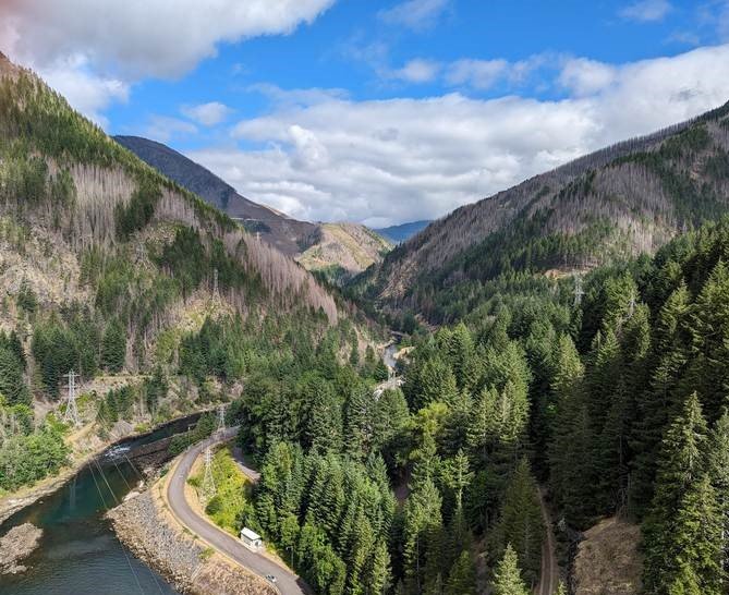


STOP 1 - DETROIT DAM

View downstream from the top of Detroit Dam
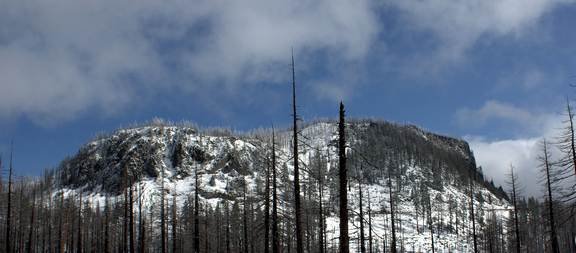
Our first stop was Detroit Dam (yes, there’s plenty of water there this year). Denny Chamberlin told us about the Western Cascades (he lives in the far west side of them, in Mill City). These are mountains that were created 40 million years ago at the edge of what was the shoreline at that time. They are now eroded by wind and water and landslides and are very steep and rugged. The North Santiam River is tucked in a large canyon and was an obvious choice for building this dam in the early 1950s. In addition to talk of the geology, we discussed the strength of the dam in respect to earthquakes (pretty decent, they say) and the consequences of the Beachie Creek Fire in 2020 on the landscape around us.
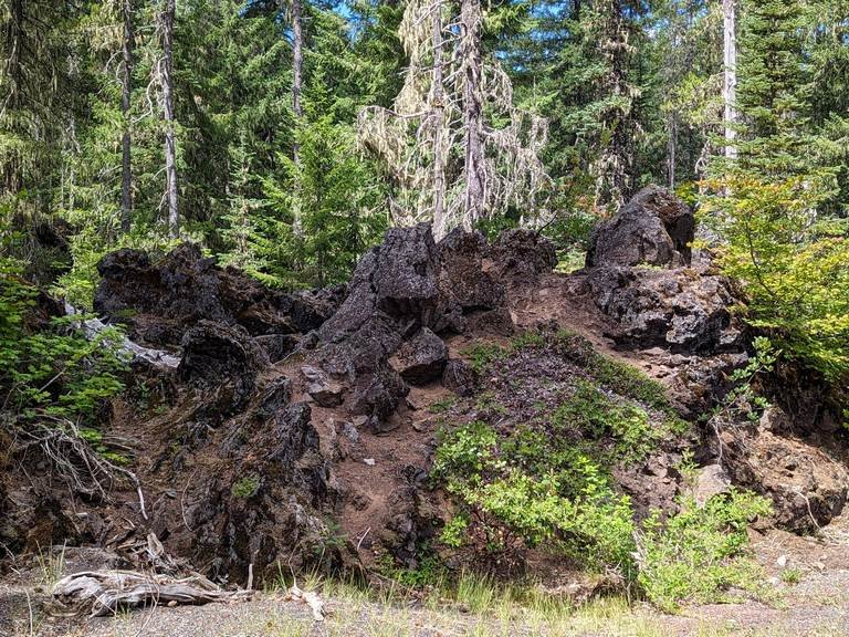
STOP 2 - LAVA FLOW

Lava Flow along Highway 22
If you’ve driven Route 22 through the Cascades, you may have noticed this rough looking lava flow. It’s on both sides of the road and has very little vegetation on it. It’s about 2000 years old and may have come from Little Nash Crater (next stop).
Sheila took out her sweet treats and described three different volcanoes to us – vanilla wafers for shield volcanoes which ooze lava that is less viscous and contains less silica (like the classic Hawaii volcanoes with aʻā or pāhoehoe); Hershey’s kisses (steep sides) for stratovolcanoes which are explosive and may create pyroclastic flows, large ash clouds and lava bombs (more viscous and silica rich, what we’re seeing above); and large chocolate chips for the cinder cones with smaller eruptive events that create lots of scoria which typically piles up right around the cone like a bunch of Rice Krispies. Cinder cones can build up gradually with Rice Krispies, then change to flowing magma like maple syrup, then progressively more layers eventually becoming a stratovolcano in shape.
Classic textbooks teach that magma in the shield volcanoes creates lava with less silica and more iron and magnesium and is therefore called mafic (think of the ma=magnesium, f(fe)=iron), creating basalt; whereas stratovolcanoes have more silica and are called felsic, creating andesitic lava.
We also talked about the subduction of the Pacific Plate under the North American Plate and how it influences where and why a volcano may erupt violently (or not). Sheila talked about the depth at which rock melts creating magma that might eventually vent at the earth’s surface. Then she explained that this trip covers not only the classic volcano and magma types, but also how many exceptions there are to these “rules”!
STOP 3 - LITTLE NASH CRATER

Little Nash Crater - now a quarry
Just west of the intersection of Highways 22 and 20, Little Nash Crater is an example of a cinder cone. This is now a quarry and therefore does not look like the classic cinder cone. The red color is caused by the iron content of the magma. If magma spends a shorter period underground, it contains more of the heavy elements (iron/magnesium and others) from the melted rocks. If it spends a longer time in the ground, the silica from the surrounding rock combines with the heavier elements in the magma.
We discussed the differences between scoria and pumice. Both are gas filled, but the scoria is darker and heavier because of the different chemical composition – iron/magnesium/other – and is associated with basalt. Pumice is lighter in color and weight, with more silica, in the magma chamber for longer time, and is associated with more violent eruptions that result from the gas trapped in andesitic or rhyolitic lava. Sheila also noted that phreatic eruptions occur when there is water involved (a body of water or melting glaciers) due to the quick conversion of the water into gas.
STOP 4 - HOGG ROCK

Hogg Rock (by Tedder at Wikimedia Commons, CC BY 3.0, https://commons.wikimedia.org/w/index.php?curid=9814808)
A brief stop in a pull off on Highway 22.
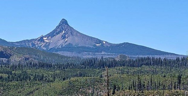
A term most of us had not heard before was introduced to us – a Tuya volcano. There have been very few of these identified in the world, but two of them (Hogg Rock and Hayrick Butte) are in this area. Tuya volcanoes are when the lava erupts underneath a glacier. It causes the flat top and steeply sloped sides of this feature. The very thick glacier was heavy enough and cold enough to thwart the progress in growing the volcano. Hogg Rock has been dated to 80,000 years old and has andesitic lava.
STOP 5 - MT WASHINGTON VIEWPOINT

Mt Washington - note the gentle slope to the right and how that indicates the shield shape
Definitely Hershey Kiss, right? Sheila and many other geologists always thought it was the eroded remnant of a stratovolcano. Daniele Mckay explained otherwise on a prior field trip and Sheila passed this on to us at this stop. Mt Washington is actually a highly eroded shield volcano, as you can see if you think of the gentle slope on the right extending right up to the top of Mt Washington.
You might ask about Black Butte, which is located quite close to Mt Washington. Black Butte is described by some as a classic little-eroded, steep-sided Cascade shield volcano, but others refer to it as a stratovolcano. Its lava is basaltic andesite, so a bit of a different thing from the purely andesitic Mt Jefferson or Mt Hood (see the later discussion about this). Whereas Mt Washington began developing about 300k years ago, Black Butte is much older, recently dated at 1.5 million years old. Current theory has that it was not covered by glaciers and therefore escaped much of the erosion caused by meltwater and moraines that Mt Washington shows.
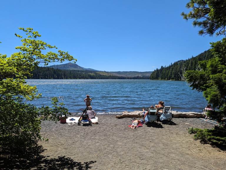
LUNCH AT SUTTLE LAKE

Suttle Lake - glacially carved, looking west. Mt Washington is to the left (not in the picture). Swimmers (not GSOC) enjoying the warm water.
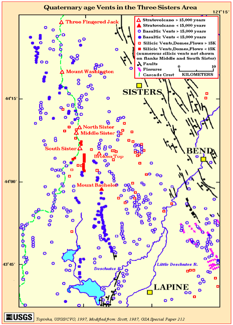
STOP 6 - THREE SISTERS VIEWPOINT

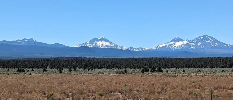
Three Sisters viewpoint on Hwy 20. From the left, Broken Top, South Sister, Middle Sister, and North Sister
The view is astounding from this pullout. North Sister is the oldest of the Three Sisters, and South Sister is the highest. North Sister is considered to be a shield volcano, with basaltic andesite being the most prevalent lava. South Sister created mainly andesitic lava, but its summit is basaltic andesite and it has abundant scoria in the cone. Broken Top is also visible at this viewpoint.
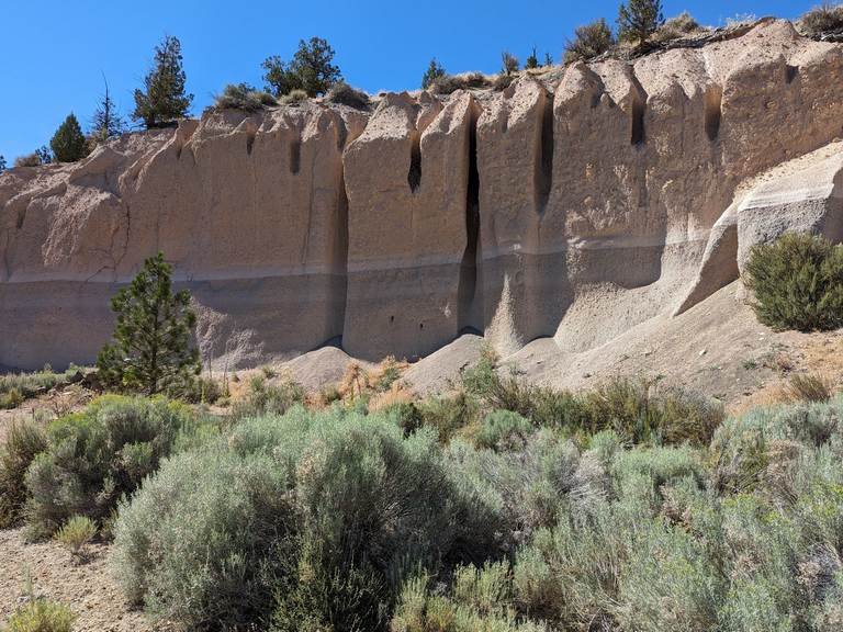
STOP 7 - TUMALO TUFF

Tumalo Tuff layers
The layers are from a large volcanic explosion, resulting in the dark ash layer in the bottom layer, then a “surge” layer of lots of hot gas and fine ash (the light layer in the middle) and finally a pyroclastic flow which settled the ash and fine pumice/scoria on the top. This outcrop (about 65 – 75 feet) is an example of the layers of volcanic material that “pave” the area of the High Cascades, with just the peaks of the highest volcanoes poking out the top. In this picture, the top layer is eroding, primarily from water, and there is a house at the top (not visible here) which we all decided we had no interest in owning.
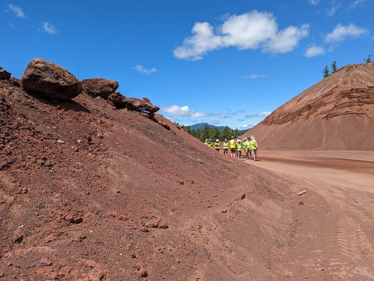
STOP 8 - PILOT BUTTE

On top of Pilot Butte in Bend, Oregon

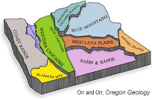
Physiographic Provinces of Oregon (from DOGAMI)
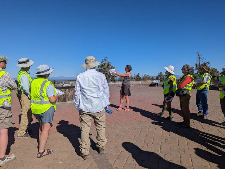
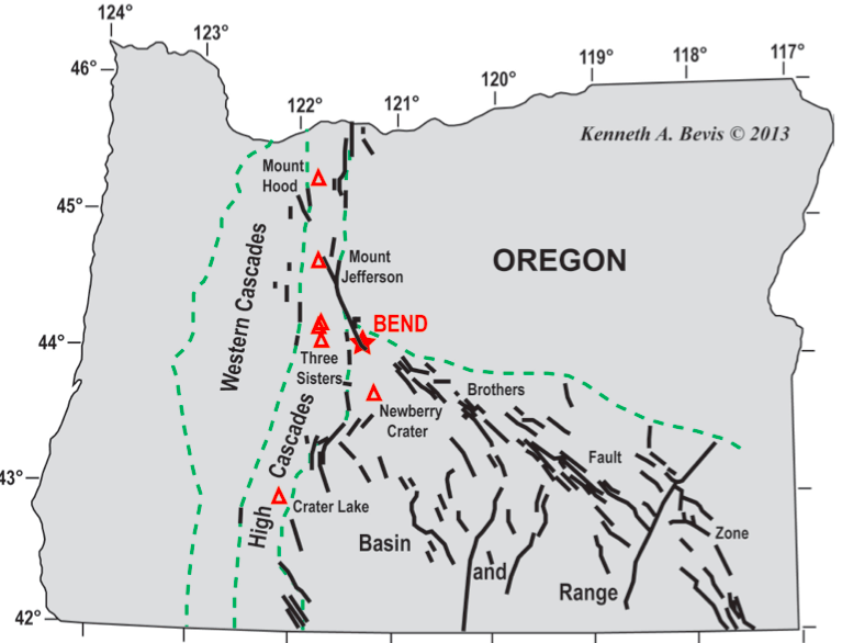
We met Daniele Mckay at the top of Pilot Butte, where she oriented us to the physiographic provinces of Oregon. Several are visible from Pilot Butte (particularly on this day, when the weather was perfect), including the High Lava Plains, Blue Mountains, the High Cascades, the Western Cascades, and the Basin and Range. We could see the High Cascades all the way from Mt Hood up north to Mt Thielson in the south. And at Mt Bachelor, the weather was clear enough that Sheila saw Mary’s Peak at the eastern edge of the Coast Range.
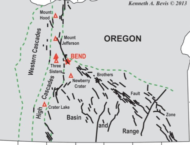
See the graphics below this paragraph. Daniele talked about the many identified fault lines in the Bend area (left) and how many of them lean south to north. Also she noted the numerous cinder cones (middle graphic), over 400 around Newberry Volcano alone. It is possible to infer that there are lines of cinder cones going up and through the Three Sisters, but this could also be coincidental.
Fault Lines Cinder Cones Rotation(GPS readings)
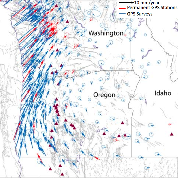
Danielle brought the graph on the right of the many GPS measurements taken over the last 30 years or so that show the rotation of Oregon and Washington clockwise from southeast to northeast. Daniele and Sheila noted that, for the Pacific NW, this may be as important as the breakthrough of plate tectonics was in its time. This gives a potential explanation for why the Basin and Range is pulling apart and possibly an explanation for why the volcanism moved to the east (Western Cascades to the High Cascades).
STOP 9 - MT BACHELOR
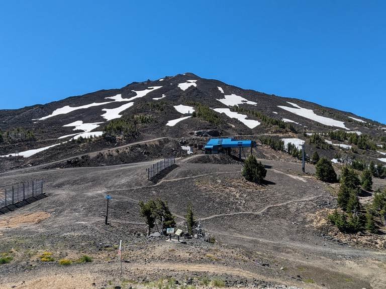
Mt Bachelor from the West Village parking lot, Pine Marten lodge is right around the tree line.
On our second day, we went to Mt Bachelor, where we took the chairlift (along with dozens of mountain bike riders) up to Pine Marten lodge. We talked for a bit, took many pictures and then ate lunch – there is a café at the lodge.
The weather was again perfect and it is from the lodge that Sheila saw Mary’s Peak, situated in the Willamette Valley at the east side of the Coast Range.
Mt Bachelor is young, about 12,000 – 15,000 years old, and given that we have recent evidence for human habitation that dates to 18,000 years ago, it would seem that humans actually saw this change happen in the central Oregon skyline.
Daniele and Alyssa spoke about the sites visible here and helped us understand that the classic ideas of stratovolcano, cinder cone and shield volcano are way too simplified to describe what is happening in Central Oregon (and likely many other places worldwide). Alyssa’s PhD studies are about the differences in the volcanoes made of andesite (Mt Hood, Mt Jefferson) as vs. those large volcanoes such as Black Butte and North Sister that are made of basaltic andesite.
Here is a description found on the web. The USGS describes Mt Bachelor and the surrounding cinder cones as: “… typical of one style of mafic (basalt to andesite) volcanism found throughout the Cascades Volcanic Arc—effusive eruptions from aligned short-lived volcanic vents.” This is why Daniele, Alyssa and other scientists are beginning to describe volcanoes as mafic or shield-shaped composites.
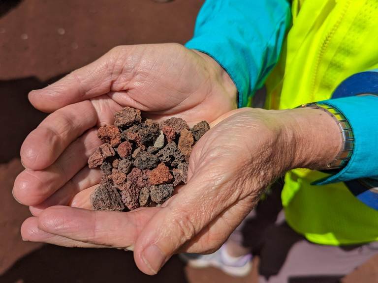
We observed the small rocky bits of scoria at the parking lot and on the mountain, but also saw larger lava rocks and bombs there.

On the left, small cinder cone chunks from Nash Crater, but indicative of much of the ground cover in central Oregon including Mt Bachelor. And on the right, larger pieces of lava seen on Mt Bachelor.
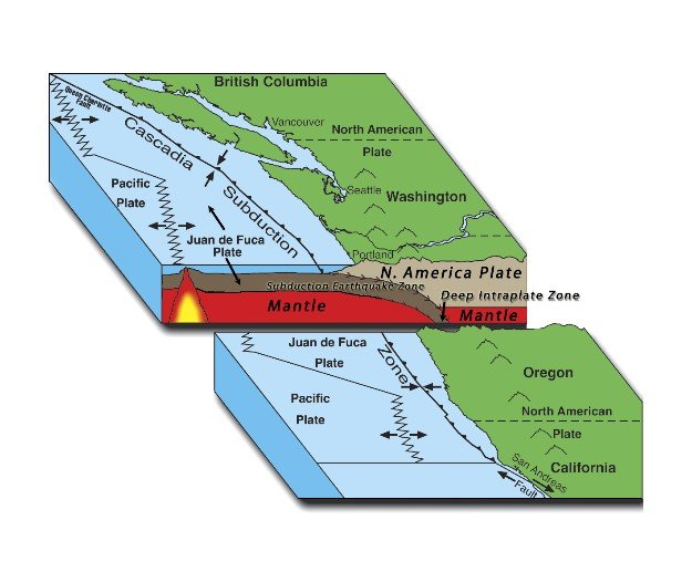
Daniele described subduction (at which point the wind always increased and blew the papers she was using every which way!) and the effects on volcanism.

This graphic shows the general idea; Daniele pointed out that the angle of subduction has a great deal to do with what we see on the surface and can expect. Magma is generated (rocks melt due to heat and water from the oceanic plate that reduces the melting point) at about the depth of 60 miles below the surface. Decreases or increases in the angle of subduction change the location of the active volcanoes.
Daniele also spoke about the ‘myth’ of a magma chamber. Magma is more likely to be injected in between rock layers. The image of branches on a tree trunk or the root system of a tree is more applicable. Any cracks or faults or weaknesses in the rock above the storage level of magma may result in a volcano – depending on the pressure, heat, water, and gas in the rock below. This may occur once (monogenetic) or many times (polygenetic) in any given spot. The many fairly recent cinder cones as well as Mt Bachelor are indications that the magma is active and possibly increasing under central Oregon.

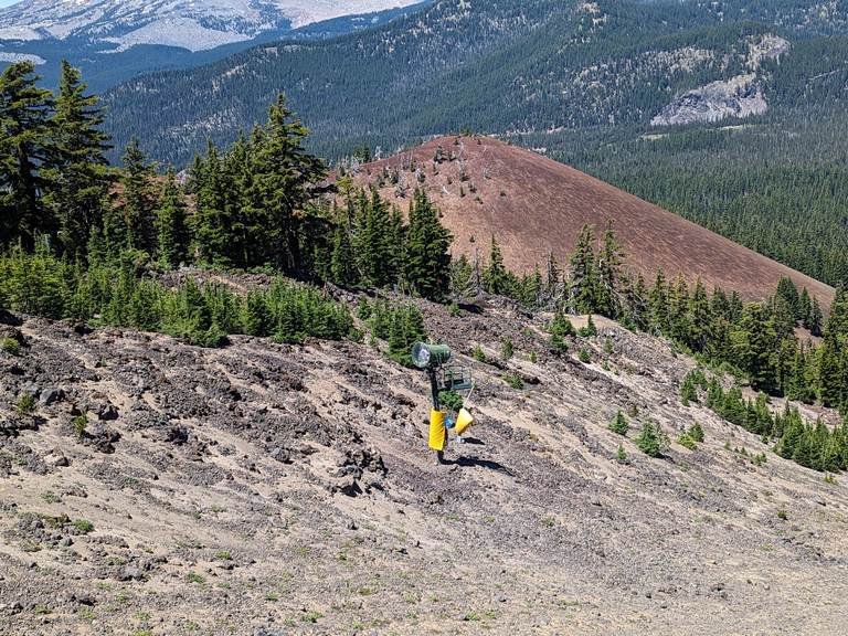
Cinder cone on the north side of Mt Bachelor - unofficially called the Egan Cone.
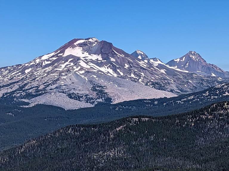

Three Sisters and Broken Top as seen from Mt Bachelor
Broken Top is a good example of not conforming to the shape designations. Broken Top was a shield volcano, that started erupting mafic lava, then changed its nature and started erupting more explosively. Daniele prefers to describe Broken Top and others with the same characteristics as mafic composite volcanoes.
In 1997, there was some uplift on the west side of South Sister, but it effectively stopped by about 2007 (though some 2021/2 activity has now been noted). The hazard to Bend, Redmond and associated communities is high were anything to begin erupting again. Daniele told us that on a quiet news day in Bend later in the 2010s, there were occasional headlines that simply said there has been no change in the uplift on South Sister.
The large rock outcrop on the South Sister (to the right of the summit – see picture above) is thought to be a prior summit that was displaced in a later eruption.
Daniele talked briefly about Newberry Volcano (next Field Trip, anyone?). Though the volcano is shield-shaped, it has also erupted high silica lava (for example, the Big Obsidian Flow that erupted about 1300 years ago). This brought up another ‘myth’ in basic geology literature – that obsidian cools quickly. It does, but this should be thought of as geologically quickly – years or decades of cooling, not hours, days, or months as we tend to assume when we see the word quickly.
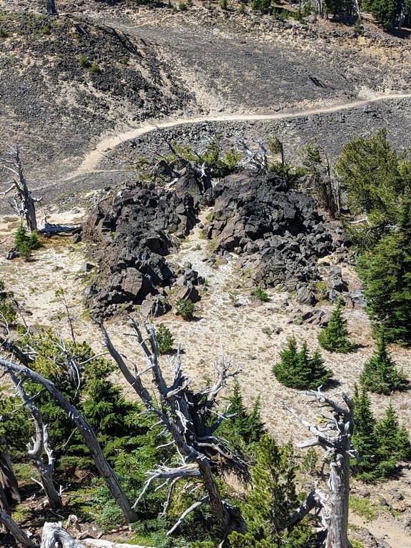
STOP 10 - DEVIL’S HILL CHAIN - LAVA FLOW

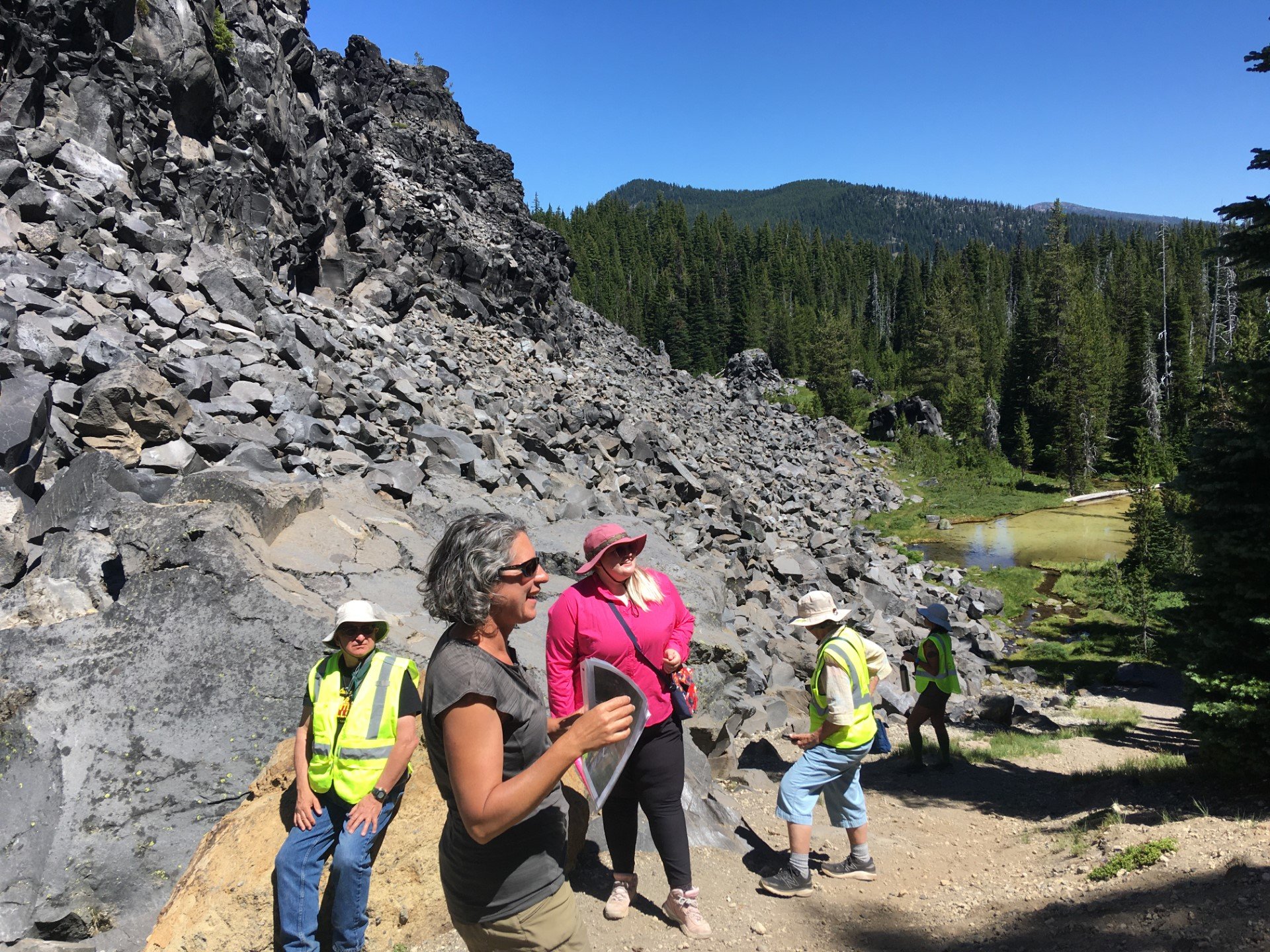
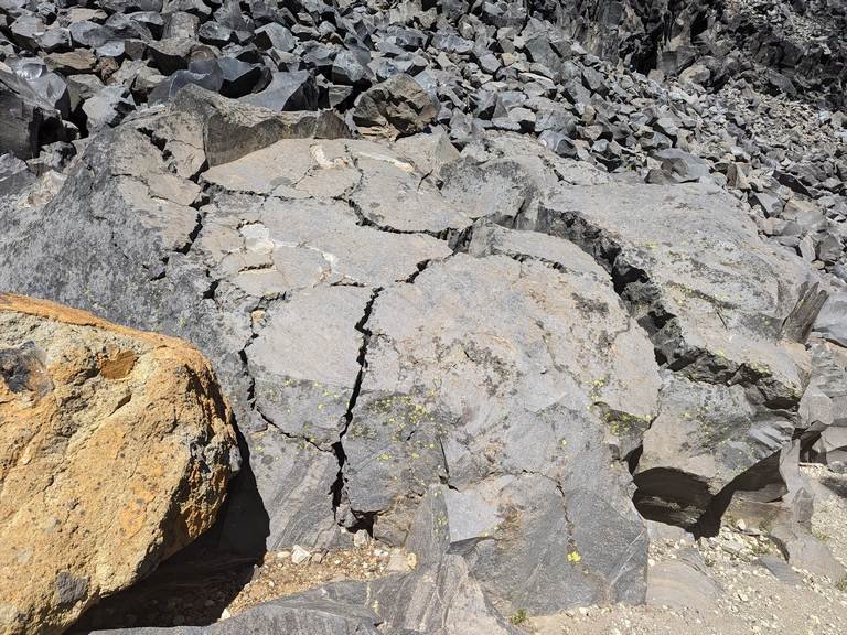
On the left - Example of freeze/thaw on very large rock and on the right - Daniele (closest) explaining groundwater at Devil’s Hill field. (by Nancy Collins)
At our last stop in Bend, we went to a fairly recent lava flow (2000 years old) just south of South Sister. Daniele talked about the rhyolitic lava and the groundwater here. The central Oregon area gets a lot of snow and there are glaciers on the Three Sisters and Mt Jefferson. When snow melts in central Oregon, just 1/3rd of it flows directly into streams and rivers. 2/3rds of it goes into the ground which is quite porous (no Columbia River Basalts here) and replenishes the groundwater of the area. At the bottom of the lava flow in the picture above, you can see a small lake which is fed by a spring under the Devil’s Hill Chain lava flow. Perhaps the most famous spring in central Oregon is the headwaters of the Metolius River, but there are many others feeding lakes and rivers.
Rhyolitic (high in silica) lava flows can become obsidian and this flow does include a few instances of obsidian. The controlling factor is heat. If the flow loses heat quickly, it will form obsidian, but this particular flow apparently did not cool that quickly and therefore crystallized into rhyolite.
OTHER INFORMATION
LIDAR Maps of Central Oregon
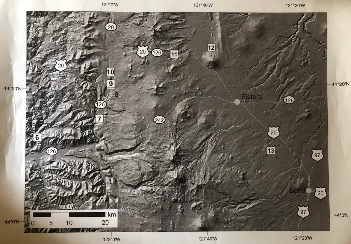
Daniele shared these maps on our trip – she had these poster-sized laminated LIDAR maps made for a different field trip – so ignore the numbers in squares.
The map on the left shows the many cinder cones around Newberry Volcano and the Sisters. The map on the right makes obvious the sharp difference between the older Western Cascades and the High Cascades. The area where the High Cascades currently are was a graben (sunken area between two higher ones – as you would find in the ‘basin’ of the Basin and Range geologic province). The High Cascades began eruptions and the base is now covered with so much volcanic material that it filled in the graben and the peaks of the highest volcanoes stick up through the newer levels of lava. The rotation of Oregon and Washington can potentially also explain how this graben came into existence – the Western Cascade area is pulling away through the rotational movement, causing the graben.
STOPS ON THE WAY BACK TO SALEM (DAY 2)
So much of our Day 2 was taken up with Mt Bachelor and Devil’s Lava that we left Bend 2 hours later than intended. Therefore only 6 – 8 of the 22 of us accompanied Sheila back to the original car park.
Sheila had intended to stop at Lost Lake (also called a lava tube though it is not) but decided against that. She and the remaining folks did stop at one spot – a roadcut exposure along Hwy 22 near Sublimity where there is lahar material likely from Mt Jefferson. This mud flow consisting of hot ash and gas made it all the way to Sublimity with some pieces of wood in it.
All in all, a wonderful, educational, fun field trip. Many thanks to Sheila, Denny, Daniele and Alyssa – all of whom gave generously of their time and energy to GSOC!


