Willamette East Bank Bike Geotour Recap and DIY Field Trip
/Recap of the GSOC Willamette East Bank Bike Geotour - June 26, 2022

Map of the tour showing the stops in relation to the surrounding geologic setting.

A closer view of the first half of the bike tour. This part of the route follows the Willamette East Bank bike path from north to south until the riders come to the Oaks Bottom underpass.
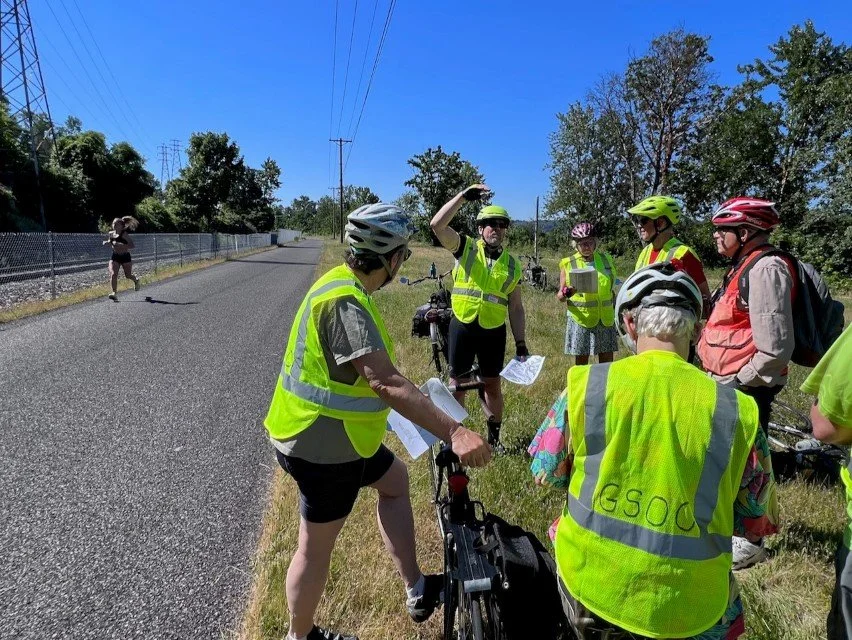
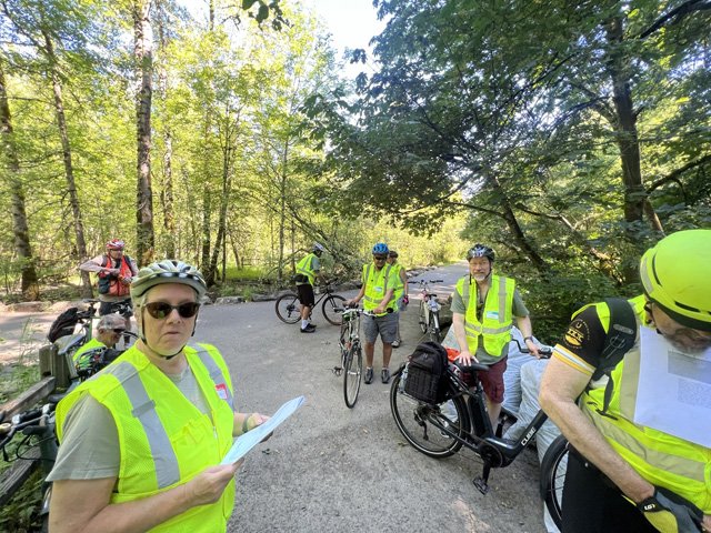
GSOC participants of the 3rd Eastbank Bike Geotour field trip met at 9:00 on the morning of Sunday, June 26, in order to complete the tour before the 90+ degree temperatures of the hottest day of the year (so far) set in. This tour had not been run in three years due to the pandemic, and the leaders included a newly retired Ian Madin and Dr. Lalo Guerrero, who teaches geology at Portland Community College. Paul Edison-Lahm, who spearheaded the creation of this unique geology trip, was along to keep us all together and moving toward the next stop.
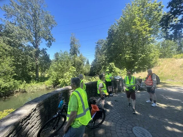
After a brief hello at Peace Memorial Park in Portland, the participants rode down the bridges and ramps at the end of the Eastbank Esplanade to the riverbank south of the Steel Bridge east abutment, where an outcrop of the Troutdale Formation could be seen emerging from the near flood stage water in the Willamette River. The unusually high river level came from the rainiest spring in 80 years. Nevertheless, the rains had finally tailed off and the sun shone hotly on this fine June morning.
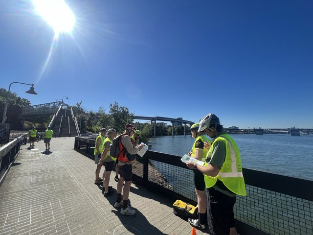
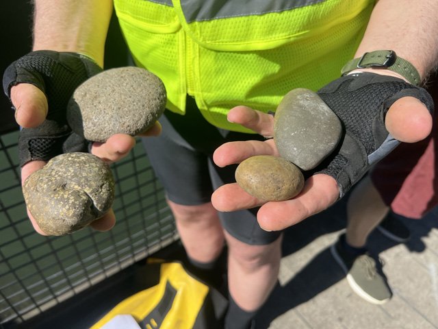
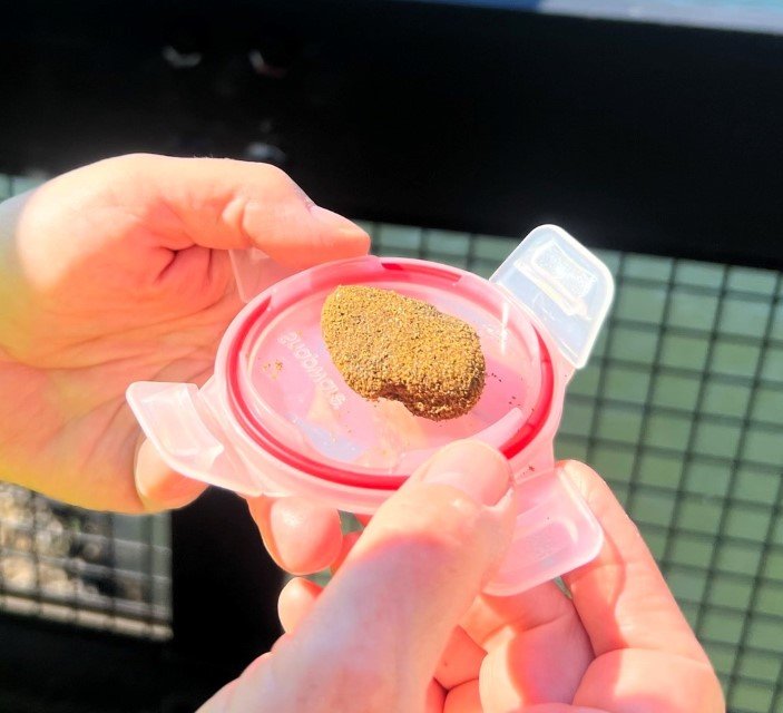
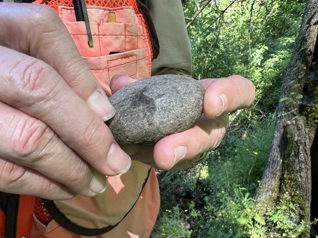
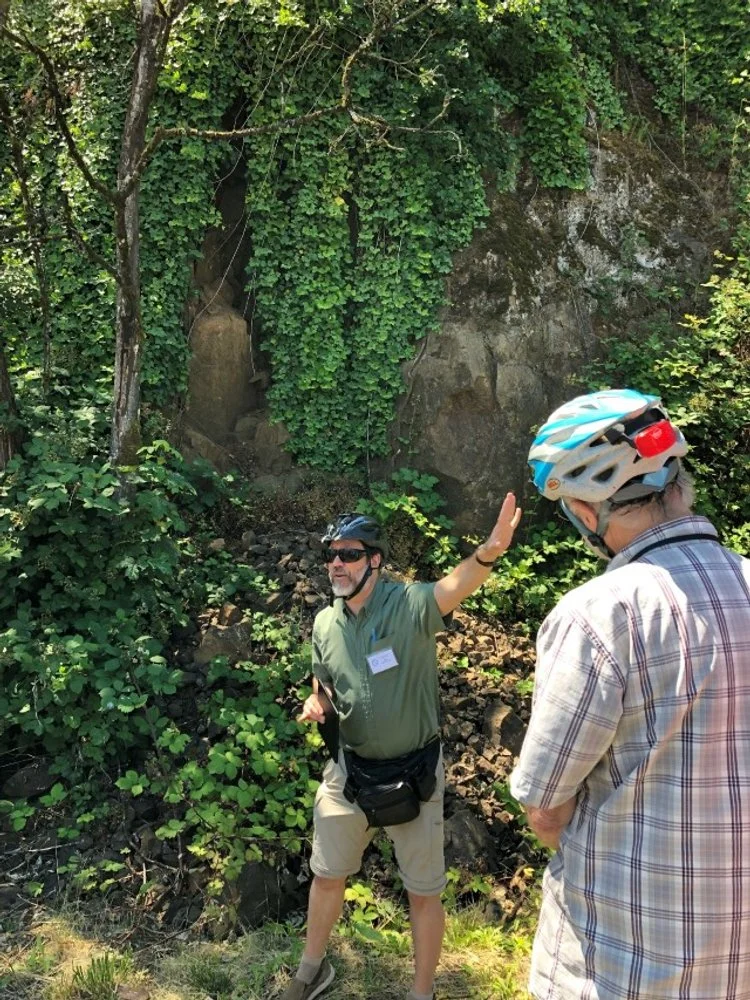
Ian Madin gave most of the geologic explanations at each stop, a product of many years of working in the Portland Basin for the Oregon Department of Geology and Mineral Industries (DOGAMI). The Troutdale Formation at Stop 1 Steel Bridge was described as a conglomerate that has a particularly interesting matrix, or material that cements the rounded river rock together. Madin showed the group a piece of the matrix, which had a texture of fine broken glass with the mustard color of palagonite, indicating that it had been exposed to water when erupting. This material was derived from Cascade eruptions into the Columbia River. That, and a smattering of river rock that had been transported from Idaho and British Columbia, were clues that at least some of the material deposited here came from the Columbia River. Madin also showed the group examples of Cascade porphyry, Boring lava, Columbia River Basalt, and quartzite that are found here, and pointed to a large cobble of Challis andesite with large pink crystals at the edge of the water.
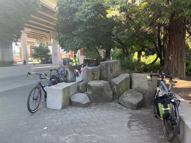
Vera Katz and Paul Edison-Lahm watch over our bikes while Ian tells us about CRBG at Stop 2. The columns we discussed are in the center of the photo.

Vera and I in 2019 on the second running of the trip.
The group proceeded south along the Eastbank Esplanade to the Stop 2 Vera Katz statue just north of the Hawthorne Bridge abutment. A bronze replica of former Portland mayor Vera Katz is seated along a low wall and surrounded by a number of columns of the Sentinel Gap Unit of the Frenchman Springs Member of the Wanapum Basalt Formation. These decorative columns of Columbia River Basalt are representative of material that was plucked from its outcrops in Eastern Washington and Oregon and carried down the Columbia River Gorge in the raging Missoula Floods during the end of the last Ice Age. It is also presumed to be the material underlying the 1500 feet or so of sediment that fills the Willamette Valley here.
Madin further talked about the structure of the Columbia River Basalt, or CRBG as it is known in local geology circles. There was a large gap in time between the flows of two of the formations, the Grande Ronde and the Wanapum, at about 15.6 million years ago, and a significant layer of red clay soil developed that is called the Vantage Horizon. This gooey layer is responsible for a number of giant landslides in the Portland Hills to the west of the river. Madin’s work at DOGAMI largely focused on geohazards, and much work involved the identification of landslides in the state including Portland.
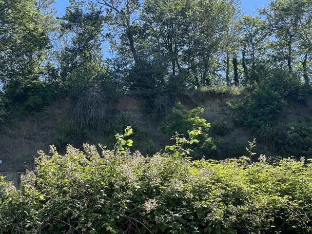
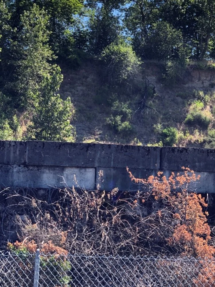
Missoula rhythmites as viewed from the Willamette East Bank bike path and across the railroad tracks. This cut bank is getting somewhat grown over, but there is also another cut bank down the path a little ways.
The same bluff in 2019.
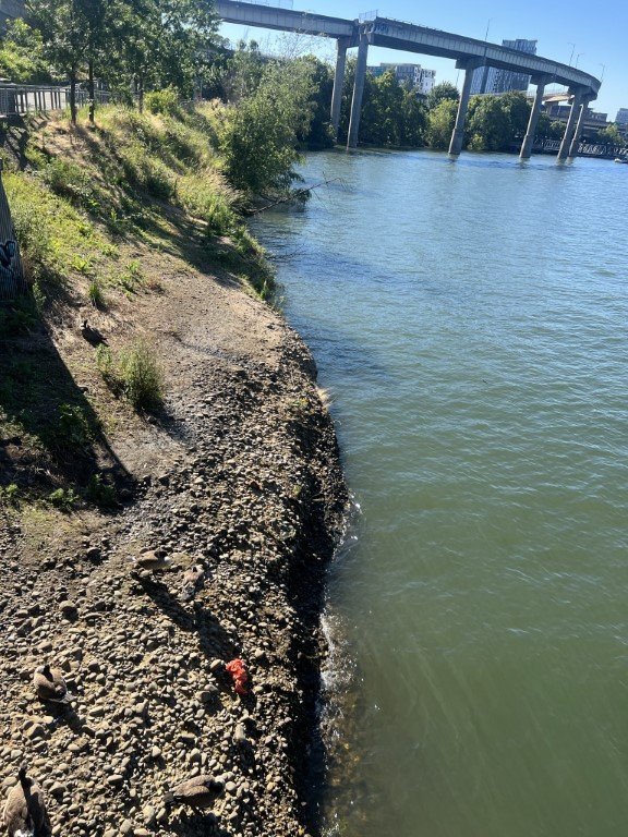
Stop 3 was about a mile further south at the old Ross Island Sand and Gravel quarry. The deposits of gravel go deep within the sediments here, because during the Ice Ages, river levels were much lower because sea level was much lower than it is today. Much sea water was locked up in the continental and mountain glaciers that existed then. Near the end of the Ice Ages, the Missoula Floods, which were up to 400 feet deep at this location, made more deposits and reworked material in the river floodplain.
Ian discusses the Missoula Floods at Stop 3.
To the east of Stop 3, Madin pointed out a bluff about a hundred feet from the group that contains rhythmites from the Missoula Floods. The rhythmites consist of layers of fine-grained material, and each layer represents the deposit of a different flood event. Each layer of the rhythmite would have been deposited decades or centuries apart from the preceding layer. This characteristic distinguishes rhythmites from varves, which represent the yearly deposits at the bottom of lakes. Madin also told the group that another place to view rhythmites in the Willamette Valley is along the Pudding River (the course of which is discussed in the article on the 2022 GSOC Willamette Transect Field Trip).
Another topic discussed here by Madin was the bog iron that was mined in the Lake Oswego area. This is a product of weatherization, sedimentation, and collection of iron-bearing basalt lavas in a reducing swampy environment and is found in the Vantage Horizon layers in a band stretching from Lake Oswego to St. Helens, Oregon, with the richest deposits found at either end. The iron ore was found in the 1840’s and smelted until it became uneconomical in the early 1900’s. Imagine someone trying to mine and smelt iron there today!
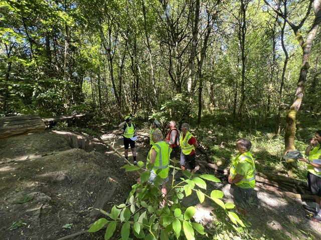
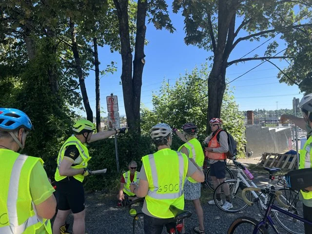
The GSOC bikers next biked another mile or so down to the Oaks Bottom area along the river bike route, then turned left under the railroad tracks to the Oaks Bottom trails. Parking their bikes along the main trail, they walked along the base of the river terrace slope on a side trail to Stop 4. Here a landslide could be observed amongst the trees. Madin began collecting LiDAR (Light Detection and Ranging) data for the state of Oregon about 12 years ago, and this recent technology has been a real breakthrough as a tool for geologists, especially those working in heavily forested areas like the Pacific Northwest. Using ultra-sharply focused LiDAR ground images, many thousands of landslides have been mapped in the state. This tool is also useful for finding earthquake faults which are recent enough to have left fresh tracks of scarps in the landscape. In fact, two other GSOC field trips this summer have been produced to examine earthquake faults in Oregon found by Madin.

Portland map showing bike geotour stops and the faults mapped in the area.
And speaking of which, the Portland Hills Fault is mapped running through the Oaks Bottom area. This shallow crustal fault, one of several running NW to SE in this part of the state, has been evaluated as potentially producing M6.8 earthquakes in the Portland metropolitan area. Later in the tour Madin discussed the major crustal faults of the Portland basin. Although their primary motion is strike/slip, or sideways movement, they also produce vertical movement as well – about 200’ for the Portland Hills Fault and at least 800’ on the Oatfield Fault to the west. The Oatfield Fault in particular had cut through the light rail tunnel, and it was observed here that Columbia River Basalt was thrust overtop the younger Boring Lava.
Another feature of the area discovered using the LiDAR imaging are known as “pits of mystery,” or odd depressions. About 3000 of these have been mapped along edges of major Missoula Floodways. They mark iceberg melt sites, as the floods occurred as a result of the bursting of a wall of ice of the lobe of a continental ice sheet. The bergs also floated down many large erratic rocks and dropstones in their makeup.
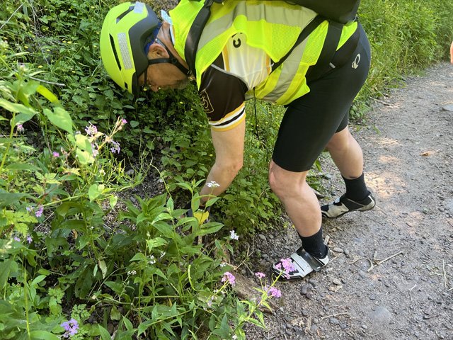
While the group was listening to Madin talking about the uses of LiDAR technology, their attention was directed to some rounded gravel and cobbles below the landslide edge. Madin selected a small cobble to show the group that was made from granite, which does not occur naturally in the Portland basin. Another reminder that this area is full of exotic stones.

The south half of the bike tour. Major north-south streets used by the group are marked.
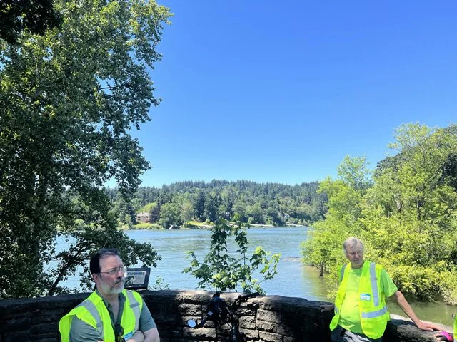
After gleaning the information told to them at Stop 4, the group proceeded northeast up the terrace slope and out of the floodplain of the Willamette River. Looking east from Stop 5, a parking lot close to the intersection of SE 17th Avenue and McLoughlin Blvd., the group could see the edge of another terrace at Reed College, and beyond to mounds of Boring Lava volcanoes and the High Cascades in the far distance. Both the High Cascades, represented by Mt. Hood, and the Boring Lava volcanoes of Mt. Tabor, Kelly Butte, and Mt. Scott, were the products of subduction fed mantle material. Madin also distinguished two types of Boring Lava volcanoes – true stratovolcanoes like Mt. Scott, Jenne Butte, and Scouters Mountain, and hills created by material which leaked through preexisting faults like Mt. Tabor and Kelly Butte.
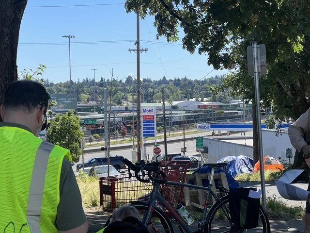
Looking ESE from the viewpoint one can see the Reed College terrace edge (greensward above and to the left of the Mobil sign) and Mt. Hood beyond.
Ian points to Rocky Butte and Mt. Tabor, two close-by examples of Boring Lava seen from the viewpoint.
Closer to the viewpoint, the railroad yards to the east of McLoughlin Blvd. were sited upon Missoula fine sediments, and the terrace at Reed College was formed by a deposit of gravel from the early Missoula floods, which were highest and carried the most sediment and rock. Later floods carved bars and channels from the earlier floods.
Ian discusses the temperature differences between the creeks at Stop 6.
Crystal Springs in the park, taken in 2019.
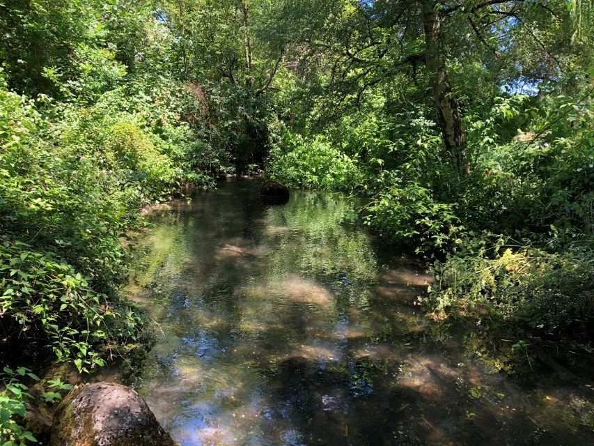
From the viewpoint, the group traveled south to Sellwood along residential streets of Westmoreland. The next destination was Stop 6 Johnson Creek Park in Sellwood, where Johnson Creek is fed by Crystal Springs Creek. Madin had the group compare the temperature of the two creeks and it was found that Crystal Springs Creek, true to its name, is spring-fed and much colder. Johnson Creek travels above ground for miles before reaching this point.
The topic then jumped to earthquake hazards in this area of Portland. One of the major causes of damage to buildings in earthquakes is liquefaction, where the grains of saturated, poorly consolidated soil, especially loose sand, will, during the shaking, lose contact with one another and float in the surrounding groundwater. When that happens, the soil cannot support foundations, and structures can sink, tilt, crack, and move laterally if there is any slope to the grade. Some of the Missoula Flood sediments can be susceptible to liquefaction even though they were deposited 15,000 years ago. Madin recommends that anyone planning to build upon or buy property in this material spend the comparatively small amount of money necessary to hire a geotechnical expert to determine the hazard.

The mini-bluff behind Bruce is formed by Waverley Basalt. This is taken from the bike path along 17th Avenue south of McBrod Avenue. We stopped here for the shade this year.
Paul is describing the Waverley Basalt from the mapped stop in 2019.

The Waverley Basalt contains zeolites formed by hydrothermal fluids circulating through the original rock.
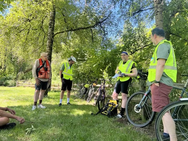
The group left Stop 6 and headed south down the bike path between SE 17th Avenue and Waverley Golf Course, paralleling the path of Johnson Creek one block to the east. The group stopped along this path in the shade of a tree just south of McBrod Avenue. Here the path was adjacent to a grade change, which nicely exposed Waverley Basalt, the topic of Stop 7. Madin found a few samples of this 40-million-year-old, hydrothermally altered basalt for the group to examine. The material was buffy brown, weathered, and riddled with zeolite crystals due to the hydrothermal alteration.
Madin discussed the origins of this volcanic material. The Waverley Basalt, like the older Siletzia Basalt underlying the coast range and the Portland basin, is a product of the Yellowstone Hot Spot. This material was produced as the volcanic Siletzia Terrane, firmly docked to the North American plate after colliding with it about 50 million years ago, passed over the plume of magma on its westward journey. A number of volcanic sills and dikes were produced at about this time all throughout the Coast Range in a similar manner.
The GSOC bikers assemble at Klein Pt. Johnson Creek is flowing towards the viewer.
Johnson Creek flows into the Willamette here at Klein Pt. The West Bank beyond is a large outcrop of Waverley Basalt with a smattering of CRBG atop it.
The group continued south along the 17th Avenue bike path into Milwaukie, and rode into the park as 17th Avenue terminated into McLoughlin Blvd. Turning right at a sharp angle, they rode down to Stop 8 Klein Point, where Johnson Creek flows into the Willamette River. Looking across to the west bank of the Willamette, Madin told them that the slope is mostly composed of Waverley Basalt with a few spots of Columbia River Basalt overlying it. There is a 23-million-year unconformity between the two layers. Other spots where Waverley Basalt occur are islands upstream of this point, near Willamette Falls in Oregon City.
Madin discussed some of the landforms in this area and the causes of the topography. The Willamette River is 130’ deep in this area as it has eroded down into its former canyon. Upstream from Milwaukie, the river passes through the center of a lowland bounded by faults, called a graben, whose axis is oriented NW to SE. On either side of this graben lie uplands called the Gladstone Horst and the West Linn Horst. The Portland Hills Fault and the Oatfield Fault define the edges of this low area.

If you DIY’ers do this trip on a summer Sunday, you’ll get to eat lunch at the Milwaukie Farmer’s Market. Otherwise, you’ll have to choose from amongst the food trucks near the Milwaukie Main MAX station.
Having completed the bike tour, the group headed back up the slope into the heart of the town, and luckily the Milwaukie Farmers Market was in business for lunch. After their repast, tour participants could ride a few blocks south to catch the MAX orange line at the Milwaukie Main rail station, where more food carts were situated. The MAX cars were air-conditioned and a handy way to ride back to Portland to connect back to the ride home.
But hey, don’t just take our word about how great this bike trip is - experience it for yourselves! Wait for the perfect day and take a ride down the Willamette East Bank. DIY pointers are provided in this article.
REFERENCES
Russell C. Evarts, Jim E. O’Connor, Ray E. Wells, Ian P. Madin, “The Portland Basin: A (big) river runs through it,” GSA Today, Geological Society of America, Volume 19 Issue 9, September 2009. https://www.geosociety.org/gsatoday/archive/19/9/article/i1052-5173-19-9-4.htm
Ira A. Williams and Henry M. Parks, “The Limonite Ores of Columbia County, Oregon,” The Mineral Resources of Oregon, The Oregon Bureau of Mines and Geology, Volume 3, Number 3, May 1923, https://www.oregongeology.org/pubs/bomg/MineralResourcesofOregonVol3No3.pdf.
Bill Tompkins, “Oregon's First Iron Smelter, Lake Oswego, Oregon,” https://www.mindat.org/article.php/982/Oregon%27s+First+Iron+Smelter
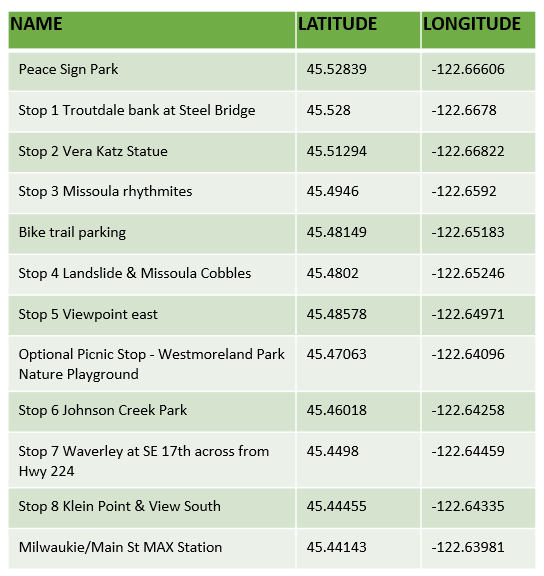
For you DIY’ers, here are the latitude and longitude coordinates of the stops and other points of interest. These can be imported into a google map if you would like to get directions.


