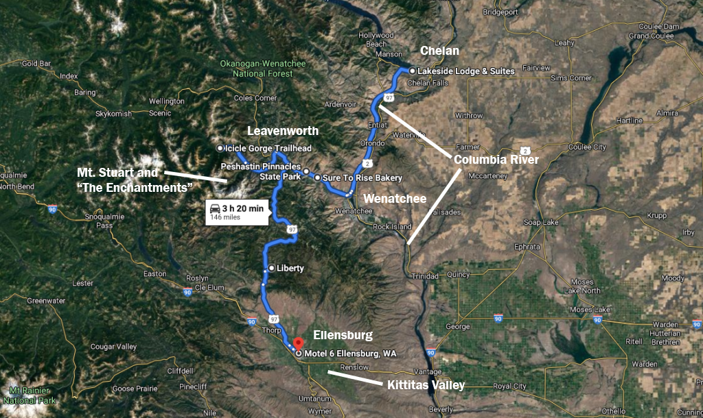
Day 7 of the 2020 trip to Eastern Washington

Carol Hasenberg, Past President of GSOC and current Field Trip Director, visited eastern Washington recently with her husband John. They based the trip primarily upon the geologic topics covered in the “Nick From Home” video series by CWU professor Nick Zentner. If you’ve come in through the back door, i.e., Facebook or some other link directly to this page, you may want to start at the introduction page to the trip.


Overview of Day 7.

Overview of Day 7.

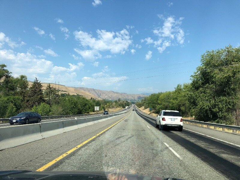
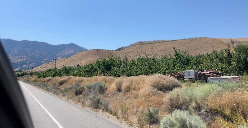
I need to do a bit of a catch-up from Day 6 as I ran out of steam by the time we got to Ellensburg in the Day 6 article. But we toured Ellensburg in both the evening of Day 6 and briefly in the morning of Day 7, so it’s good to combine the experiences. We were obviously tired of geotouring by the time we hit the Kittitas Valley, so we zoomed in on I-90. We noticed two things right away — the temperature was 90 F, although it was much hotter in Wenatchee, and the Kittitas Valley can be a wind tunnel. This worked in our favor today.

Map of Ellensburg. Click to enlarge.

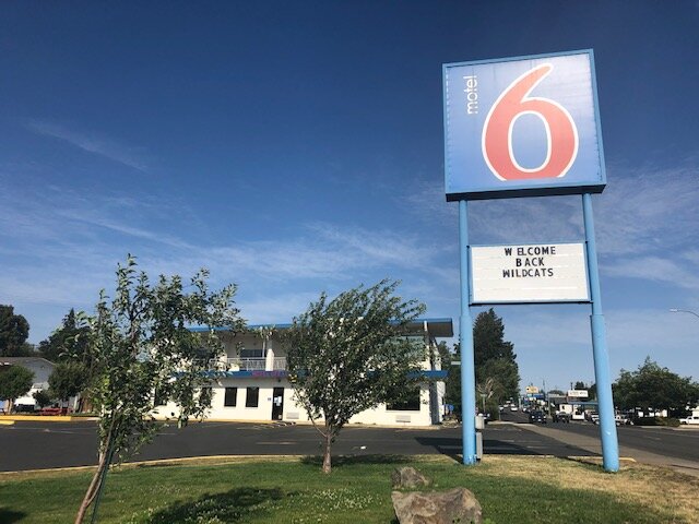
We drove around looking for a motel, and most of these were situated in the south near I-90, but we wanted to avoid the freeway noise and be closer to the university, so we ended up at Motel 6. It was about 1/3 the cost of the previous night’s lodging, and included a mini kitchen. The room was very clean. The parking lot was about the size of a football field and mostly empty, so I think they were hurting from the COVID-19 closures. They probably get a lot of business from Central Washington University, including the football crowd.

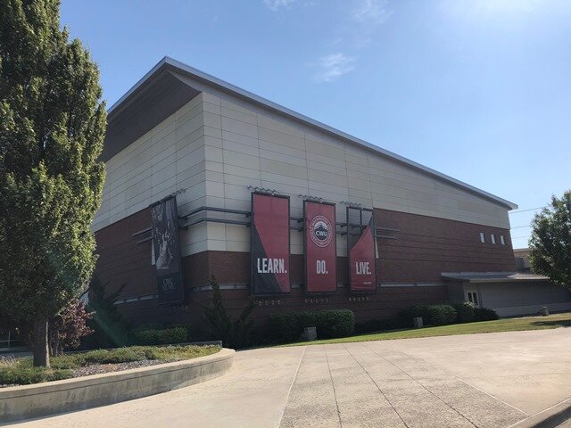
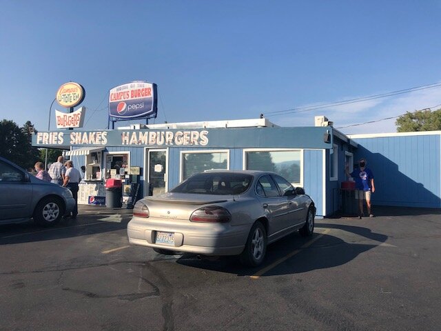
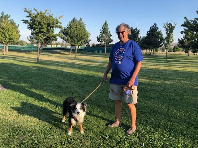
Next we toured the university district, and had a fun dinner at the retro Campus U-Tote-Em hamburger emporium. We drove around town a bit more, noting that, except for the university, the town of Ellensburg is a very ordinary, small town USA kind of place. It is the setting which makes it such an outstanding place for geologists. We wound up at a very nice play field park, Rotary Park, and took Lucy on a walk around one of the stadiums. The wind was very strong here so we were careful about walking from one sheltered spot to the next.

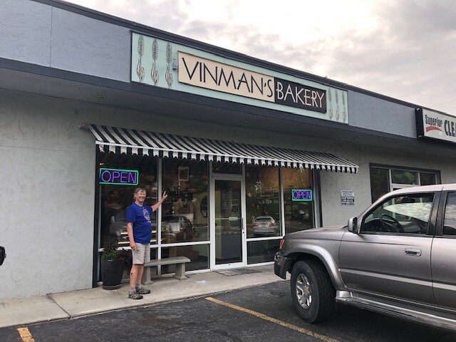
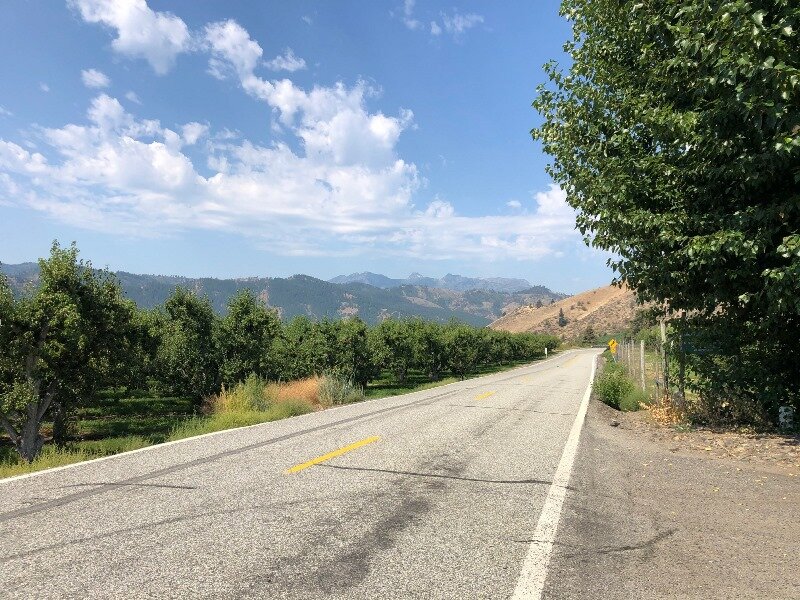
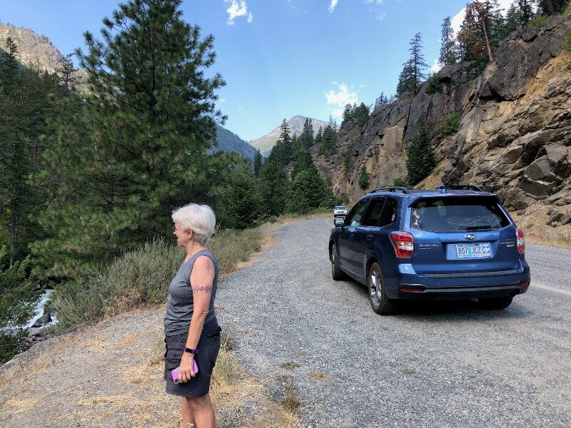
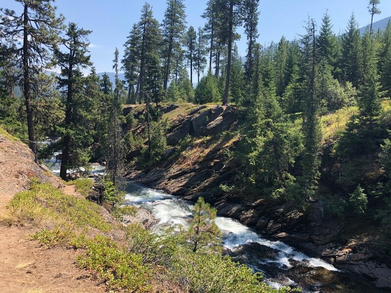
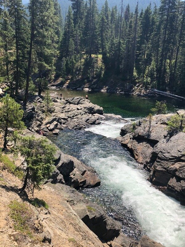
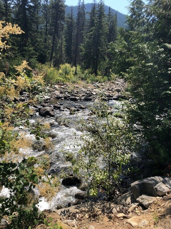
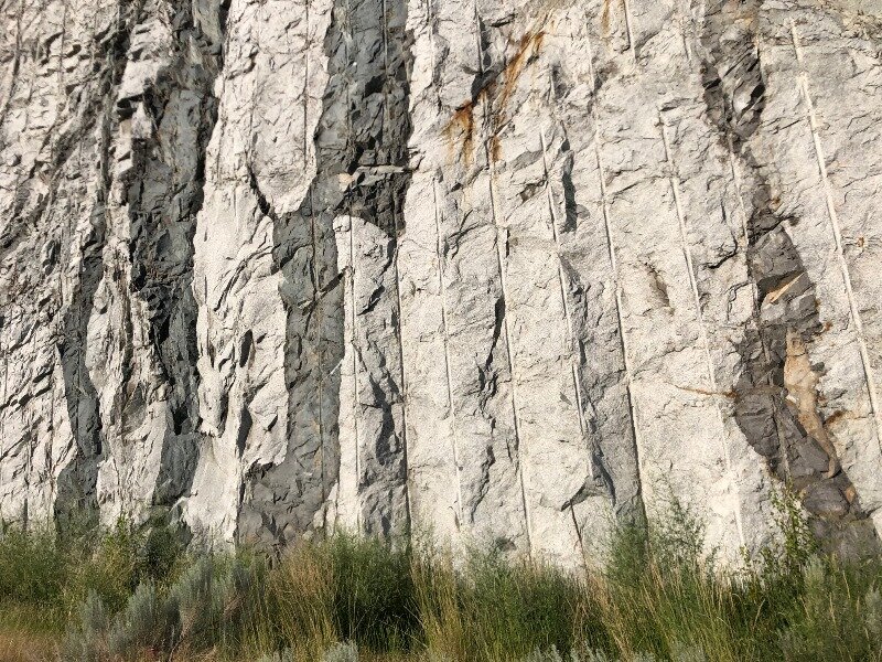
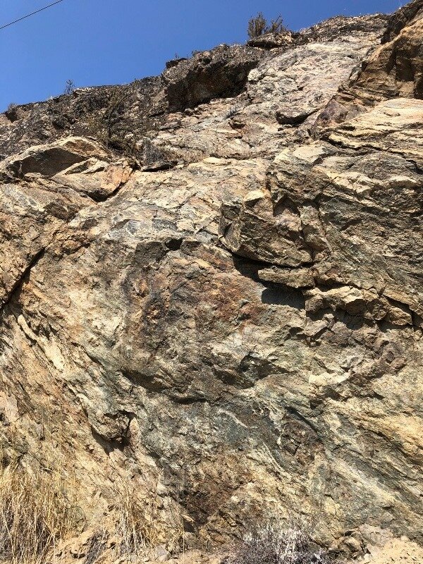
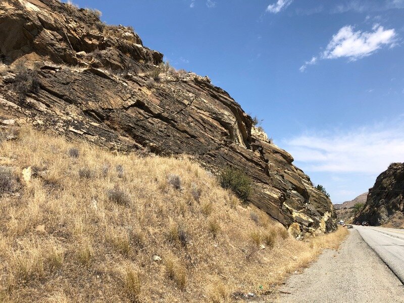
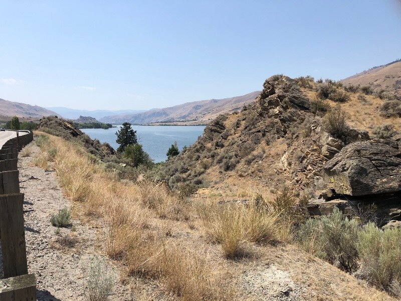
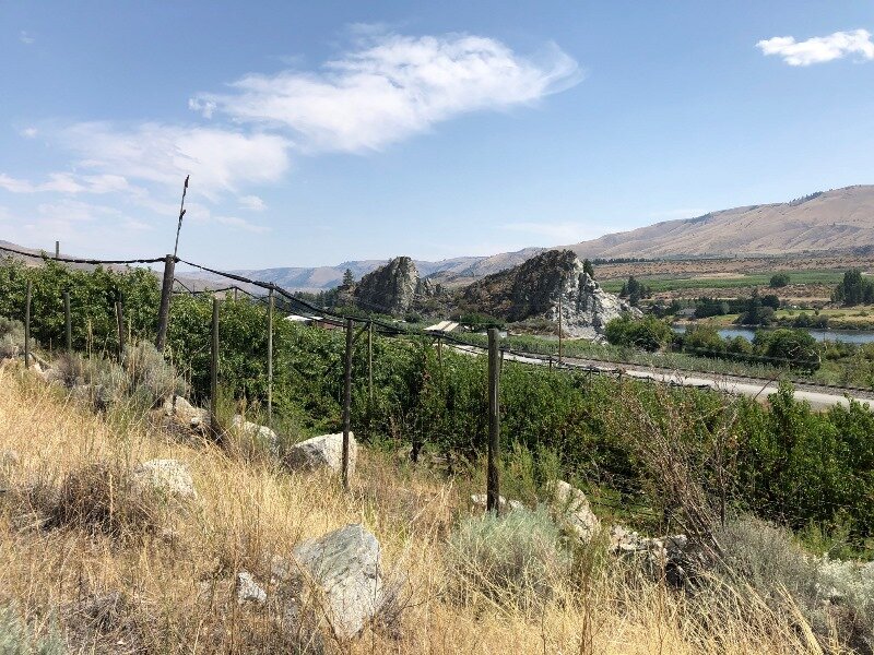
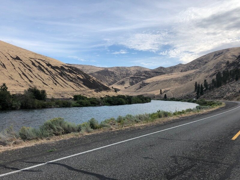
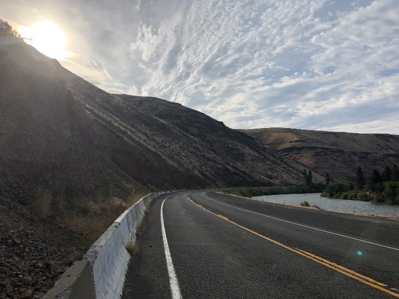
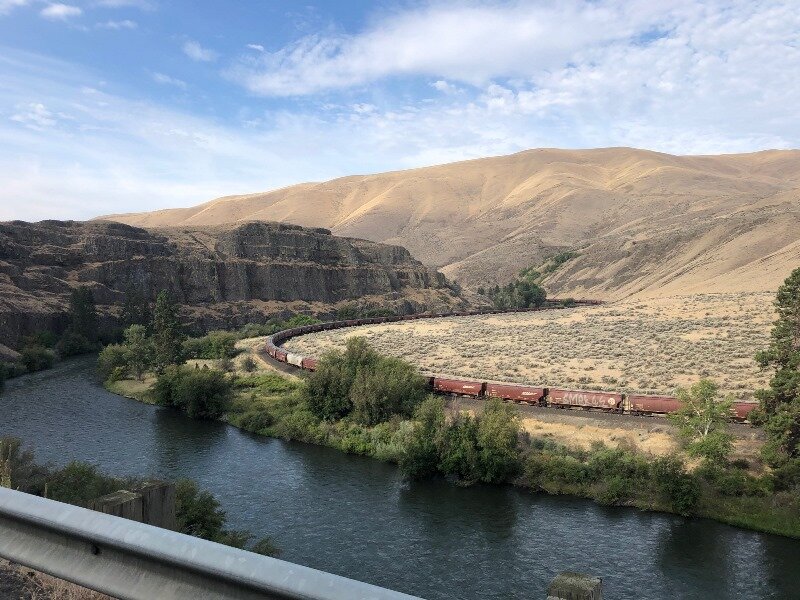
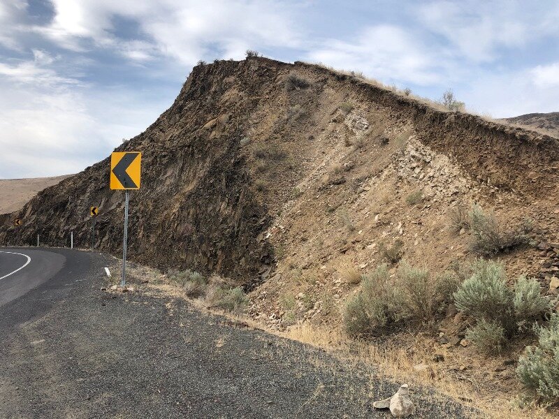
The next morning we woke up with the realization that we would be home today! After picking up a pecan roll at Vinman’s, we hit the highway early and headed south on Hwy 821 so as to go through the Yakima River Canyon. Yakima River Canyon is Zentner’s prime example of the river predating the hills that surround it. The Yakima River used to lazily meander over the top of the pancake-flat layers of Columbia River basalt and pre-basalt sediments, and then, about 16 million years ago, things started to change. Tectonically what was happening was that California was pushing the southwest corner of Oregon northward, and Oregon was rotating clockwise in response, and with the bulwark of the British Columbian Coast Plutonic Complex to the north resisting any northward motion, the state of Washington gets squeezed. This produced the Yakima Fold and Thrust Belt whose age ranges from 16 to 10 Ma.

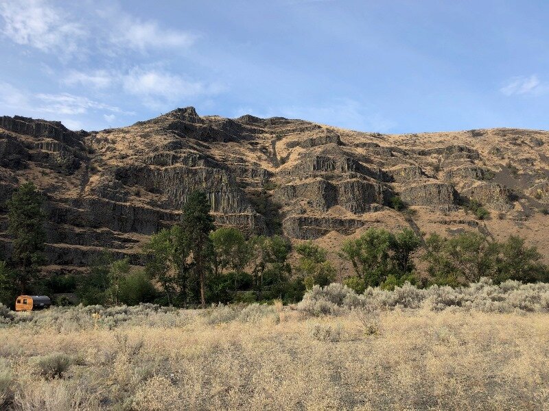
This left the Yakima River no alternative but to drill down into the layers of Saddle Mountain, Wanapum, and Grand Ronde Basalt flows, and the original meandering path of the river was preserved. There are also some outcrops of the Ellensburg Formation, which was deposited inter-fingered between the upper Grand Ronde flows and between the Grand Ronde and the Wanapum members of the Columbia River Basalt. It consists of lakebed, riverbed, and volcanic sediments, from lahar flows to tuffs, and records eruptions of the Cascade Range about 15 Ma.

Map of the Yakima River Canyon showing its meandering character.

Map of the Yakima River Canyon showing its meandering character.

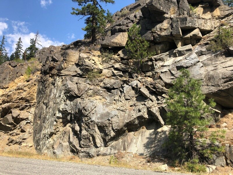
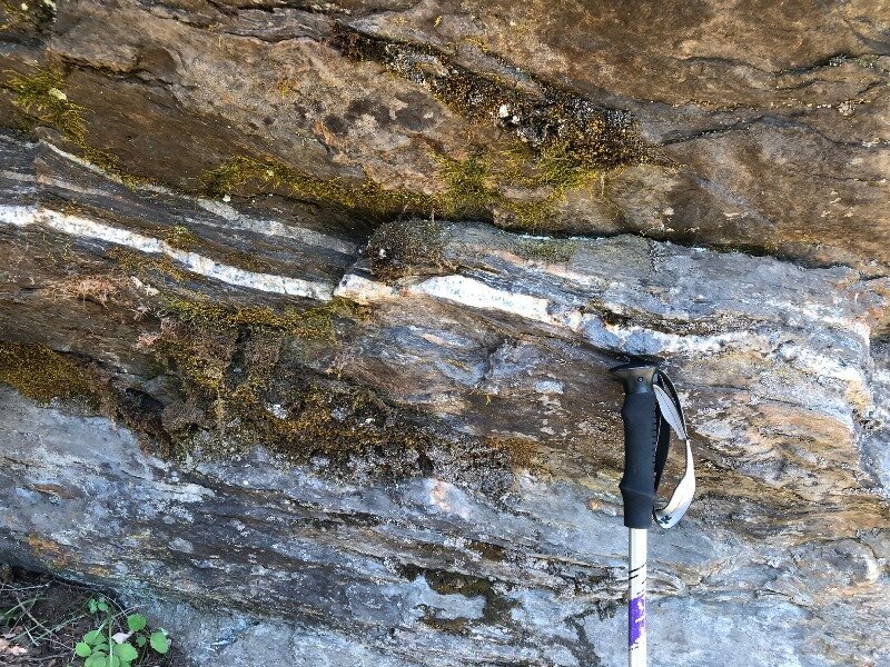
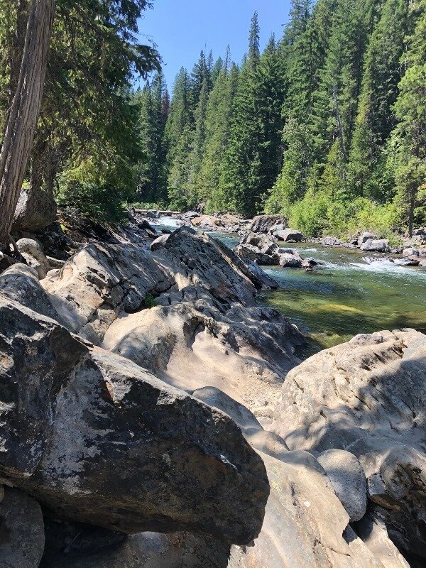
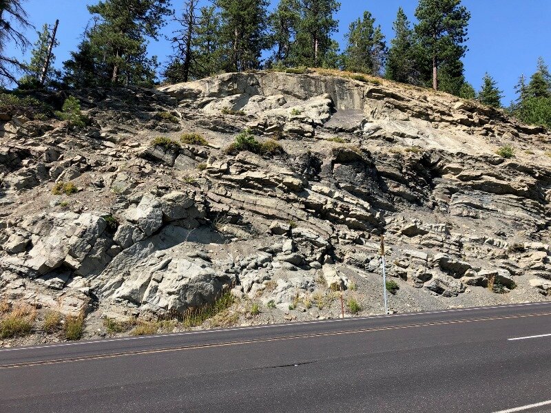
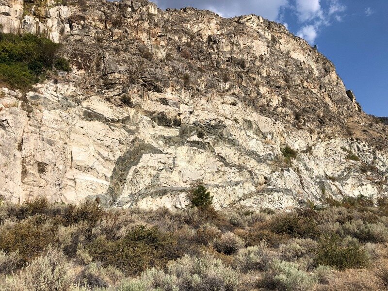
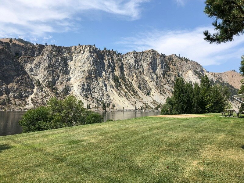
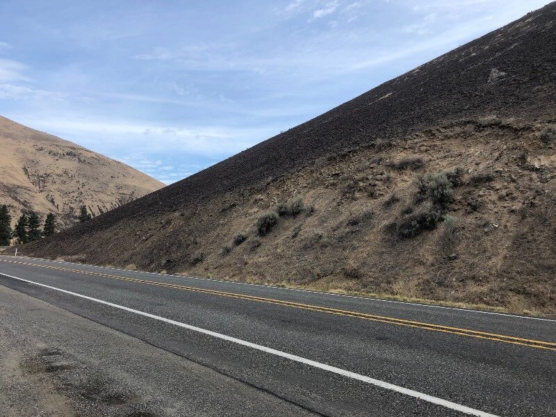
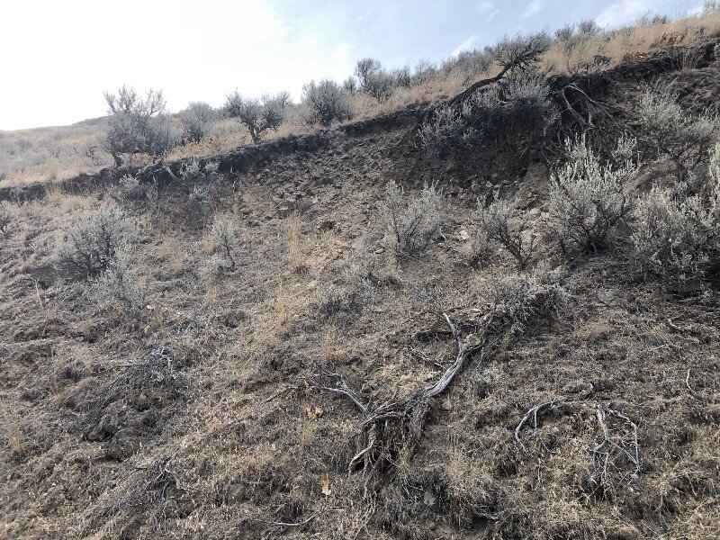
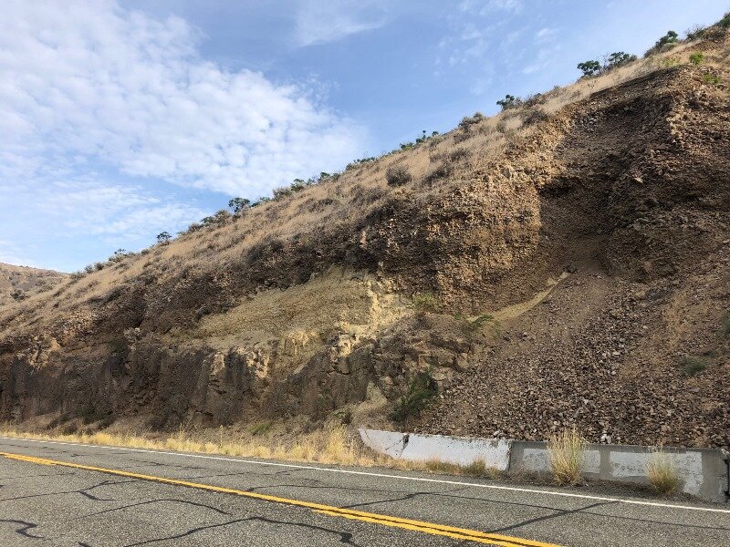
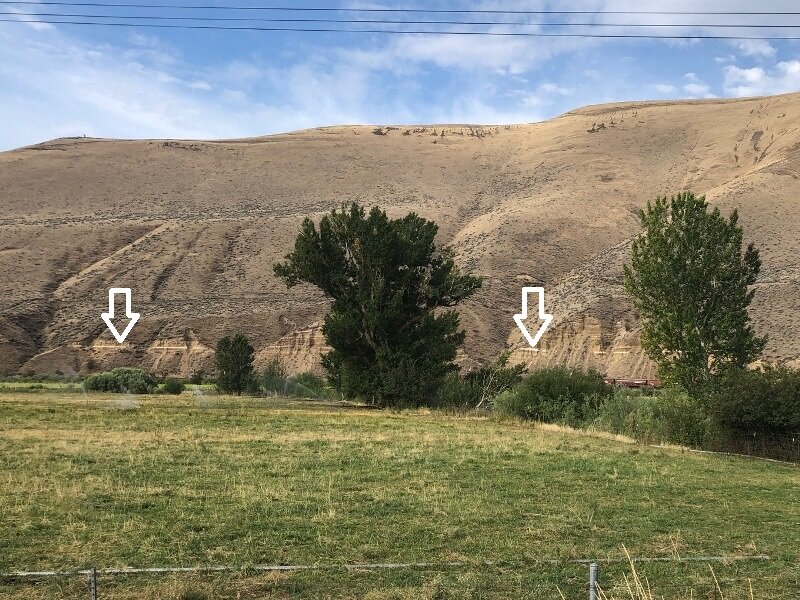
The other chief characteristic of the Yakima River Canyon is the landslides, mostly in the form of shallow debris flows and translational landslides. Some well-shaped bowl-like areas have been sculpted by this process throughout the canyon. At one point there is a prominent white stripe on the far side of the canyon, and this is suspected to have been a layer of Mazama ash (7.7 ka), but not so far confirmed, according to Miller & Cowan.

Of course I must also recommend a couple of livestreams as reference — Nick From Home Livestream #4 - Ancient Rivers and Nick From Home Livestream #23 - Yakima River Canyon and also Nick on the Fly #3 - Yakima River Canyon. In addition, there is an IAFI Ellensburg field trip guide of the Ellensburg Area available on the web. I also found additional info about the Ellensburg formation from Dan McShane’s blog, and also a Yakima Valley wine website. (Scott Burns, this one’s for you!)

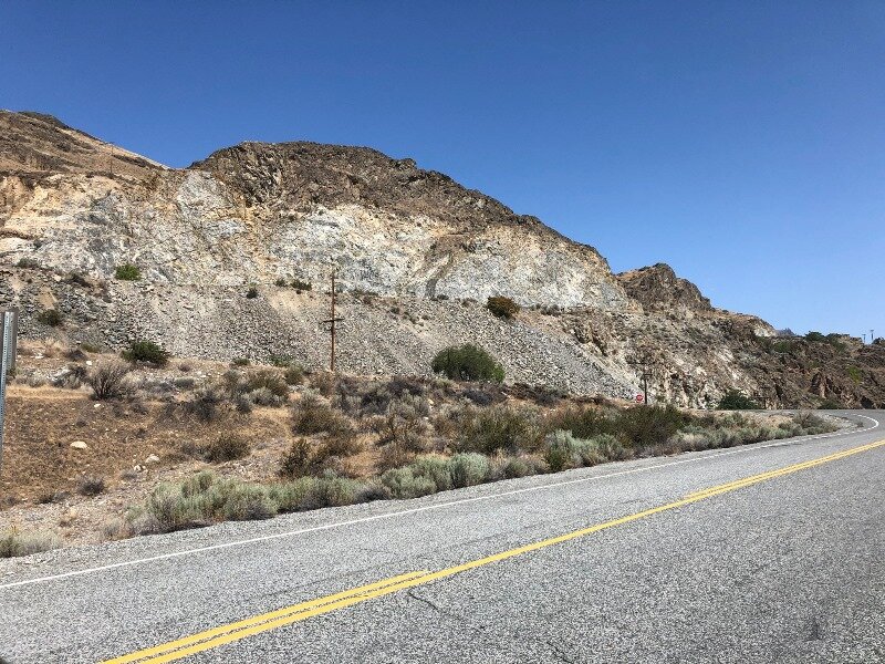
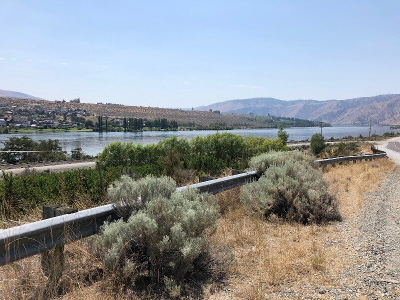
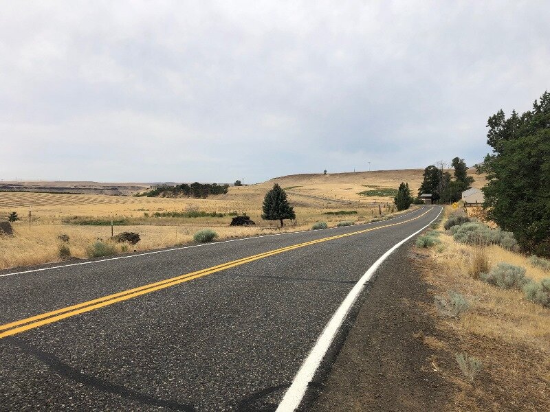
After leaving the Yakima River Canyon, we traveled down the slope of the Yakima Ridge into Yakima. On the Day 7 overview map above, I’ve marked all the wrinkles in the Yakima Fold and Thrust Belt that we transected in driving down to the Columbia, via Hwy 821, I-82, and US 97. Yakima County was a veritable hotbed for COVID-19 at that point, so we didn’t stop anywhere until we crossed the Horse Heaven Hills and ate lunch at Brooks Memorial State Park.
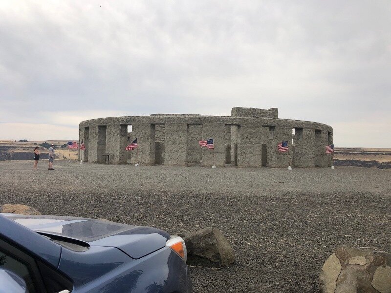
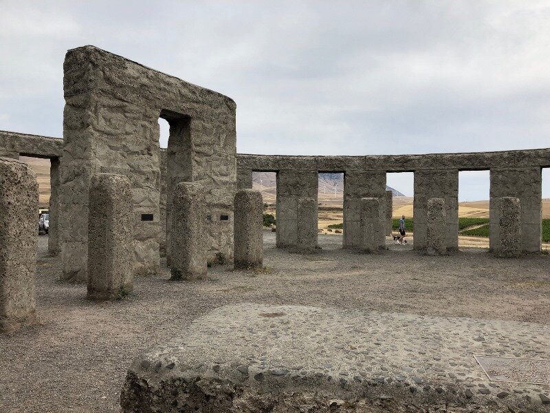
We had decided to take the Washington side of the Columbia Gorge west until at least reaching Hood River, because we’d never been that far east on Hwy 14. It proved to be well worthwhile — we were out of the nutty freeway traffic, and traveling at good speed high above the Columbia River. First stop was right where US 97 intersects Hwy 14 — the Stonehenge Memorial to the local men who lost their lives in WWI. Every time I have looked upon this monument I think it perfectly compliments its dramatic surroundings.

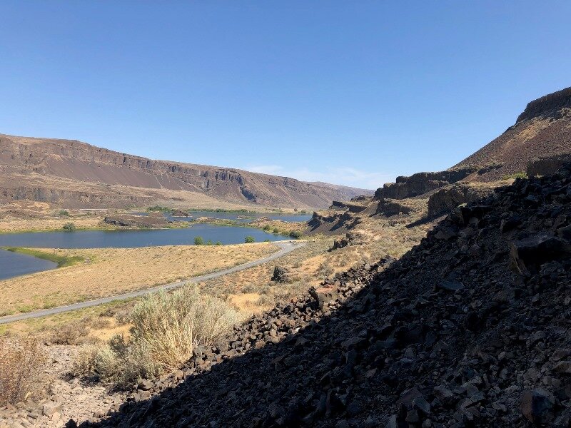
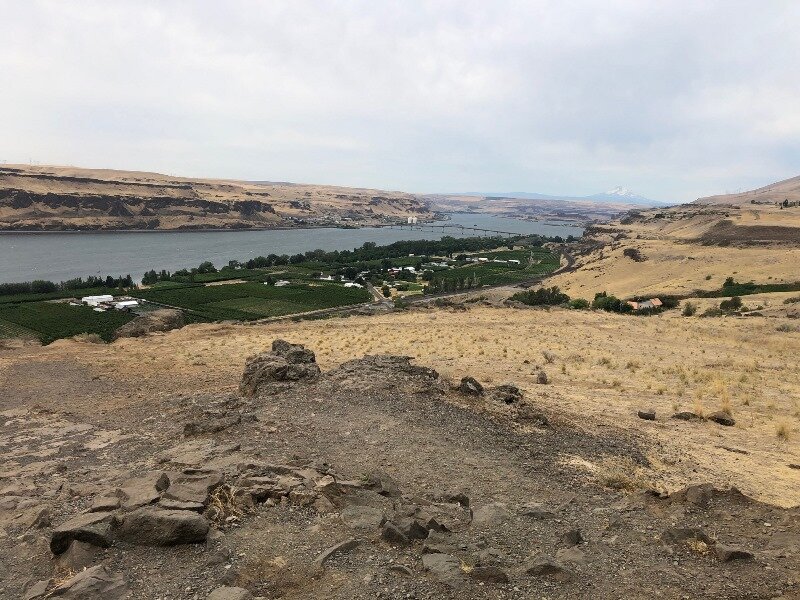
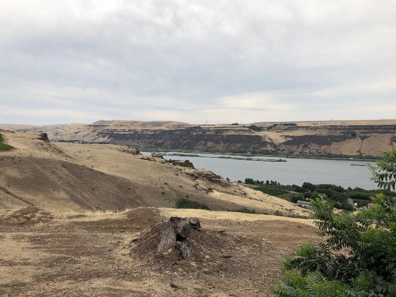
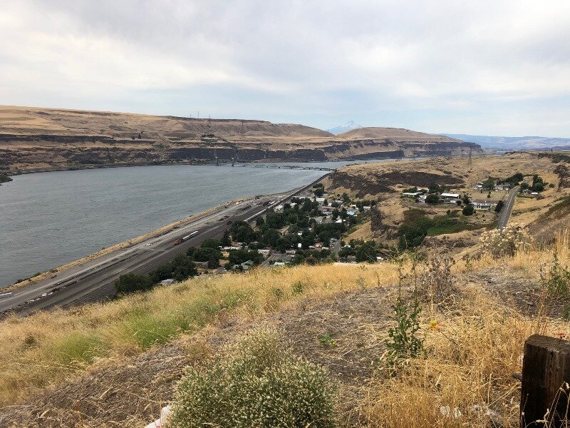
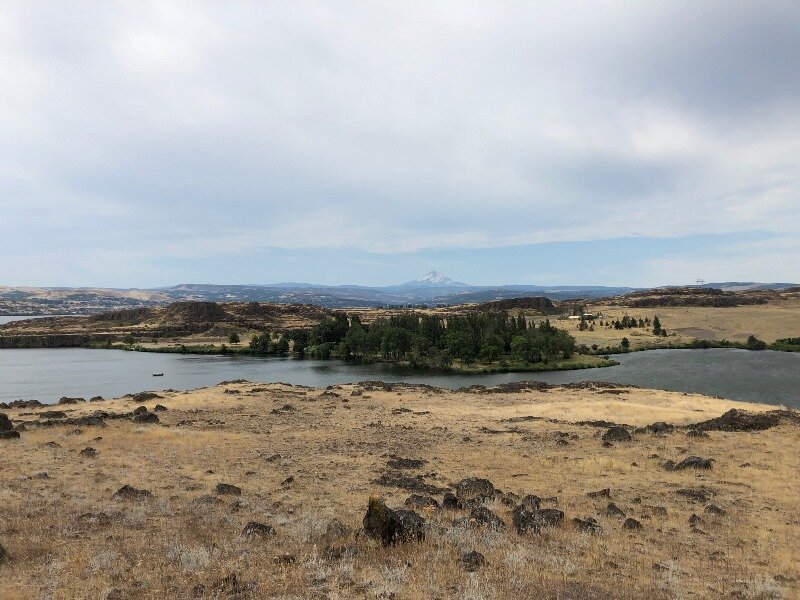
We also paused at an overlook above Wishram Heights across the river from Celilo. We’d have been looking down into Celilo Falls here, had the Dalles Dam not been built. Driving along at this height above the river, and at nearly the top of the level of the floods, it was so much easier to see the scale and imagine the floodwaters filling the gorge.

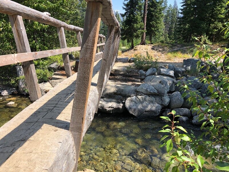
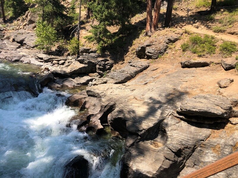
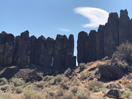
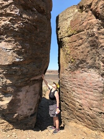
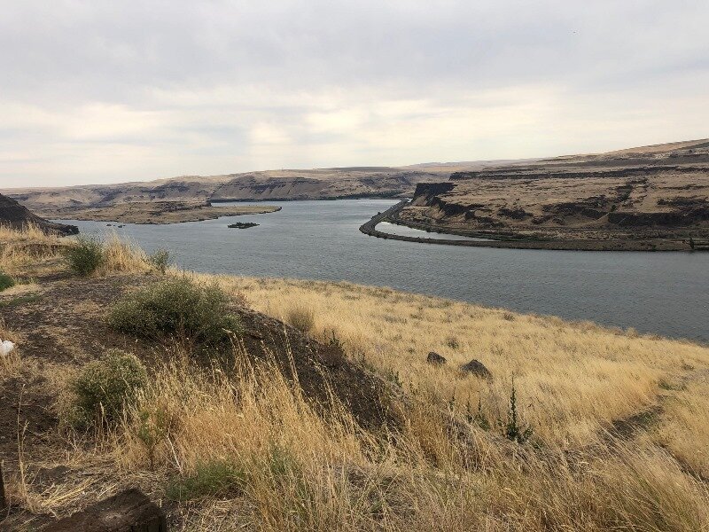
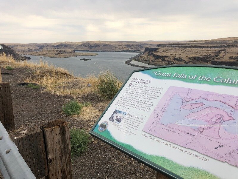
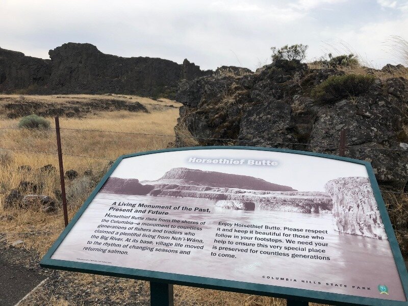
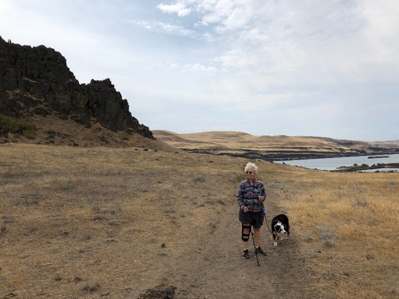
Our last stop was at Horsethief Butte in the Columbia Hills, just east of The Dalles and across the river. Here floodwaters skirted through a plateau, creating a channel through the hills and sculpting some nice basalt features, including Horsethief Butte.

And so we returned home, tired but with great memories of all the amazing landscapes we’d seen. All that was left but the write-up. This article serves as both a chronicle of the journey and a field trip guide for those of you who might want to venture forth into the wilds of Washington State. GSOC has not ventured far into Washington since our trip to Wenatchee in 2002. I think it’s high time we did. We fervently hope we will be able to do a full field trip season next year.

I’d also like to dedicate this whole adventure to Nick Zentner, who inspired and entertained us during the long home-bound days this spring at the outbreak of COVID-19. It helped to keep us sane and engaged with the world.

There are also a lot of more blog pages we could add to this article. Perhaps some of you have traveled or would like to travel to see some great geology. If you like, send some pictures with captions to my field trip director email address, fieldtrips@gsoc.org, and we will get them up on the website!

Carol Hasenberg

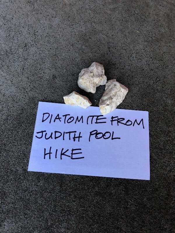
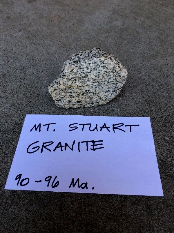
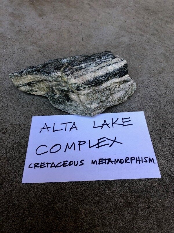
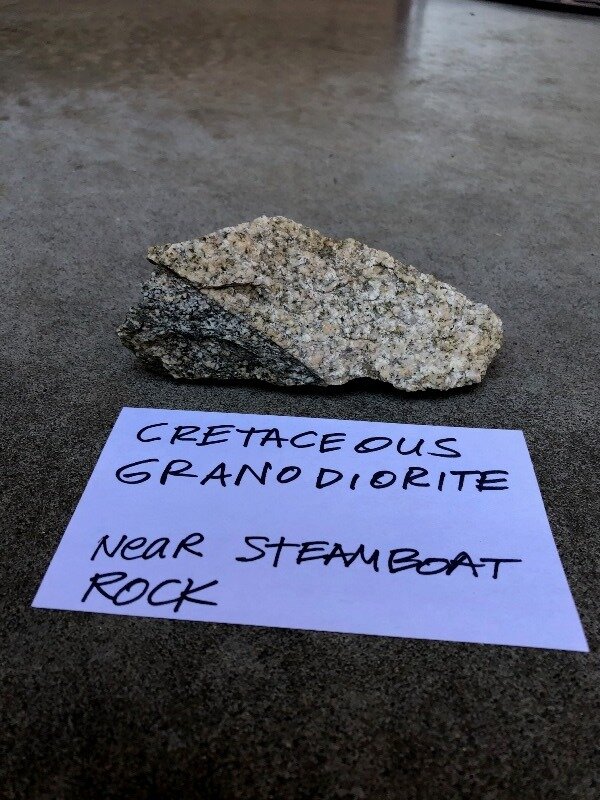
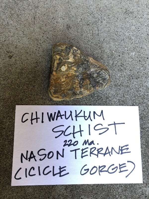
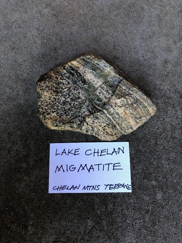
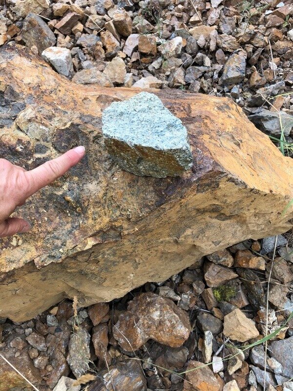
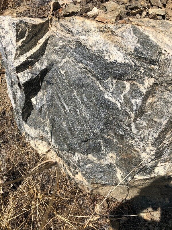
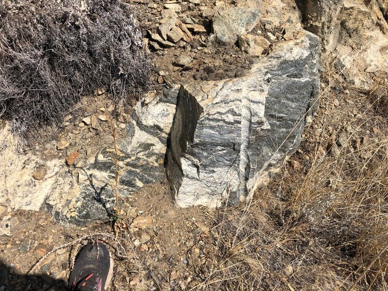
Postscript: My rock collection from the trip:

Day 6 of the 2020 trip to Eastern Washington

Carol Hasenberg, Past President of GSOC and current Field Trip Director, visited eastern Washington recently with her husband John. They based the trip primarily upon the geologic topics covered in the “Nick From Home” video series by CWU professor Nick Zentner. If you’ve come in through the back door, i.e., Facebook or some other link directly to this page, you may want to start at the introduction page to the trip.


Overview of Day 6.

Overview of Day 6.

Aah, the luxury of waking up in an air conditioned room, in a bed with sheets and our own bathroom, too! Yet we still ate our own breakfast food (COVID-19) and prepared to face the hottest day of the week!

Washington Terrane Map. Click to enlarge.

Our plan was simple: it’s gotta be cooler up in the mountains, and there will be some trees, too! Plus, we wanted to see the Mt. Stuart area and so it seemed like a good plan to do the hike around Icicle Gorge.

Icicle Gorge geology map, from USGS published “Geologic Map of the Chelan 30-minute by 60-minute Quadrangle, Washington” by Tabor et al. Click to enlarge

The Icicle Gorge hike was listed in the Carson and Babcock reference, plus I consulted a website before we left on the trip called Washington Trails Association Hiking Guide. The WTA guide turned me on to the fact that dogs are not allowed on the hikes that go up into the Enchantments, the bowl-shaped area enclosed by Mt. Stuart and the other peaks of the Stuart range (all comprised of Mt. Stuart granite). But they are allowed in the campground area trails (ie, Icicle Gorge) and trails on the outside of the Enchantments area, like Ingalls Creek. Oh BTW, Nick Zentner did an episode of his latest Nick on the Fly series (Livestream #2 Beverly Creek Serpentinite), a bit west of Ingalls Creek but still in the Ingalls Complex, a former ophiolite, or packet of rocks from the seafloor.

Surrounding Icicle Creek there is also the Chiwaukum Schist, a Cretaceous metamorphic version of sediments of the Triassic seafloor, and of the Nason Terrane. Miller & Cowan have a nifty terrane map of North Cascades National Park on pag. 110 of Roadside, plus Carson and Babcock have 2 terrane maps on pgs. 91 and 92 of Hiking Guide. An online animation from the Washington Geological Survey also ends with the current terrane map, which I have included above.

Detailed map of several stops of Day 6.

Detailed map of several stops of Day 6.

Satellite view of Peshastin Pinnacles showing sandstone ridges as layers of sediment of the Chumstick Formation, which filled the Chiwaukum graben 49 to 45 Ma. The dip, or angle of the surface of the layers with the horizontal, is very high, as they…

Satellite view of Peshastin Pinnacles showing sandstone ridges as layers of sediment of the Chumstick Formation, which filled the Chiwaukum graben 49 to 45 Ma. The dip, or angle of the surface of the layers with the horizontal, is very high, as they are nearly vertical.

We set off for Icicle Gorge with a couple of planned short stops along the way. John wanted to visit a bakery, and since the ones in Wenatchee were a distance from the roads we were taking, we decided to stop in the little town of Cashmere, Washington. Turns out Cashmere is the home of Aplets and Cotlets, and it had that small town charm.

After John scored at the bakery, we headed to the Peshastin Pinnacles SP. On the way to Cashmere we had descended into this broad valley littered with little hills of sedimentary rocks of the Chumstick Formation, with steeply tilted layers. The Peshastin Pinnacles is the showpiece of the Chumstick, where hard sandstone layers stick out above the other material. We got to the park but could not get in (a COVID-19 closure). Still, we got some pictures of the pinnacles.

It took awhile to get out to the Icicle Gorge Trailhead, but the scenery was fun and the road was paved I think to the Johnny campgrounds, so we only had a mile or two of gravel road. Driving upstream, we stopped at every campground but did not see any open campsites, and we were glad we’d changed our lodging plans for the final days of the trip.

Trail map of the Icicle Gorge Trails. Click to enlarge.

On the way up to the trailhead we also passed a lot of outcrops, and these were in the Mt. Stuart batholith. According to the Chelan 30’x60’ quadrangle, on the left the batholith rocks were tonalite and granodiorite, and on the right they were gabbro and diorite. Another interesting fact about the Mt. Stuart batholith is that starting in 1972 with the work of Myrl Beck of Western Washington University, paleomagnetism of this batholith and other bodies in the region have gotten geologists to wondering if this body and several others were formed 2500 km or so to the south and rode the tectonic conveyor belt up to Oregon, Washington and British Columbia. This really put some complications on how they had viewed the subduction of the Farallon Plate but also explained some other strange places in the Washington geologic mishmash. This theory is called Baja-BC and, you guessed it, Nick From Home #Livestream #10 - Baja BC Exotic Terranes has got the topic covered. Plus you can see an interview with Myrl Beck on Nick on the Fly Livestream #13 - Baja BC with Myrl Beck. I’ve also put a few references at the bottom of the page for those of you who like to get the data “from the horse’s mouth.”

Ok, let’s get on down the hiking trail! This was a great easy trail with some nice geology to observe. In Icicle Creek there were many sections where the stream dumped large boulders, and many of these were Mt. Stuart Granite. There were also pretty pools, and sections where the stream was cutting a relatively boulder-free path. The banks were lined with the Chiwaukum Schist, which had a lovely marbled color and consisted of massive but knobby slabs. Enjoy the photos of the hike!

Day6Leav1.jpg

Well, all that was part one of the day. Part two was to drive back to US 97, and head south to Ellensburg. On the way we passed through the Ingalls Complex and the Liberty gold mining area. But first, we passed through the town of Leavenworth, and it was one of those Disney-esque tourist towns that has a bit of a kitschy Bavarian theme. I’ll leave you to judge the architectural merit of the buildings.

Day6Leav2.jpg

Heading south on US 97, we passed through the Ingalls Complex, which included cliffs of argillite and serpentinite, then over Bluett Pass a large area of Swauk sediments, which were earlier than the Chumstick at 54 to 48 Ma., and grayish in color. We stopped at the same outcrop as Miller & Cowan and snapped a photo, while big trucks and cars whizzed by at 70 mph. We then entered the Liberty mining district, And here I can refer you, once again to Nick From Home episodes covering this area. Livestream #8 - Liberty Gold w/ Rob Repin and Livestream #5 - Ellensburg Blue Agates cover the topics associated with Liberty — gold mining and blue agates. The parent rock is the Teanaway Basalt (49 Ma.) for the agates and we passed a little mine along the road that looked like it was the Teanaway. The gold has a more complicated story and I added a screenshot from the program that pretty much tells it to the gallery below.

Well, all that was left of the day was to get to Ellensburg and find a motel. We zipped down US 97 to I-90 and high-balled it into town. We did a little touring of Ellensburg, but I’ll add that to Day 7 blog. Bye for now!

REFERENCES

Myrl E.BeckJr., Russell F. Burmester, Ruth Schoonover, "Paleomagnetism and tectonics of the Cretaceous Mt. Stuart Batholith of Washington: translation or tilt?", Earth and Planetary Science Letters, Volume 56, December 1981, Pages 336-342.

Darrel S. Cowan, Mark T. Brandon, and John I. Garver, “Geologic Tests of Hypotheses for Large Coastwise Displacements--A Critique Illustrated by the Baja-British Columbia Controversy,” American Journal of Science, Volume 297, February 1997.

Bernard A. Housen and Myrl E. Beck, Jr., “Testing terrane transport: An inclusive approach to the Baja B.C. controversy,” Geology; December 1999; v. 27; no. 12; p. 1143–1146.

Housen, Bernard A.; Beck Jr., Myrl E.; and Burmester, Russ R., "Paleomagnetism of the Mt. Stuart Batholith Revisited Again: What Has Been Learned Since 1972?" (2003), Western Washington University Geology Faculty Publications. 17.

Jay J. Ague, Mark T. Brandon, "Regional tilt of the Mount Stuart batholith, Washington, determined using aluminum-in-hornblende barometry: Implications for northward translation of Baja British Columbia", GSA Bulletin; April 1996; v. 108; no. 4; p. 471– 488.

Kirsten B. Sauer, Stacia M. Gordon, Robert B. Miller, Jeffrey D. Vervoort, and Christopher M. Fisher, "Evolution of the Jura-Cretaceous North American Cordilleran margin: Insights from detrital-zircon U-Pb and Hf isotopes of sedimentary units of the North Cascades Range, Washington", GSA Geosphere, Volume 13, Number 6, 2017.

Nick on the Fly Livestream #11 - Mission Ridge with Mike Eddy

'Nick On The Fly' #13 - Baja BC interview with Myrl Beck

'Nick On The Fly' #16 - Baja BC interview w/ Darrel Cowan

Click here for Day 7.

Day 5 of the 2020 trip to Eastern Washington

Carol Hasenberg, Past President of GSOC and current Field Trip Director, visited eastern Washington recently with her husband John. They based the trip primarily upon the geologic topics covered in the “Nick From Home” video series by CWU professor Nick Zentner. If you’ve come in through the back door, i.e., Facebook or some other link directly to this page, you may want to start at the introduction page to the trip.


Overview of Day 5.

Overview of Day 5.

It’s a new day dawning at Alta Lake SP.

It’s a new day dawning at Alta Lake SP.

This morning at 4:30 am I woke up to the sound, “Who-who-who, Who!, Who!”. This repeated four or five times. For sure it was an owl! A few minutes later I heard a couple of high nasal “Peent!” cries. As I lay there listening, I suddenly remembered that I had the Audubon app on my iPhone. Hoping there was internet access, I got out my phone, checked out the most likely candidates, and sure enough I had heard a great horned owl in the Ponderosa Pine forest at Alta Lake SP. The later call was that of a common nighthawk. Cool!

Sometime later I emerged from the tent to greet a lovely new day. At the start of this day, John and I had thought that we were going to head over to Icicle Gorge by Leavenworth and snag a campsite in one of the several national forest campgrounds over there before the weekenders arrived (it was Thursday). We were getting weary of camping, though. It had been very hot and dusty in all the campgrounds (except for the picnic areas) and there were lots of folks here at Alta who were not being very careful. The Alta Lake beach had been a complete zoo as well, so we drove right by without stopping. In addition, the weather forecast had indicated that it would get to 105 F in Wenatchee this day and 107 F the following day. With that in mind, we kept our options open. We drove down the west bank of the Columbia bound for the Lake Chelan area.

…and then we arrived at Lake Chelan.

…and then we arrived at Lake Chelan.

Neither of us had visited Lake Chelan before this trip. I had been to the migmatite of the Chelan Complex with GSOC on the Wenatchee field trip of 2002, but we didn’t visit the lake, and I’d always heard how beautiful the lake was. Well, we got there on a fine hot day and stopped at a lakeside park to look at the water. The lake was so beautiful and the water so crystal clear! Well, that was a game-changer. I asked John, “Hey, why don’t we stay here for the night?” It did not take much convincing. We booked the last room in the beautiful lodge right by the park. My brain was already busy recomputing trip itineraries.

Lucy and I at Lake Chelan SP.

Lucy and I at Lake Chelan SP.

But just for the sake of completeness, before we confirmed the booking we drove over to Lake Chelan SP and checked out the camping scene. It was a total zoo. I don’t think that there was a single empty site, and it didn’t look like COVID-19 was a concern for any of the campers. We did stop at the lakefront away from the beach to take a photo. We decided that with a hotel room we’d at least have a bathroom to ourselves, and more importantly, AIR CONDITIONING!

With that business taken care of, we were free to explore. We decided that we could drive down the Columbia to Wenatchee on the east side and back to Chelan on the west side, seeing the sights, stopping at some of the parks and checking out the rocks. And what an interesting stretch of highway this is! We referenced Miller & Cowan’s Wenatchee-Pateros trip on US 97 (pg. 142), and the description of the route was “nearly all the bedrock exposed along the road belongs to terranes of the Crystalline Core of the North Cascades.” Yes!

Of course, we had been seeing the metamorphic rocks of the Chelan Complex all around the lake. But we’re getting ahead of ourselves here, because up in Chelan the star of the show is the lake itself. I recommend the Nick From Home Livestream #16 on this topic for a more in-depth treatment. The deep trough housing the lake was carved by two competing lobes of the Cordilleran Ice Sheet; the Skagit Lobe from the northwest coming down the valley and the Okanogan Lobe coming from the southeast going up the valley. The lake is very deep (1486’) and the lowest point is 388 feet below sea level! It’s about a mile wide and 50 miles long. The outlet to the valley was dammed by the glacial debris from the Okanogan Lobe. This was further augmented by the Washington Water Power Company in 1927 raising the lake level by 20’.

It’s only icing on the cake that the most interesting roadcut all along this stretch of road is the migmatite of the Chelan Complex that is exposed on the grade from Lake Chelan to the Columbia River at Chelan Falls. It’s striped, swirled, and even contains parts that look igneous (ie, unmetamorphosed). The rock metamorphosed in the late Cretaceous and this rock, along with the Entiat pluton, whose tonalite grades into the migmatite, represents the Chelan Mountains terrane along the Columbia.

Between Entiat and Wenatchee lies outcrops of another terrane, the Swakane Biotite Gneiss of the Swakane Terrane. This material is darker and more fractured than the other rocks along the river, but of a similar age. A large island of Swakane Biotite Gneiss called Turtle Island is found in the Columbia River north of Wenatchee due to an ancient landslide.

What lovely rocks we saw this day! We got back to our nice cool hotel room and prepared to get to Icicle Gorge the next day for a hike, then to overnight in Ellensburg, the heart of Zentner Country!

Click here for Day 6.

Day 4 of the 2020 trip to Eastern Washington

Carol Hasenberg, Past President of GSOC and current Field Trip Director, visited eastern Washington recently with her husband John. They based the trip primarily upon the geologic topics covered in the “Nick From Home” video series by CWU professor Nick Zentner. If you’ve come in through the back door, i.e., Facebook or some other link directly to this page, you may want to start at the introduction page to the trip.


Overview of Day 4.

Overview of Day 4.

Our first stop in the Grand Coulee was near the south end of Lake Lenore.

Our first stop in the Grand Coulee was near the south end of Lake Lenore.

Today in Othello the forecast is for even hotter weather, about 105 F. We thought that traveling north to Alta Lake would be a bit cooler. Turned out that 99 doesn’t feel much different!

Anyhoo, we broke camp at Potholes and began a journey to and through the Grand Coulee of Washington. This would be our last journey through “The German Chocolate Cake” as Zenter calls the Columbia River Basin, filled with layer after layer of dark Columbia River Basalt. I was looking with some anticipation on viewing some metamorphic rocks.

But let’s not get ahead of our story. We started the drive similarly to the previous day’s trip, passing through Moses Lake and skirting around Ephrata on the Hwy 17 bypass (I know, the map does not show this correctly) and I think we made a stop for ice at the town of Soap Lake. Soap Lake (the lake) is an interesting feature because of its history as a health spa in past years. Soap Lake is full of concentrated salts and minerals from its role as a remnant lake of the Ice Age and has a pH reading of 9. Amara & Neff said that the Columbia Basin Project irrigation system was built to bypass Soap Lake for this reason.

I had switched reference books for this part of the trip to Amara & Neff because they had a lot of information about the Grand Coulee. We followed their tour right up through the coulee. Their tour turned me onto the Lake Lenore Caves, where we stopped for a short hike up the side of the coulee to caves that had been used by the local tribes as temporary lodgings while they fished, hunted, and collected plants in the area. Caches of materials dated at thousands of years old have been found in the caves.

The remnants of the cross section of the Grand Coulee in Lake Lenore shows the outline of the monocline, which was the weakness exploited by the Ice Age Floods to develop a coulee along the breadth of the feature.

The remnants of the cross section of the Grand Coulee in Lake Lenore shows the outline of the monocline, which was the weakness exploited by the Ice Age Floods to develop a coulee along the breadth of the feature.

Driving up the west wall of the Grand Coulee towards Dry Falls, one can see further evidence of the monocline.

Driving up the west wall of the Grand Coulee towards Dry Falls, one can see further evidence of the monocline.

As we traveled from Lake Lenore to Dry Falls, we could see the remnants of layers sloping down towards the east side of the coulee. This slope is called the Grand Coulee Monocline. The Ice Age Floods were able to rip apart this area more easily than the flat intact basalt layers.

Dry Falls from the overlook. It’s no wonder that J Harlen Bretz could see that massive amounts of water had come through here.

Dry Falls from the overlook. It’s no wonder that J Harlen Bretz could see that massive amounts of water had come through here.

No wonder also that at Dry Falls you will find the commemorative plaque honoring the work and insight of J Harlen Bretz. Click on the pic to enlarge and read the plaque.

Dry Falls is an incredible sight. It cannot be viewed without a sense of awe regarding the forces that created it. Nick Zentner devoted an episode, Nick From Home Livestream #17, to J Harlen Bretz, the man who challenged the geologic community to view the features created by the Ice Age Floods and to see them for what they are.

Well, onward and upward. The floor of the Grand Coulee takes a step upward at Dry Falls, and the coulee walls ramp up accordingly as you head north. This part of the coulee is mostly filled with Banks Lake, the biggest storage chamber for the water of the Columbia Basin Project. It is so elegant how the men designing this project took advantage of this wonderful, empty corridor to create the biggest irrigation project in the United States.

Steamboat Rock, a flood survivor, sits in the middle of Banks Lake.

Steamboat Rock, a flood survivor, sits in the middle of Banks Lake.

Lovely Cretaceous granodiorite makes a nice contrast with “The German Chocolate Cake.”

Lovely Cretaceous granodiorite makes a nice contrast with “The German Chocolate Cake.”

As we drew level with Steamboat Rock, I began to look near the road for an outcrop of pale Cretaceous granodiorite. This was mentioned in both Amara & Neff and Miller & Cowan references. As much as I like to see a nice wall of basalt, I’d seen quite a few of them in the last 4 days, and was ready for something new. I wanted to turn back the clock into deep time.

Eventually Banks Lake came to an end and we kept an eye out for our turn west on Hwy 174. We were going to cut across the northern extremity of the Columbia Basin, which is a high plateau in this area, to Bridgeport, where there is a bridge over the Columbia River. As we headed up Hwy 174 from the Grand Coulee, we crossed over the feeder canal for Banks Lake. The head of the coulee is much higher than the Columbia valley, and even with the water height increase from the Grand Coulee Dam at Roosevelt Lake, the water still must be pumped up 280 feet to a canal that feeds Banks Lake.

Further up the hill was a viewpoint atop hills of Eocene granite down to a stunning view of the Grand Coulee Dam.

Grand Coulee Dam from the viewpoint.

Grand Coulee Dam from the viewpoint.

Glacial moraine along Hwy 174 to Bridgeport.

Glacial moraine along Hwy 174 to Bridgeport.

Passing over the plateau to Bridgeport, we saw a lot of glacial moraine material. And, although I did not get a picture of this, there were lake deposits from the Ice Age, possibly Glacial Lake Columbia. I’ve located a blog that talks about this by Dan McShane, an engineering geologist with Stratum Group based in Bellingham, Washington.

After we crossed the Columbia at Bridgeport, we began to see large terraces along the Columbia River. The terraces line the north side of the river all the way to Pateros and Alta Lake, where we were to camp for the night. The hills behind the terraces are metamorphic rocks of the Crystalline Core Complex of Washington.

Miller & Cowan describe these high terraces as glacial outwash terraces from the Okanogan Lobe of the Cordilleran Ice Sheet. Further down the Columbia River south of the glacially covered zones, there are flood gravel deposits. Also, the Columbia River has cut down into its bed and left some regular alluvial deposits stranded at higher elevations along the river. You can see how this might get a bit confusing. So I’m sticking to the Miller & Cowan definitions for this location.

Finally Alta Lake was in sight! But it was only about 3:00 in the afternoon and nearly one hundred degrees. We hung out in the picnic area again, where sprinklers were making the rounds, and Lucy and I took little runs through the sprinklers from time to time. Our campsite was in a beautiful Ponderosa Pine forest and I was looking forward to checking out the metamorphic rocks of the Alta Lake complex…in the morning! So we turned in at last and slept the night.

Click here for Day 5.

Day 3 of the 2020 trip to Eastern Washington

Carol Hasenberg, Past President of GSOC and current Field Trip Director, visited eastern Washington recently with her husband John. They based the trip primarily upon the geologic topics covered in the “Nick From Home” video series by CWU professor Nick Zentner. If you’ve come in through the back door, i.e., Facebook or some other link directly to this page, you may want to start at the introduction page to the trip.

Day 3 overview map

Day 3 overview map

I rubbed my hands when waking up this morning. This was the gravy day! We were to travel a loop around the Quincy Basin, looking at many Columbia River Basalt and Ice Age Floods features, and there were several hiking possibilities. A bit dampened by the fact that the high temperature today was to be 102 F.

Boulders spewed out in the Ephrata fan. Click to enlarge.

A good background for this trip can be found in Alt pgs. 133-141. When the Okanogan Lobe of the Cordilleran Ice Sheet filled the northwest Columbia channel, floodwaters swept down the Grand Coulee, sprayed out of this channel at Ephrata (dumping sediment as it lost energy), and surged into Quincy Basin. The water was impeded by the Frenchman Hills and then the Saddle Mountains on its way south and down, so it skirted these obstacles by falling into the Columbia channel to the west in Potholes Coulee, Frenchman Coulee, and a few other spots, and flowing across the Potholes Reservoir and Drumheller Channels to the east. All this action makes for some pretty dramatic scenery.

We started the tour du jour by heading east across the top of the O’Sullivan dam, which today holds a lot of water used in the Columbia Basin Project, then connected with Hwy 17 heading north through the town of Moses Lake to Ephrata. For several miles outside of Ephrata, the barren fields are filled with boulders dumped by the floods.

West Bar overlook at Trinidad - there’s no way to show the scale of this scene from a picture on the web. The giant ripples on West Bar were made by the last Ice Age Flood to surge down the Columbia, and not the stronger larger earlier floods.

West Bar overlook at Trinidad - there’s no way to show the scale of this scene from a picture on the web. The giant ripples on West Bar were made by the last Ice Age Flood to surge down the Columbia, and not the stronger larger earlier floods.

Detail map of West Bar overlook.

Detail map of West Bar overlook.

We then headed west from Ephrata through Quincy to the little town of Trinidad on the lip of the Columbia Gorge. Heading down towards the Crescent Bar Resort on the river, there is a beautiful overlook just past the switchback. A vast bend in the Columbia River is filled by a huge flood gravel bar, and the giant ripples on its surface are at least two miles from the observer.

Still in awe from this scene, we headed back toward Quincy and turned south onto White Trail Road to our next destination, Potholes Coulee. There are a number of hikes outlined for this area in Bjornstad, and we chose Trail Q Judith Pool Trail because it was short, pretty flat, and had planed off Roza flow columns you could stand on. We figured we could make it there and back without dying from heat exhaustion.

Map to Judith Pool trail in Potholes Coulee. The only sign marking this trail was a punched metal sign which said “Ancient Lake Trail” by the gate.

Map to Judith Pool trail in Potholes Coulee. The only sign marking this trail was a punched metal sign which said “Ancient Lake Trail” by the gate.

Lucy and I are ready to go! Included in this shot is the only sign identifying the trail, and “Ancient Lake Trail” is a misnomer because the Upper Ancient Lake trailhead is actually about a mile down the road.

Lucy and I are ready to go! Included in this shot is the only sign identifying the trail, and “Ancient Lake Trail” is a misnomer because the Upper Ancient Lake trailhead is actually about a mile down the road.

And we were not disappointed by the sights we saw on the hike. It started blandly travelling west down a small coulee, then the trail crossed from the south to the north side of the coulee, past a former diatomite mine, and ended at the Judith Pool with dramatic views down the coulee to the Columbia River. I especially liked the flood-polished tops of the Roza flow columns at the outlet falls of Judith Pool. Also, the vegetation was lush around the pool, which must be receiving water from the Columbia Basin Project (the lakes east of the road are impoundments in the system), and it included some beautiful purple-flowering plants. The diatomites and opalized chert that were mined in the area came from the deposits of lakes which formed between flows of the Columbia River Basalt.

The old diatomite diggings with Lucy for scale.

The old diatomite diggings with Lucy for scale.

Anyway, not bad for a two mile hike. We were good and toasted when we got back to the shade of the large cottonwood tree where we had parked the car. We backtracked to the White Trail Road and headed east to I-90. It was time to pick a lunch spot and the only town between Potholes Coulee and Frenchman Coulee is George, Washington. (It wasn’t until I wrote this article that I figured out why they named it George!)

Left to right: Judith Pool, outlet falls over Roza columns, Ancient Lake Basin, Potholes Coulee.

Left to right: Judith Pool, outlet falls over Roza columns, Ancient Lake Basin, Potholes Coulee.

Closer view of the outlet falls with John for scale. Click to enlarge.

George, Washington has a beautifully irrigated city park where we stopped for lunch.

George, Washington has a beautifully irrigated city park where we stopped for lunch.

Lunch was enjoyed in a beautiful green city park in George. The only other people there were from a couple of government trucks - BLM, maybe?

Once again, it’s really hard to capture the scale of the landscape with a photo, but here’s my attempt with a photo of John looking down Frenchman Coulee. What a waterfall it must have been!

Once again, it’s really hard to capture the scale of the landscape with a photo, but here’s my attempt with a photo of John looking down Frenchman Coulee. What a waterfall it must have been!

The rest of the sites we had planned to visit that day were car stops and very short walks. Our next stop was right along I-90, so we got back on the freeway heading east towards the Columbia River. The thermometer in the car read 102 F.

Our destination was a short 6 or 7 miles from George. It is called Frenchman Coulee and Nick Zentner did a ‘Nick From Home’ episode #52 there in which he was actually away from home and walking around with his iPhone strapped to “the gadget." Nick spent most of his Frenchman Coulee episode in Echo Basin just to the south of Frenchman Coulee.

We stayed in Frenchman Coulee and took a short walk up to the ‘Feathers,’ a line of Roza columns sticking up above the surrounding terrain, survivors of the cataclysms. The columns did not look that big from the road but they sure were huge up close! I wonder what Stephen W. Morris, the J Tuzo Wilson professor of physics at the University of Toronto, would make of the parameters affecting the size of basalt columns. Will have to see that video again!

Upriver view of the cliffs on the west side of the Columbia River. It looks like the valley cleaving the cliffs is taking advantage of an area weakened by the abrupt increase in dip in the cliffs to the north of the gap, a cross-section through the …

Upriver view of the cliffs on the west side of the Columbia River. It looks like the valley cleaving the cliffs is taking advantage of an area weakened by the abrupt increase in dip in the cliffs to the north of the gap, a cross-section through the Frenchman Hills Anticline.

Back to I-90, and this time we were planning to visit the Ginkgo Petrified Forest SP near Vantage, Washington, across the Columbia River on the west side. But after a few miles, when the freeway was beginning to make its descent into the Columbia Valley, there was a scenic lookout and so we took that. There was another huge vista here and I’ve included a couple of photos, and find the view southward down the river to Sentinel Gap to be nostalgic. I believe I have a photo of the 2002 trip to Wenatchee that features the Sentinel Gap; it was used as a GSOC banquet photo that year.

Downriver view of the I-90 bridge at Vantage and the Sentinel Gap beyond. Nick fans, which came first, the Saddle Mountains or the Columbia River?

Downriver view of the I-90 bridge at Vantage and the Sentinel Gap beyond. Nick fans, which came first, the Saddle Mountains or the Columbia River?

Homage to Professor George W. Beck. Click to enlarge.

We finally got to the Ginkgo Petrified Forest SP, and at the Visitor Center there was a little display dedicated to Professor George W. Beck, a predecessor of Nick Zentner at CWU. He was the man responsible, in the 1930’s, for getting state protection for the petrified wood that can be found at the base of the Ginkgo flow of the Wanapum Basalt, and this flow takes its name from the gingko logs preserved at the site, along with several other species of wood of the Miocene in Oregon.

The museum also contained many samples (ie, polished trunk sections and others) of the buried forest and other Pacific NW petrified wood. The park also had an interpretive walk where you could see petrified wood in situ about a couple of miles from the Visitor Center. The SP rep told us we could see several not far from the trailhead (the trail was 3 miles long). So, we went out there and saw the in situ petrified trees, surrounded in thick metal cages so they would not walk out of the park. Lucy was a bit confused about why we would want to walk in molten heat to look at stumps in cages. Humans!

Lucy inspecting the caged stumps. What the?!?

Lucy inspecting the caged stumps. What the?!?


We got back in the car and checked the temperature readout. 102 F. Time to get back to the campground and chill!

We drove east towards Othello and noted all the fields of espaliered fruit trees on the way. They had trained the trunk and branches of each tree on a grid that leaned out slightly towards the aisles to aid in the picking of the fruit. I regret not getting a picture of this.

Back at Potholes SP, we decided to spend the rest of the daylight at the well-watered picnic area and just come back to the camp for bedtime. I had spent about 20 minutes that morning picking foxtail grass seeds out of Lucy’s paws from the campsite. Plus, it was so green and nice at the picnic area and we were the only people in it. It put a beautiful end on a fruitful day.

Click here for Day 4.

Lucy is happier in this scenario, and so are we!

Lucy is happier in this scenario, and so are we!


Day 2 of the 2020 trip to Eastern Washington

Carol Hasenberg, Past President of GSOC and current Field Trip Director, visited eastern Washington recently with her husband John. They based the trip primarily upon the geologic topics covered in the “Nick From Home” video series by CWU professor Nick Zentner. If you’ve come in through the back door, i.e., Facebook or some other link directly to this page, you may want to start at the introduction page to the trip.

Day 2 overview map

Day 2 overview map

My birthday present - a trip to Palouse Falls. Better than hearing that Beatles song!

My birthday present - a trip to Palouse Falls. Better than hearing that Beatles song!

I woke up this morning and I realized “Hey, it’s my birthday!” Sweet 64, and nobody playing that Beatles song for me. Oh, well. I looked at the Google weather forecast and the current temperature was 64 degrees. There you go!

This day I had prepared a nice birthday treat- Palouse Falls! I had wanted to see this for a long time. The day was beginning to be fine and hot, even though it had been a bit chilly the night before. This was the last time we could claim this on this trip. The weather forecast had begun to morph into the hottest week of the year scenario. Looked like 100+ weather through Thursday, and it was just Monday morning.

Looking up the Palouse River from Lyons Ferry Park.

Looking up the Palouse River from Lyons Ferry Park.

John and I broke camp and headed up US 12, then cut NW on Hwy 261 towards Lyons Ferry, where the highway crosses the Snake River. This section of the Snake was affected by the Ice Age Floods- they backed up into the river and deposited much gravel, and several gravel bars and giant ripples can be found from Lyons Ferry and west along the river today. The Lower Monumental Dam impounded water on the Snake up past Lyons Ferry and into the Palouse River, which enters the Snake just east of the bridge. I did not see any obvious ripples on the sediments at Lyons Ferry, but the scenery was spectacular.

Just a few miles north of this is Palouse Falls on the Palouse River. The Cheney-Palouse floodway sent a massive flood of water down Washtucna Coulee to the north, and some of this overtopped and flowed over to what is now the Palouse Canyon on a shortcut to the Snake River. The blocky-looking erosion of the canyon and side channels of the Palouse is due to the water having taken advantage of the weak planes of faults that have cut through the Columbia River Basalt.

Nowadays the Palouse River Travels through a canyon several sizes too big for it to have carved, but the falls does the graceful 185’ drop into the over-sized plunge pool in a most scenic fashion.

Looking up Devils Canyon.

Looking up Devils Canyon.

Fanciful colonade at Devils Canyon. Click to enlarge.

Another nearby feature, Devils Canyon, was carved by the floods in a similar situation to that of the Palouse River. We visited this narrow, straight canyon on our way down to the Windust Park area, where I had noted from Bjornstad that a flood-created gravel bar could be seen with giant ripples. The canyon had some very cool basalt colonnades creating fantastic patterns. These included intercanyon flows and straight columns with the look of an archaeological oddity.

Detail map of Kahlotus, Devils Canyon and Windust area.

Detail map of Kahlotus, Devils Canyon and Windust area.


We were pretty thrilled with all the features found on this little side trip down to Windust. Although the park at Windust was closed due to COVID-19, we parked alongside the road a mile or so below the park to snap pictures of the giant ripple marks in the gravel bar across the Snake River. Luckily a train came by and the cars make a great size comparison in getting the scale of the features.


After leaving Devils Canyon, we drove back to Kahlotus and west to the town of Othello, where we had lunch. An alternative route would be to travel down the Pasco-Kahlotus Highway, seeing more flood features in the Snake River Canyon. Refer to Bjornstad’s Road Tour 1: Palouse-North Snake River.

Interlaced fan-shaped jointing patterns in the basalt in Devils Canyon.

Interlaced fan-shaped jointing patterns in the basalt in Devils Canyon.

Giant ripples in the gravel bar across the Snake River from Windust. Below the eroded face of the ripples you can see the cars of a passing train for scale.

Giant ripples in the gravel bar across the Snake River from Windust. Below the eroded face of the ripples you can see the cars of a passing train for scale.

Hanford Reach just seemed too hot today.

Hanford Reach just seemed too hot today.

We found a nice spot for lunch in Othello in a nice shady city park. Othello also had grocery stores, gas stations, and all the amenities. It is also smack in the middle of the Columbia Basin Project, and the effects of having water for irrigation were everywhere. Like the green city park. Like thousands of acres of crops, mostly fruit trees, everywhere. Er well, almost everywhere. On the hills and plains of loess that had not been stripped by the Ice Age Floods, or the large basins that had received deposits of the loess by the floods.

Ricas Frutaletas & Ice Cream treats in Othello - highly recommended!

Ricas Frutaletas & Ice Cream treats in Othello - highly recommended!

We had plans to go after lunch to Hanford Reach National Monument, because there on the north banks of the Columbia River are the White Bluffs, and the white coloring is from deposits of the Ringold Formation, remains of a Pliocene lake (3-8 Ma.) that covered the Pasco Basin. We drove south to the turnoff for the North Trailhead, but by then we were into triple digits temperature-wise. That gravel road just was not very appealing right then. Instead, we went back to Othello and the ice cream store we’d scoped out earlier. Alas, I did not get another chance to see the Ringold Formation on the trip.

Drumheller Channels scene. Click to enlarge

After downing the birthday ice cream treat, we took off for the campground at Potholes Reservoir SP. Our route took us through the Drumheller Channels, a major scabland south of Potholes Reservoir. Sagebrush was the most prevalent crop in this wild region. It was here that Ice Age Floodwater poured south after exiting the Grand Coulee at Ephrata.

We finally made it to the campground at Potholes Reservoir SP. We had carefully chosen the campsite most isolated from the others in the tent camping loop. This was good from the noise and COVID-19 isolation standpoint. We had hoped to swim in the reservoir, but there was only a boat ramp and no beach. But the showers were nice and refreshing! Although I’ll warn you there was no hot water. The majority of campers were in the RV loop and they had their own showers, so there were not a lot of people using them.

Click here for Day 3.

Day 1 of the 2020 trip to Eastern Washington

Carol Hasenberg, Past President of GSOC and current Field Trip Director, visited eastern Washington recently with her husband John. They based the trip primarily upon the geologic topics covered in the “Nick From Home” video series by CWU professor Nick Zentner. If you’ve come in through the back door, i.e., Facebook or some other link directly to this page, you may want to start at the introduction page to the trip.


Overview of Day 1.

Overview of Day 1.

Day1TwinSis.png

Day 1

We were happy to leave Portland for a break! The trip started on Sunday, July 26, 2020, with us barreling down I-84 east through the Columbia River Gorge. Our first geology stop would be Wallula Gap. On the way out, to get us into geo-mode and to break the monotony, I pointed out the roadcut with palagonite near Hood River, and the Ice Age Floods gravel bar in Phillipi Canyon near the mouth of the John Day River. Eventually the Wallula Gap hove into view, and we were rarin’ to go! We whipped by the parking lot for the Twin Sisters and had to turn around and backtrack to it (the first of many such instances).

My sidekicks on the trip, husband John and Lucy the Australian shepherd, posing in front of the Twin Sisters.

My sidekicks on the trip, husband John and Lucy the Australian shepherd, posing in front of the Twin Sisters.

At Twin Sisters, there is short hike up the draw and we bore right, towards the top of the bluff overlooking Wallula Gap and with a great view of the Twin Sisters. These are a couple of stubborn pillars of basalt which resisted the assault of tens of massive floods as they poured their waters through the gap and over the smaller bluffs. Up we went and were rewarded with a spectacular view of the Gap.


Panorama of Wallula Gap from the bluff near Twin Sisters.

Panorama of Wallula Gap from the bluff near Twin Sisters.

Closeup of the route from Wallula Gap to Lewis & Clark SP. Can you tell which way the water flowed during the Ice Age Floods?

Closeup of the route from Wallula Gap to Lewis & Clark SP. Can you tell which way the water flowed during the Ice Age Floods?

My closeup of the Gardena bluffs and the Touchet beds. How many can you count?

My closeup of the Gardena bluffs and the Touchet beds. How many can you count?

I was keen to try out a very recent purchase of a clip-on telephoto lens (for my iPhone X), and I thought that the Touchet beds in the Gardena Bluffs just south of Touchet would be a good trial. I had studied and studied Google maps but could not find a place to go right up to the foot of the cliffs. So, we drove down Byrnes Road just west of the town, then down Maiden Road, around an airstrip, and alongside a farmer’s field on the dirt road. Not sure if this was a public road, but it did have a street sign.

The car got caked with loess while we looked at the Touchet beds. Fortunately there were lots of car wash emporiums in Walla Walla, just down the road.

The car got caked with loess while we looked at the Touchet beds. Fortunately there were lots of car wash emporiums in Walla Walla, just down the road.

As we got as near as we were going to get, I assembled my camera gear. I had a bit of trouble lining the lens up with the camera, so I ended up with a less than perfect shot. It was clear that I needed to practice with the lens a lot more. It didn’t help that we were practically up to our ankles in powdery loess, that wonderful soil of the Palouse but very susceptible to blowing around. Well, that is how it got to the Palouse. The soil was ground from rock by the Cordilleran Ice Sheet and it was blown all over Washington and parts of Oregon. Check out our car from a brief exposure.

But getting back to those Touchet beds. BTW, I’ve heard it pronounced as TOO-shee. According to Bjornstad, there are 62 rhythmites, or slack water deposits, from the IAF’s exposed on the Gardena cliffs along the Walla Walla River. Clastic dikes occur as well, and I think I’ve got one in my photo, such that it is.

It was a pretty big deal to see this site because I didn’t know of any other place which is accessible where so many rhythmites could be seen. Burlingame Canyon is on private land, and permission to see that site is very limited.

Map of where we viewed the beds in relation to the town and US 12. You might also be able to approach from the south side of the river, or on a boat.

Map of where we viewed the beds in relation to the town and US 12. You might also be able to approach from the south side of the river, or on a boat.

This digital zoom from the iPhone is also a bit disappointing, but you get the idea.

This digital zoom from the iPhone is also a bit disappointing, but you get the idea.

The two sites were all that I had planned to see on the first day. We continued through Walla Walla, and the hills of the Palouse, until we reached Lewis & Clark Trail SP and made camp for the night.

Friday July 24 weather forecast.

Friday July 24 weather forecast.

A word about the weather may be in order here before I conclude the discussion of Day 1. We started this trip thinking that we were going to have really hot weather for a day or two and then it would be cooling down. That cooling down did not happen, and the heat wave kept sending us temperatures in the 100+ range through Thursday, July 30. So, plans had to revise a bit based on environmental conditions.

COVID-19 assessment of Lewis & Clark State Park: Restrooms were cramped and the shower area was inside the restroom. Lots of families were camping there and not being especially careful. We decided not to shower at this park, and wore masks in the restrooms and washed hands well!

Click here for Day 2.