A Hike into the Sandy River Canyon
/Trip Date: September 22, 2026
Trip Leader: Ian Madin, retired Senior Scientist from Oregon Department of Geology and Mineral Industries
Article by Carol Hasenberg
Photos by Carol Hasenberg

Directions to the trailhead: Take exit 18 Lewis and Clark State Recreation Site off of Interstate 84 east of Troutdale, Oregon. Turn south onto the Historic Columbia River Highway and go about 4.3 miles, then straight onto SE Hurlburt Road. Travel another 2 miles and take a slight right onto SE Gordon Creek Road. The parking area is a wide shoulder about 3.5 miles further.
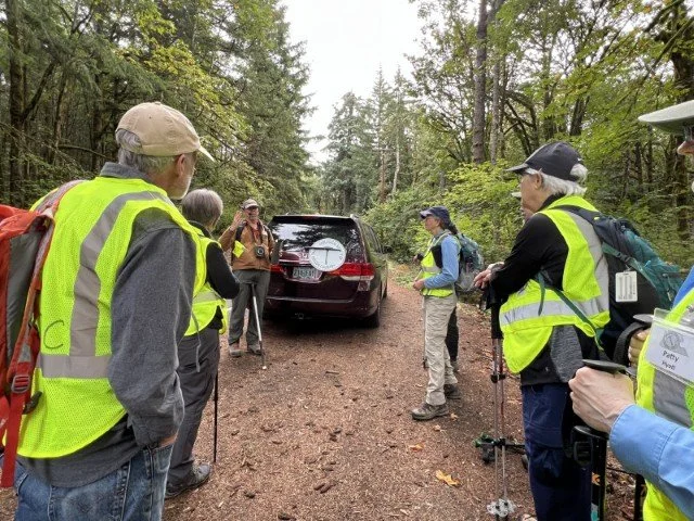
GSOC hikers meet at the trailhead with leader Ian Madin.
This one-day field trip was a hike into the eastern terrace of the Sandy River Canyon, and was led by Ian Madin, retired Senior Scientist from Oregon Department of Geology and Mineral Industries. The target geology was the material deposited between 16 and 2 million years ago (Ma) above the Columbia River Basalt which underlies the Portland basin.

Soil derived from the weathered LKT basalt. LKT stands for “low potassium tholeiite” and this basalt and basaltic andesite is typical of the Cascade Mountains’ platform lavas containing more mantle material than that of the stratovolcanoes.
The path followed an old logging road down the scarp of an older, massive landslide to the Sandy River floodplain. The old landslide had conveniently exposed the bedrock stratigraphy of the Portland basin that underlies the surficial geology of the late Pleistocene and modern times, and overlies the Columbia River Basalt (~16 Ma). These deposits of material in the late Miocene through the Pliocene epochs include basalts and basaltic andesites related to the Cascades dubbed the LKT flows; and the Troutdale Formation and the Sandy River Mudstone, both of which were deposited by the ancient Columbia River.
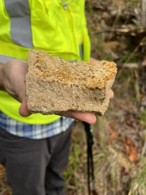
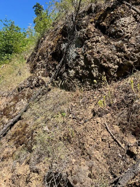
Highly weathered LKT basalt below the soil has a diktytaxitic texture with high porosity.
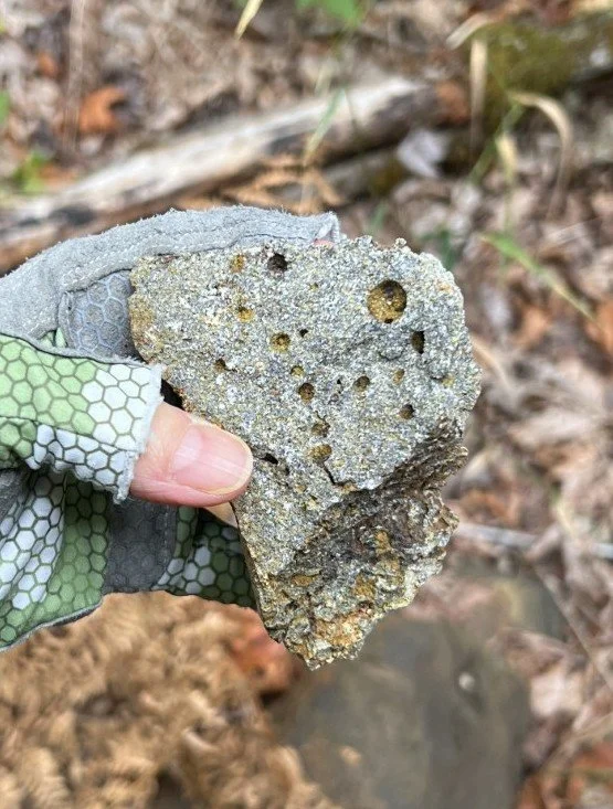
The LKT basalt contains gas bubbles and weathered olivine crystals. White plagioclase crystals can be easily seen in the matrix.
The fault scarp on the uphill side of the path revealed first the highly weathered LKT basalt. As the group headed down the hill, they saw red soil, brownish-gray soil, punky solid rock and finally a cliff of relatively unweathered basalt, all derived from the same sequence of lava flows with varying degrees of weathering. This area receives much rain from clouds that hang up on the steepening slopes of the Cascade highlands, and weathering of the porous basalt happens rapidly.
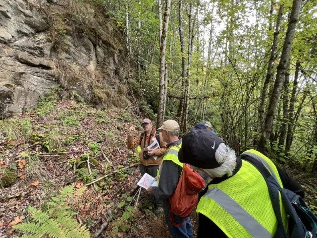
Madin discusses spherical weathering of the LKT basalt.
Below the basalt was the Troutdale Formation. The Troutdale Formation contains two distinct facies. The Hyaloclastite Sandstone (HSS) Member consists of a sandstone rich with tiny particles of lava which flowed into the ancient Columbia River and shattered. It often contains the mineral palagonite, which is a sulphureous yellow in color, derived from the basalt’s contact with water. Interfingered with the HSS Member is the Troutdale Conglomerate Member, a cemented collection of rounded cobbles dropped from the ancient Columbia River bed as it swept down from the uplifting Cascade Mountains. This conglomerate characteristically contains some potato-looking cobbles of quartzite from the Belt rocks of Idaho, which is part of the Columbia’s watershed.
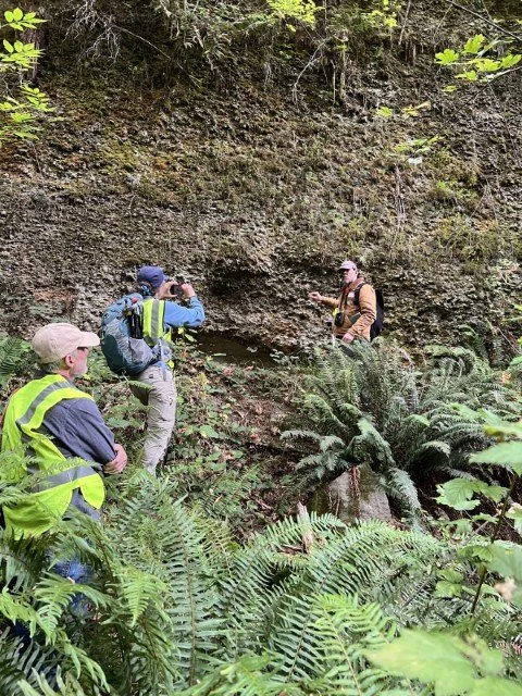
The cobbly face of the Troutdale Conglomerate Member.
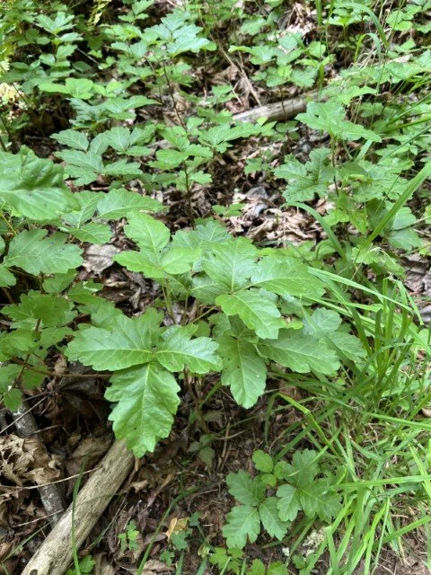
Poison oak lined the trail in places.
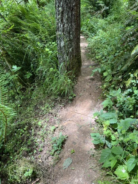
The path was a narrow space between the hill and the dropoff in a few places.
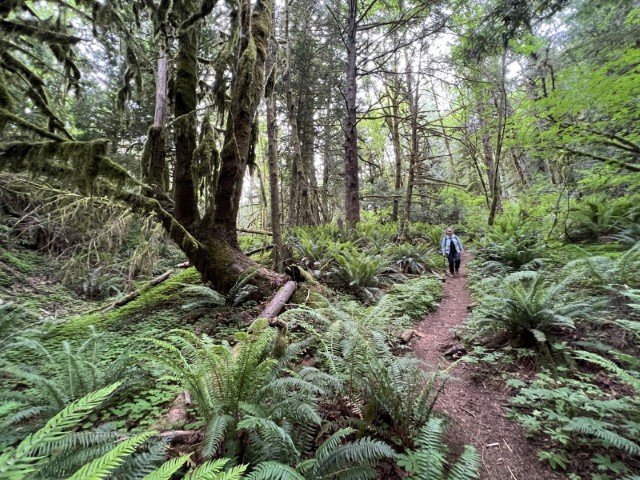
The hikers often needed to walk carefully as the old road had receded to a thin path on the scarp edge. At the bottom of the scarp the path turned toward the river onto an old ramp constructed through the jumbled terrain of the landslide deposit. Here the forest was thick with moss and the air was laden with moisture. The main path then turned left through the jumble, and into a stream alcove which terminated into a slot carved through the Troutdale Conglomerate with a small spring-fed waterfall.
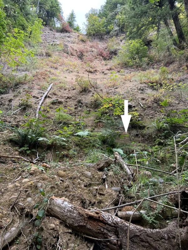
The smooth face of the Hyaloclastite Member of the Troutdale can be seen peeking out in this more recent landslide scarp along the trail.
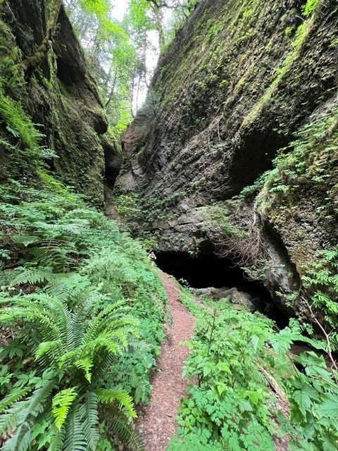
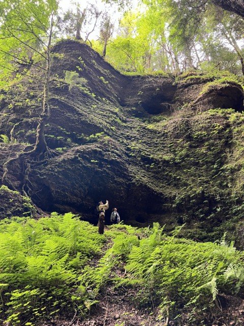
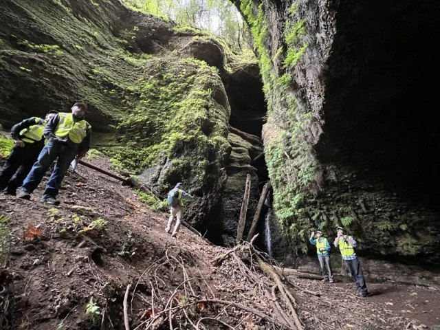
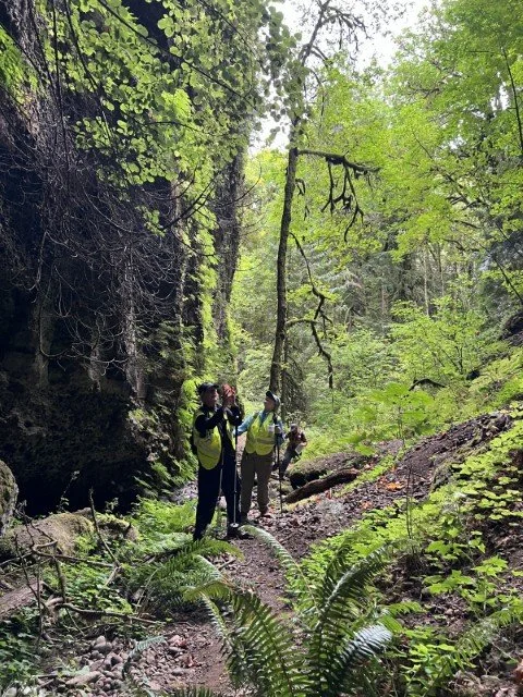
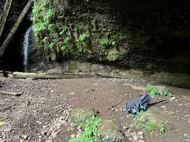
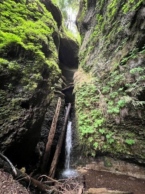
This alcove is a magical place framed by the high walls of Troutdale Conglomerate and the tree canopy far overhead. In its green lighted space the hikers found a deep overhang in the conglomerate, where the stream is undercutting the alcove wall by eroding the Sandy River Mudstone at the base of the wall.
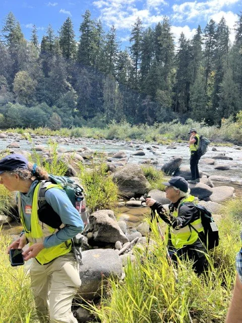
LKT boulders in the Sandy River
After eating lunch in the alcove, the hikers walked back to the ramp and took a side path that terminated at the Sandy River. From the river’s edge the hikers got a view of the stream emptying into the river at another waterfall. There the light-colored, layered Sandy River Mudstone lies below and to the left of a deeply carved channel filled with Troutdale Conglomerate. The river was strewn with boulders of the LKT basalt. It had been a beautiful day to explore the Portland basin stratigraphy at the Sandy River Canyon. Time to head back up the hill.
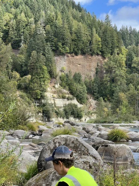
The Sandy River Mudstone (left side of cliff) frames the stream outlet waterfall. Above and to the right is the Troutdale Conglomerate channel.